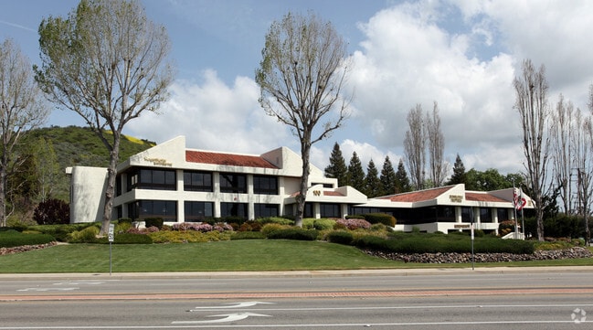
Property Record
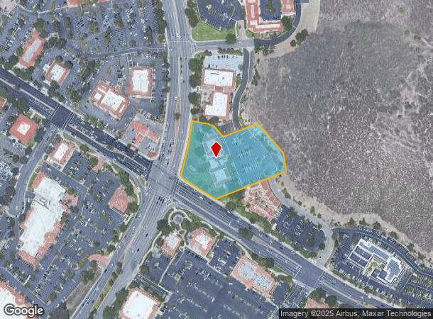
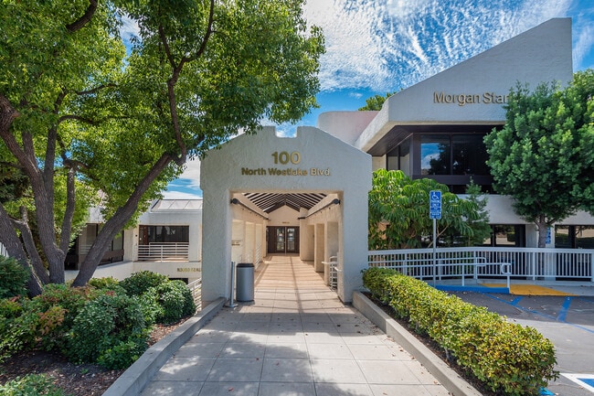
100 N Westlake Blvd, Westlake Village, CA 91362

This Property Is For Sale
NEARBY LISTINGS FOR SALE OR LEASE
Property Detail
100 N Westlake Blvd
680-0-230-575
Parcel Map Ld 288
Officebuilding
PARCEL MAPS 21 PG 31 LOT 2
X
Ventura
06111C0987F
California
2024
2.62 AC
2025
Thousand Oaks/SE County
007402
Los Angeles
24,525 SF
Oxnard-Thousand Oaks-Ventura, CA
DEMOGRAPHICS near 100 N Westlake Blvd
1 Mile
3 Mile
5 Mile
2024 Total Population
7,399
50,294
119,981
2029 Population
7,309
49,294
117,997
Pop Growth 2024-2029
(1.22%)
(1.99%)
(1.65%)
Average Age
46
45
44
2024 Total Households
3,170
19,840
45,300
HH Growth 2024-2029
(1.36%)
(2.10%)
(1.77%)
Median Household Inc
$118,364
$133,571
$128,827
Avg Household Size
2.30
2.50
2.60
2024 Avg HH Vehicles
2.00
2.00
2.00
Median Home Value
$927,742
$1,001,217
$903,198
Median Year Built
1976
1979
1978
Nearby Places
Map Layers
Map Styles
 Street
 Aerial
- Restaurants
- Banks
- Shops
- Fitness
- Groceries
PUBLIC TRANSPORTATION
AIRPORT
Bob Hope
DRIVE
WALK
Distance
Bob Hope
38 min
32.0 mi
Los Angeles International
DRIVE
WALK
Distance
Los Angeles International
45 min
43.9 mi
Freight Ports
The Port of Hueneme
DRIVE
WALK
Distance
The Port of Hueneme
1 min
21.7 mi
Nearby Properties
Address
Land Use
TOTAL SIZE
Lot Size
Zoning
Address
Land Use
TOTAL SIZE
Lot Size
Zoning
38,851 SF
40.49 AC
M-1
Address
Land Use
TOTAL SIZE
Lot Size
Zoning
676,545 SF
19.76 AC
WVM1*
Address
Land Use
TOTAL SIZE
Lot Size
Zoning
239,224 SF
11.65 AC
Address
Land Use
TOTAL SIZE
Lot Size
Zoning
253,686 SF
13.69 AC
RPD2
Address
Land Use
TOTAL SIZE
Lot Size
Zoning
142,150 SF
15.35 AC
AH SP*
Address
Land Use
TOTAL SIZE
Lot Size
Zoning
233,391 SF
11.71 AC
RPD2
Address
Land Use
TOTAL SIZE
Lot Size
Zoning
736,464 SF
19.64 AC
WVM1*
Address
Land Use
TOTAL SIZE
Lot Size
Zoning
17,278 SF
15.46 AC
Address
Land Use
TOTAL SIZE
Lot Size
Zoning
10.63 AC
C4
Address
Land Use
TOTAL SIZE
Lot Size
Zoning
168,729 SF
10.21 AC
WVM1*
Address
Land Use
TOTAL SIZE
Lot Size
Zoning
2,398 SF
11.59 AC
C2
Address
Land Use
TOTAL SIZE
Lot Size
Zoning
169,597 SF
7.19 AC
AH SP*
Address
Land Use
TOTAL SIZE
Lot Size
Zoning
117,172 SF
14.47 AC
C1
Address
Land Use
TOTAL SIZE
Lot Size
Zoning
177,503 SF
5.36 AC
Address
Land Use
TOTAL SIZE
Lot Size
Zoning
116,906 SF
6.35 AC
LCA21*
Address
Land Use
TOTAL SIZE
Lot Size
Zoning
201,223 SF
6.94 AC
LCA21*
Address
Land Use
TOTAL SIZE
Lot Size
Zoning
6,606 SF
5.42 AC
M1
Address
Land Use
TOTAL SIZE
Lot Size
Zoning
90,194 SF
4.12 AC
Address
Land Use
TOTAL SIZE
Lot Size
Zoning
365,098 SF
18.18 AC
WVM1*
Address
Land Use
TOTAL SIZE
Lot Size
Zoning
73,421 SF
2.66 AC
C2
Address
Land Use
TOTAL SIZE
Lot Size
Zoning
42,203 SF
16.37 AC
CHEVRON TE
Address
Land Use
TOTAL SIZE
Lot Size
Zoning
94,268 SF
0.81 AC
Address
Land Use
TOTAL SIZE
Lot Size
Zoning
138,762 SF
8.69 AC
LCA21*
Address
Land Use
TOTAL SIZE
Lot Size
Zoning
89,664 SF
5.03 AC
R-3
Address
Land Use
TOTAL SIZE
Lot Size
Zoning
230,960 SF
6.99 AC
WVM1*
Address
Land Use
TOTAL SIZE
Lot Size
Zoning
115,790 SF
5.41 AC
WVM1*
Address
Land Use
TOTAL SIZE
Lot Size
Zoning
2.13 AC
M1
Address
Land Use
TOTAL SIZE
Lot Size
Zoning
28,309 SF
5 AC
C2
Address
Land Use
TOTAL SIZE
Lot Size
Zoning
10,201 SF
0.81 AC
Address
Land Use
TOTAL SIZE
Lot Size
Zoning
The World's #1 Commercial Real Estate Marketplace
Connect with us
© 2025 CoStar Group
The information above has been obtained from sources believed reliable. While we do not doubt its accuracy we have not verified it and make no guarantee, warranty or representation about it. It is your responsibility to independently confirm its accuracy and completeness. Any projections, opinions, assumptions, or estimates used are for example only and do not represent the current or future performance of the property. The value of this transaction to you depends on tax and other factors which should be evaluated by your tax, financial, and legal advisors. You and your advisors should conduct a careful, independent investigation of the property to determine to your satisfaction the suitability of the property for your needs.