Property Record
100 Naamans Rd, Claymont, DE 19703


NEARBY LISTINGS FOR SALE OR LEASE
Property Detail
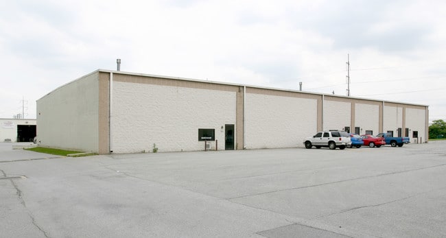
100 Naamans Rd
06-060.00-009
Gilbert Subd
Warehouse
New Castle
X
Delaware
10003C0087L
9.08 AC
2024
Wilmington
2024
Philadelphia
010105
Philadelphia-Camden-Wilmington, PA-NJ-DE-MD
84,956 SF
DEMOGRAPHICS near 100 Naamans Rd
1 Mile
3 Mile
5 Mile
2024 Total Population
2,183
58,237
145,606
2029 Population
2,212
58,394
146,145
Pop Growth 2024-2029
+ 1.33%
+ 0.27%
+ 0.37%
Average Age
37
41
41
2024 Total Households
819
23,894
57,501
HH Growth 2024-2029
+ 1.47%
+ 0.31%
+ 0.40%
Median Household Inc
$67,695
$70,704
$75,072
Avg Household Size
2.60
2.40
2.50
2024 Avg HH Vehicles
2.00
2.00
2.00
Median Home Value
$165,354
$255,293
$293,013
Median Year Built
1962
1964
1963
Nearby Places
Map Layers
Map Styles
 Street
 Aerial
- Restaurants
- Banks
- Shops
- Fitness
- Groceries
PUBLIC TRANSPORTATION
COMMUTER RAIL
Claymont Transportation Center (Wilmington/Newark Line - SEPTA)
DRIVE
WALK
Distance
Claymont Transportation Center (Wilmington/Newark Line - SEPTA)
6 min
1.9 mi
Claymont (R2 - Southeastern Pennsylvania Transportation Authority Regional Rail (SEPTA Regional Rail))
DRIVE
WALK
Distance
Claymont (R2 - Southeastern Pennsylvania Transportation Authority Regional Rail (SEPTA Regional Rail))
7 min
2.0 mi
AIRPORT
Philadelphia International
DRIVE
WALK
Distance
Philadelphia International
22 min
13.5 mi
Freight Ports
Port of Wilmington, RI
DRIVE
WALK
Distance
Port of Wilmington, RI
17 min
10.4 mi
Nearby Properties
Address
Land Use
TOTAL SIZE
Lot Size
Zoning
Address
Land Use
TOTAL SIZE
Lot Size
Zoning
Address
Land Use
TOTAL SIZE
Lot Size
Zoning
26,424 SF
341 AC
Address
Land Use
TOTAL SIZE
Lot Size
Zoning
141,978 SF
2.11 AC
Address
Land Use
TOTAL SIZE
Lot Size
Zoning
167.83 AC
LI
Address
Land Use
TOTAL SIZE
Lot Size
Zoning
36.50 AC
Address
Land Use
TOTAL SIZE
Lot Size
Zoning
164,862 SF
10.70 AC
Address
Land Use
TOTAL SIZE
Lot Size
Zoning
15,880 SF
27.07 AC
Address
Land Use
TOTAL SIZE
Lot Size
Zoning
23,179 SF
2 AC
Address
Land Use
TOTAL SIZE
Lot Size
Zoning
95,760 SF
20 AC
Address
Land Use
TOTAL SIZE
Lot Size
Zoning
22,140 SF
16 AC
Address
Land Use
TOTAL SIZE
Lot Size
Zoning
401,000 SF
10 AC
Address
Land Use
TOTAL SIZE
Lot Size
Zoning
148,451 SF
22.82 AC
Address
Land Use
TOTAL SIZE
Lot Size
Zoning
37,216 SF
7.68 AC
Address
Land Use
TOTAL SIZE
Lot Size
Zoning
10,716 SF
14.34 AC
Address
Land Use
TOTAL SIZE
Lot Size
Zoning
208,352 SF
21 AC
Address
Land Use
TOTAL SIZE
Lot Size
Zoning
5,626 SF
54.24 AC
Address
Land Use
TOTAL SIZE
Lot Size
Zoning
5,812 SF
72.63 AC
Address
Land Use
TOTAL SIZE
Lot Size
Zoning
11,146 SF
21.82 AC
Address
Land Use
TOTAL SIZE
Lot Size
Zoning
122,819 SF
21.23 AC
S
Address
Land Use
TOTAL SIZE
Lot Size
Zoning
560 SF
298.31 AC
Address
Land Use
TOTAL SIZE
Lot Size
Zoning
240,690 SF
18.44 AC
NCAP
Address
Land Use
TOTAL SIZE
Lot Size
Zoning
44,200 SF
9.30 AC
Address
Land Use
TOTAL SIZE
Lot Size
Zoning
131,812 SF
20.70 AC
Address
Land Use
TOTAL SIZE
Lot Size
Zoning
166,216 SF
5.01 AC
NCAP
Address
Land Use
TOTAL SIZE
Lot Size
Zoning
141,066 SF
36.52 AC
S
Address
Land Use
TOTAL SIZE
Lot Size
Zoning
231.88 AC
RFI
Address
Land Use
TOTAL SIZE
Lot Size
Zoning
162,420 SF
8 AC
Address
Land Use
TOTAL SIZE
Lot Size
Zoning
359,520 SF
28.18 AC
HI
Address
Land Use
TOTAL SIZE
Lot Size
Zoning
324,733 SF
17.70 AC
NCAP
Address
Land Use
TOTAL SIZE
Lot Size
Zoning
54,000 SF
9.58 AC
The World's #1 Commercial Real Estate Marketplace
Connect with us
© 2025 CoStar Group
The information above has been obtained from sources believed reliable. While we do not doubt its accuracy we have not verified it and make no guarantee, warranty or representation about it. It is your responsibility to independently confirm its accuracy and completeness. Any projections, opinions, assumptions, or estimates used are for example only and do not represent the current or future performance of the property. The value of this transaction to you depends on tax and other factors which should be evaluated by your tax, financial, and legal advisors. You and your advisors should conduct a careful, independent investigation of the property to determine to your satisfaction the suitability of the property for your needs.