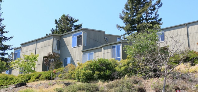
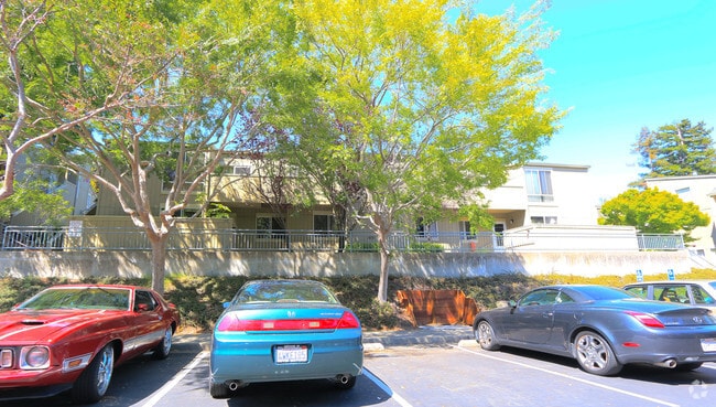
Property Record
100 Neds Way, Belvedere Tiburon, CA 94920

NEARBY LISTINGS FOR SALE OR LEASE
Property Detail
100 Neds Way
058-151-39
Hilarita
Taxexempt
Marin
X
California
06041C0489E
7.58 AC
2025
Outer Mill Vly/Corte Madera/Sausalito
2025
North Bay/Santa Rosa
124200
San Rafael, CA
83,323 SF
DEMOGRAPHICS near 100 Neds Way
1 Mile
3 Mile
5 Mile
2024 Total Population
6,005
30,299
63,859
2029 Population
5,915
29,625
62,224
Pop Growth 2024-2029
(1.50%)
(2.22%)
(2.56%)
Average Age
50
47
46
2024 Total Households
2,624
13,812
27,359
HH Growth 2024-2029
(1.60%)
(2.30%)
(2.60%)
Median Household Inc
$191,405
$149,271
$166,846
Avg Household Size
2.30
2.20
2.30
2024 Avg HH Vehicles
2.00
2.00
2.00
Median Home Value
$1,142,286
$1,130,266
$1,128,247
Median Year Built
1967
1966
1965
Nearby Places
Map Layers
Map Styles
 Street
 Aerial
- Restaurants
- Banks
- Shops
- Fitness
- Groceries
PUBLIC TRANSPORTATION
COMMUTER RAIL
Larkspur Smart (Main Line - Sonoma Marin Area Rail Transit)
DRIVE
WALK
Distance
Larkspur Smart (Main Line - Sonoma Marin Area Rail Transit)
13 min
7.0 mi
San Rafael Smart (Main Line - Sonoma Marin Area Rail Transit)
DRIVE
WALK
Distance
San Rafael Smart (Main Line - Sonoma Marin Area Rail Transit)
14 min
8.9 mi
AIRPORT
San Francisco International
DRIVE
WALK
Distance
San Francisco International
48 min
29.3 mi
Metro Oakland International
DRIVE
WALK
Distance
Metro Oakland International
51 min
36.5 mi
Freight Ports
Port of Richmond
DRIVE
WALK
Distance
Port of Richmond
29 min
17.1 mi
Nearby Properties
Address
Land Use
TOTAL SIZE
Lot Size
Zoning
Address
Land Use
TOTAL SIZE
Lot Size
Zoning
257,091 SF
14.21 AC
Address
Land Use
TOTAL SIZE
Lot Size
Zoning
Address
Land Use
TOTAL SIZE
Lot Size
Zoning
64,780 SF
50 AC
Address
Land Use
TOTAL SIZE
Lot Size
Zoning
110,272 SF
10.69 AC
Address
Land Use
TOTAL SIZE
Lot Size
Zoning
115,264 SF
6.29 AC
Address
Land Use
TOTAL SIZE
Lot Size
Zoning
100,900 SF
4.32 AC
Address
Land Use
TOTAL SIZE
Lot Size
Zoning
175,913 SF
19.81 AC
Address
Land Use
TOTAL SIZE
Lot Size
Zoning
75,629 SF
2.80 AC
Address
Land Use
TOTAL SIZE
Lot Size
Zoning
100,000 SF
6.30 AC
Address
Land Use
TOTAL SIZE
Lot Size
Zoning
65,933 SF
3.11 AC
Address
Land Use
TOTAL SIZE
Lot Size
Zoning
23,156 SF
3.71 AC
Address
Land Use
TOTAL SIZE
Lot Size
Zoning
18.30 AC
Address
Land Use
TOTAL SIZE
Lot Size
Zoning
175,802 SF
10.87 AC
Address
Land Use
TOTAL SIZE
Lot Size
Zoning
54,424 SF
2.31 AC
Address
Land Use
TOTAL SIZE
Lot Size
Zoning
159,300 SF
23.62 AC
Address
Land Use
TOTAL SIZE
Lot Size
Zoning
92,278 SF
49.10 AC
Address
Land Use
TOTAL SIZE
Lot Size
Zoning
72,126 SF
4.36 AC
Address
Land Use
TOTAL SIZE
Lot Size
Zoning
85,883 SF
3.52 AC
Address
Land Use
TOTAL SIZE
Lot Size
Zoning
79,070 SF
3.85 AC
Address
Land Use
TOTAL SIZE
Lot Size
Zoning
7.15 AC
Address
Land Use
TOTAL SIZE
Lot Size
Zoning
31,645 SF
0.61 AC
Address
Land Use
TOTAL SIZE
Lot Size
Zoning
62,142 SF
4.75 AC
RMP148
Address
Land Use
TOTAL SIZE
Lot Size
Zoning
26,298 SF
1.20 AC
Address
Land Use
TOTAL SIZE
Lot Size
Zoning
25,517 SF
13.29 AC
Address
Land Use
TOTAL SIZE
Lot Size
Zoning
19,363 SF
2.83 AC
Address
Land Use
TOTAL SIZE
Lot Size
Zoning
66,197 SF
3.60 AC
Address
Land Use
TOTAL SIZE
Lot Size
Zoning
2.76 AC
Address
Land Use
TOTAL SIZE
Lot Size
Zoning
3.53 AC
Address
Land Use
TOTAL SIZE
Lot Size
Zoning
20,352 SF
0.63 AC
The World's #1 Commercial Real Estate Marketplace
Connect with us
© 2026 CoStar Group
The information above has been obtained from sources believed reliable. While we do not doubt its accuracy we have not verified it and make no guarantee, warranty or representation about it. It is your responsibility to independently confirm its accuracy and completeness. Any projections, opinions, assumptions, or estimates used are for example only and do not represent the current or future performance of the property. The value of this transaction to you depends on tax and other factors which should be evaluated by your tax, financial, and legal advisors. You and your advisors should conduct a careful, independent investigation of the property to determine to your satisfaction the suitability of the property for your needs.