Property Record
100 Northern Dr, Troy, NY 12182


NEARBY LISTINGS FOR SALE OR LEASE
Property Detail
100 Northern Dr
1700-080-3-4
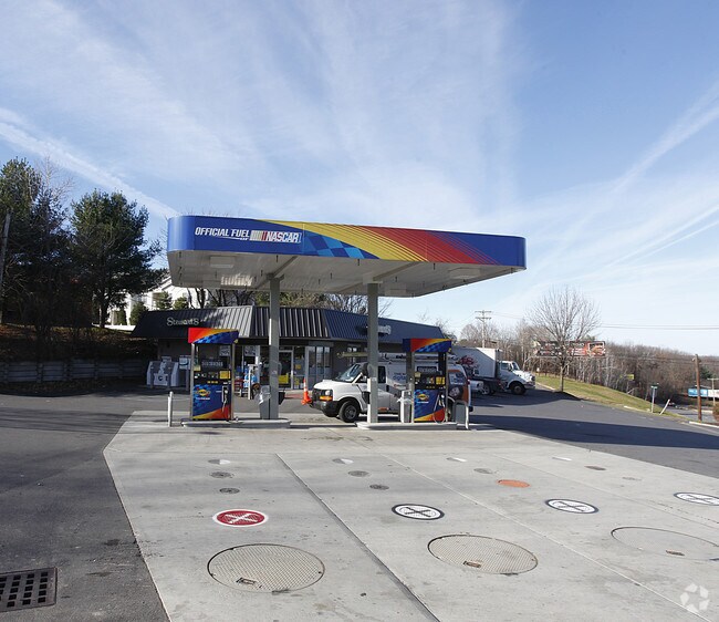
1 STY MAS & FR BLDG & GAS BAY OAKWOOD & NORTHERN 381-3
Servicestationmarket
Rensselaer
ARE
New York
36083C0117D
4.000
2025
1.52 AC
2024
Greater Troy
041400
Albany/Schenectady/Troy
3,891 SF
Albany-Schenectady-Troy, NY
DEMOGRAPHICS near 100 Northern Dr
1 Mile
3 Mile
5 Mile
2024 Total Population
6,324
37,969
98,470
2029 Population
6,204
37,238
97,320
Pop Growth 2024-2029
(1.90%)
(1.93%)
(1.17%)
Average Age
43
41
40
2024 Total Households
2,780
17,188
42,684
HH Growth 2024-2029
(1.98%)
(2.08%)
(1.24%)
Median Household Inc
$56,333
$55,994
$60,993
Avg Household Size
2.20
2.10
2.10
2024 Avg HH Vehicles
1.00
1.00
1.00
Median Home Value
$167,022
$181,958
$215,579
Median Year Built
1959
1949
1954
Nearby Places
Map Layers
Map Styles
 Street
 Aerial
- Restaurants
- Banks
- Shops
- Fitness
- Groceries
PUBLIC TRANSPORTATION
AIRPORT
Albany International
DRIVE
WALK
Distance
Albany International
19 min
11.0 mi
Freight Ports
Albany, NY Port
DRIVE
WALK
Distance
Albany, NY Port
24 min
13.7 mi
Nearby Properties
Address
Land Use
TOTAL SIZE
Lot Size
Zoning
Address
Land Use
TOTAL SIZE
Lot Size
Zoning
173.09 AC
Address
Land Use
TOTAL SIZE
Lot Size
Zoning
5,000 SF
48.44 AC
CR
Address
Land Use
TOTAL SIZE
Lot Size
Zoning
150,000 SF
45.60 AC
07 - MIXED
Address
Land Use
TOTAL SIZE
Lot Size
Zoning
39.06 AC
Address
Land Use
TOTAL SIZE
Lot Size
Zoning
77,193 SF
28.41 AC
SF
Address
Land Use
TOTAL SIZE
Lot Size
Zoning
Address
Land Use
TOTAL SIZE
Lot Size
Zoning
16,698 SF
46.45 AC
MF
Address
Land Use
TOTAL SIZE
Lot Size
Zoning
193,144 SF
41.18 AC
Address
Land Use
TOTAL SIZE
Lot Size
Zoning
251,672 SF
16.18 AC
06 - INDUS
Address
Land Use
TOTAL SIZE
Lot Size
Zoning
346,727 SF
15.06 AC
03 - MULTI
Address
Land Use
TOTAL SIZE
Lot Size
Zoning
1.30 AC
Address
Land Use
TOTAL SIZE
Lot Size
Zoning
210,415 SF
1.69 AC
MF
Address
Land Use
TOTAL SIZE
Lot Size
Zoning
Address
Land Use
TOTAL SIZE
Lot Size
Zoning
723,643 SF
27.56 AC
Address
Land Use
TOTAL SIZE
Lot Size
Zoning
93,373 SF
4.50 AC
02 - SINGL
Address
Land Use
TOTAL SIZE
Lot Size
Zoning
5,500 SF
15.31 AC
MU2
Address
Land Use
TOTAL SIZE
Lot Size
Zoning
148,200 SF
7.43 AC
06 - INDUS
Address
Land Use
TOTAL SIZE
Lot Size
Zoning
1,500 SF
7.01 AC
WMU
Address
Land Use
TOTAL SIZE
Lot Size
Zoning
3,844 SF
3.18 AC
Address
Land Use
TOTAL SIZE
Lot Size
Zoning
Address
Land Use
TOTAL SIZE
Lot Size
Zoning
42,075 SF
4.30 AC
02 - SINGL
Address
Land Use
TOTAL SIZE
Lot Size
Zoning
120,000 SF
14.10 AC
06 - INDUS
Address
Land Use
TOTAL SIZE
Lot Size
Zoning
95,466 SF
7.64 AC
MF
Address
Land Use
TOTAL SIZE
Lot Size
Zoning
52 AC
CR
Address
Land Use
TOTAL SIZE
Lot Size
Zoning
3,320 SF
215.98 AC
CR
Address
Land Use
TOTAL SIZE
Lot Size
Zoning
23,768 SF
8.78 AC
05 - COMME
Address
Land Use
TOTAL SIZE
Lot Size
Zoning
70,069 SF
4.47 AC
03
Address
Land Use
TOTAL SIZE
Lot Size
Zoning
31,746 SF
14.19 AC
I
Address
Land Use
TOTAL SIZE
Lot Size
Zoning
212,672 SF
3.90 AC
07 - MIXED
Address
Land Use
TOTAL SIZE
Lot Size
Zoning
86,904 SF
150.22 AC
The World's #1 Commercial Real Estate Marketplace
Connect with us
© 2025 CoStar Group
The information above has been obtained from sources believed reliable. While we do not doubt its accuracy we have not verified it and make no guarantee, warranty or representation about it. It is your responsibility to independently confirm its accuracy and completeness. Any projections, opinions, assumptions, or estimates used are for example only and do not represent the current or future performance of the property. The value of this transaction to you depends on tax and other factors which should be evaluated by your tax, financial, and legal advisors. You and your advisors should conduct a careful, independent investigation of the property to determine to your satisfaction the suitability of the property for your needs.