Property Record
100 Nw 33Rd Ave, Pompano Beach, FL 33069
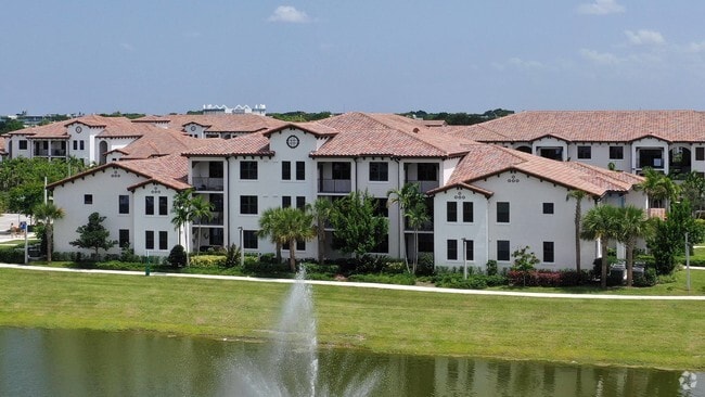


Property Detail
100 Nw 33Rd Ave
48-42-32-19-0010
RESIDENCES AT PALM AIRE 181-178 B PARCEL A
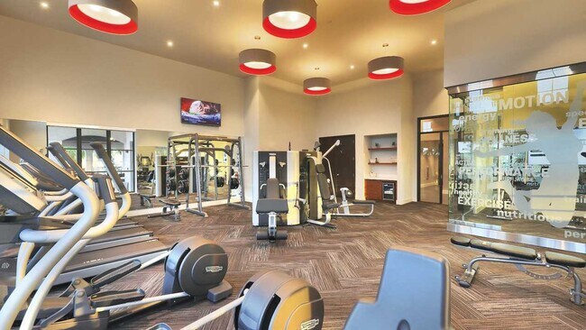
Multifamilydwelling
BROWARD
RPUD
Florida
AH Areas with a 1% annual chance of shallow flooding, usually in the form of a pond, withan average depth ranging from 1 to 3 feet. These areas have a 26% chance of flooding over the life of a 30-year mortgage.
26.84 AC
2025
Palm Aire
2026
South Florida
030602
Fort Lauderdale-Pompano Beach-Sunrise, FL
425,379 SF
NEARBY LISTINGS FOR SALE OR LEASE
DEMOGRAPHICS near 100 Nw 33Rd Ave
1 mile
3 mile
5 mile
2025 Total Population
19,774
126,736
438,847
2030 Population
21,568
135,788
466,253
Pop Growth 2025-2030
+ 9.07%
+ 7.14%
+ 6.25%
Average Age
45
42
42
2025 Total Households
8,220
50,557
175,356
HH Growth 2025-2030
+ 9.57%
+ 7.04%
+ 6.12%
Median Household Inc
$59,801
$61,684
$69,662
Avg Household Size
2.20
2.40
2.40
2025 Avg HH Vehicles
1.00
1.00
2.00
Median Home Value
$279,578
$300,757
$382,414
Median Year Built
1977
1979
1977
Nearby Places
Map Layers
Map Styles
 Street
 Aerial
Layers
 Traffic
 Biking
Places
Listings with unknown addresses are not visible on the map
- Restaurants
- Banks
- Shops
- Fitness
- Groceries
PUBLIC TRANSPORTATION
COMMUTER RAIL
Cypress Creek (Tri-County Commuter - South Florida Regional Transportation Authority (Tri-Rail))
Drive
Walk
Distance
Cypress Creek (Tri-County Commuter - South Florida Regional Transportation Authority (Tri-Rail))
8 min
4.0 mi
Pompano Beach (Tri-County Commuter - South Florida Regional Transportation Authority (Tri-Rail))
Drive
Walk
Distance
Pompano Beach (Tri-County Commuter - South Florida Regional Transportation Authority (Tri-Rail))
11 min
5.3 mi
AIRPORT
Fort Lauderdale/Hollywood International
Drive
Walk
Distance
Fort Lauderdale/Hollywood International
24 min
15.1 mi
Freight Ports
Port Everglades
Drive
Walk
Distance
Port Everglades
23 min
13.8 mi
Nearby Properties
Address
Land Use
TOTAL SIZE
Lot Size
Zoning
Address
Land Use
TOTAL SIZE
Lot Size
Zoning
202,260 SF
443 AC
GAA
Address
Land Use
TOTAL SIZE
Lot Size
Zoning
1,724,503 SF
64.97 AC
LAC
Address
Land Use
TOTAL SIZE
Lot Size
Zoning
32,538 SF
331.51 AC
P
Address
Land Use
TOTAL SIZE
Lot Size
Zoning
302,696 SF
42.40 AC
Address
Land Use
TOTAL SIZE
Lot Size
Zoning
467,722 SF
36.71 AC
I-1
Address
Land Use
TOTAL SIZE
Lot Size
Zoning
667,120 SF
12.75 AC
PCD
Address
Land Use
TOTAL SIZE
Lot Size
Zoning
297,289 SF
2.45 AC
UUV-NE
Address
Land Use
TOTAL SIZE
Lot Size
Zoning
365,849 SF
25.66 AC
RM-10
Address
Land Use
TOTAL SIZE
Lot Size
Zoning
553,007 SF
72.23 AC
CF
Address
Land Use
TOTAL SIZE
Lot Size
Zoning
591,110 SF
62.54 AC
CF
Address
Land Use
TOTAL SIZE
Lot Size
Zoning
294,865 SF
14.49 AC
PUD
Address
Land Use
TOTAL SIZE
Lot Size
Zoning
396,092 SF
1.81 AC
TO-DPOD
Address
Land Use
TOTAL SIZE
Lot Size
Zoning
380,866 SF
26.23 AC
O-IP/PCD
Address
Land Use
TOTAL SIZE
Lot Size
Zoning
500,974 SF
16.20 AC
CF-1
Address
Land Use
TOTAL SIZE
Lot Size
Zoning
238,898 SF
13.84 AC
TOC-CC
Address
Land Use
TOTAL SIZE
Lot Size
Zoning
434,859 SF
38.72 AC
CF
Address
Land Use
TOTAL SIZE
Lot Size
Zoning
548,682 SF
21.63 AC
CF
Address
Land Use
TOTAL SIZE
Lot Size
Zoning
274,772 SF
22.37 AC
PUD
Address
Land Use
TOTAL SIZE
Lot Size
Zoning
769,391 SF
51.52 AC
I-1
Address
Land Use
TOTAL SIZE
Lot Size
Zoning
295,883 SF
21.22 AC
PUD
Address
Land Use
TOTAL SIZE
Lot Size
Zoning
216,533 SF
9.99 AC
RPUD
Address
Land Use
TOTAL SIZE
Lot Size
Zoning
291,908 SF
29.79 AC
B-3
Address
Land Use
TOTAL SIZE
Lot Size
Zoning
255,974 SF
9.96 AC
PUD
Address
Land Use
TOTAL SIZE
Lot Size
Zoning
236,682 SF
43.59 AC
PUD
Address
Land Use
TOTAL SIZE
Lot Size
Zoning
283,330 SF
27.02 AC
I-1/PCI
Address
Land Use
TOTAL SIZE
Lot Size
Zoning
276,066 SF
14.32 AC
B-3
Address
Land Use
TOTAL SIZE
Lot Size
Zoning
315,006 SF
3.56 AC
B-3
Address
Land Use
TOTAL SIZE
Lot Size
Zoning
10,315 SF
37.74 AC
PCD
Address
Land Use
TOTAL SIZE
Lot Size
Zoning
224,769 SF
15.48 AC
I-1
The World's #1 Commercial Real Estate Marketplace
Connect with us
© 2026 CoStar Group
The information above has been obtained from sources believed reliable. While we do not doubt its accuracy we have not verified it and make no guarantee, warranty or representation about it. It is your responsibility to independently confirm its accuracy and completeness. Any projections, opinions, assumptions, or estimates used are for example only and do not represent the current or future performance of the property. The value of this transaction to you depends on tax and other factors which should be evaluated by your tax, financial, and legal advisors. You and your advisors should conduct a careful, independent investigation of the property to determine to your satisfaction the suitability of the property for your needs.