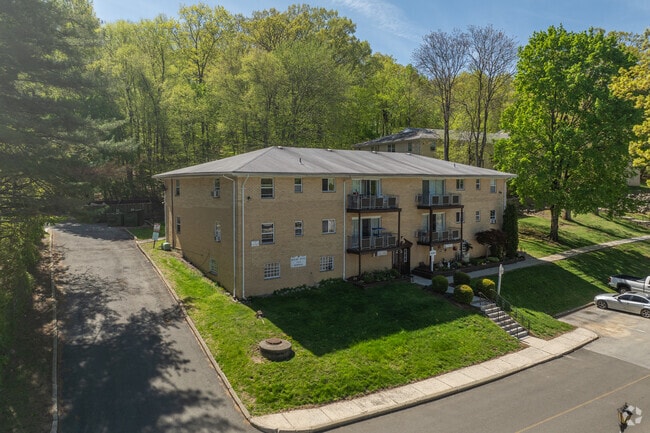
Property Record
100 Oakwood Dr, Peekskill, NY 10566


NEARBY LISTINGS FOR SALE OR LEASE
Property Detail
100 Oakwood Dr
1200-023-014-00006-000-0034
Westchester
Apartment
New York
X
34.000
36119C0016F
26 AC
2025
Outlying Westchester County
2024
Westchester/So Connecticut
014300
New York-Jersey City-White Plains, NY-NJ
DEMOGRAPHICS near 100 Oakwood Dr
1 Mile
3 Mile
5 Mile
2024 Total Population
13,134
47,487
76,123
2029 Population
12,815
46,233
74,326
Pop Growth 2024-2029
(2.43%)
(2.64%)
(2.36%)
Average Age
40
42
42
2024 Total Households
4,655
17,258
27,240
HH Growth 2024-2029
(2.58%)
(2.81%)
(2.57%)
Median Household Inc
$88,837
$98,814
$111,664
Avg Household Size
2.60
2.60
2.70
2024 Avg HH Vehicles
2.00
2.00
2.00
Median Home Value
$321,698
$374,714
$422,281
Median Year Built
1961
1961
1962
Nearby Places
Map Layers
Map Styles
 Street
 Aerial
- Restaurants
- Banks
- Shops
- Fitness
- Groceries
PUBLIC TRANSPORTATION
COMMUTER RAIL
Peekskill Station (Hudson Line - Metro-North Commuter Railroad Company (Metro-North))
DRIVE
WALK
Distance
Peekskill Station (Hudson Line - Metro-North Commuter Railroad Company (Metro-North))
6 min
2.4 mi
Manitou Station (Hudson Line - Metro-North Commuter Railroad Company (Metro-North))
DRIVE
WALK
Distance
Manitou Station (Hudson Line - Metro-North Commuter Railroad Company (Metro-North))
15 min
7.5 mi
AIRPORT
New York Stewart International
DRIVE
WALK
Distance
New York Stewart International
44 min
25.0 mi
Westchester County
DRIVE
WALK
Distance
Westchester County
42 min
30.0 mi
Freight Ports
NY - Red Hook Container Terminal
DRIVE
WALK
Distance
NY - Red Hook Container Terminal
84 min
55.5 mi
Nearby Properties
Address
Land Use
TOTAL SIZE
Lot Size
Zoning
Address
Land Use
TOTAL SIZE
Lot Size
Zoning
Address
Land Use
TOTAL SIZE
Lot Size
Zoning
Address
Land Use
TOTAL SIZE
Lot Size
Zoning
95,159 SF
34.56 AC
B2
Address
Land Use
TOTAL SIZE
Lot Size
Zoning
Address
Land Use
TOTAL SIZE
Lot Size
Zoning
Address
Land Use
TOTAL SIZE
Lot Size
Zoning
Address
Land Use
TOTAL SIZE
Lot Size
Zoning
13,520 SF
1.16 AC
CC1
Address
Land Use
TOTAL SIZE
Lot Size
Zoning
21,466 SF
2.87 AC
CC1
Address
Land Use
TOTAL SIZE
Lot Size
Zoning
Address
Land Use
TOTAL SIZE
Lot Size
Zoning
Address
Land Use
TOTAL SIZE
Lot Size
Zoning
Address
Land Use
TOTAL SIZE
Lot Size
Zoning
2.70 AC
Address
Land Use
TOTAL SIZE
Lot Size
Zoning
18.27 AC
R80
Address
Land Use
TOTAL SIZE
Lot Size
Zoning
Address
Land Use
TOTAL SIZE
Lot Size
Zoning
Address
Land Use
TOTAL SIZE
Lot Size
Zoning
7,254 SF
17.72 AC
R80
Address
Land Use
TOTAL SIZE
Lot Size
Zoning
240.57 AC
CD
Address
Land Use
TOTAL SIZE
Lot Size
Zoning
9,707 SF
5.51 AC
R80
Address
Land Use
TOTAL SIZE
Lot Size
Zoning
22.61 AC
Address
Land Use
TOTAL SIZE
Lot Size
Zoning
8,834 SF
2.58 AC
CC1
Address
Land Use
TOTAL SIZE
Lot Size
Zoning
8.93 AC
Address
Land Use
TOTAL SIZE
Lot Size
Zoning
2.99 AC
Address
Land Use
TOTAL SIZE
Lot Size
Zoning
4,160 SF
3.75 AC
R80
Address
Land Use
TOTAL SIZE
Lot Size
Zoning
Address
Land Use
TOTAL SIZE
Lot Size
Zoning
7,176 SF
4.86 AC
CC1
Address
Land Use
TOTAL SIZE
Lot Size
Zoning
9,454 SF
0.99 AC
LP
Address
Land Use
TOTAL SIZE
Lot Size
Zoning
Address
Land Use
TOTAL SIZE
Lot Size
Zoning
7.50 AC
Address
Land Use
TOTAL SIZE
Lot Size
Zoning
38.05 AC
Address
Land Use
TOTAL SIZE
Lot Size
Zoning
148.54 AC
R80
The World's #1 Commercial Real Estate Marketplace
Connect with us
© 2025 CoStar Group
The information above has been obtained from sources believed reliable. While we do not doubt its accuracy we have not verified it and make no guarantee, warranty or representation about it. It is your responsibility to independently confirm its accuracy and completeness. Any projections, opinions, assumptions, or estimates used are for example only and do not represent the current or future performance of the property. The value of this transaction to you depends on tax and other factors which should be evaluated by your tax, financial, and legal advisors. You and your advisors should conduct a careful, independent investigation of the property to determine to your satisfaction the suitability of the property for your needs.