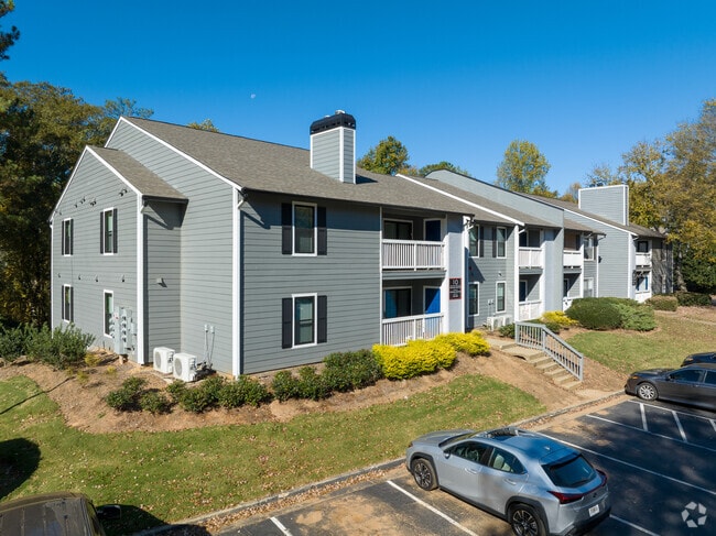
Property Record
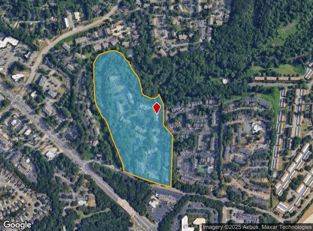
100 Old Holcomb Bridge Way, Roswell, GA 30076
NEARBY LISTINGS FOR SALE OR LEASE
Property Detail
100 Old Holcomb Bridge Way
Apartment
Fulton
AE
Georgia
13121C0064G
22.30 AC
2024
Outlying Fulton County
2025
Atlanta
011430
Atlanta-Sandy Springs-Roswell, GA
1,071,370 SF
12-2290-0539-071-1
DEMOGRAPHICS near 100 Old Holcomb Bridge Way
1 Mile
3 Mile
5 Mile
2024 Total Population
14,060
69,645
185,283
2029 Population
14,377
71,282
188,426
Pop Growth 2024-2029
+ 2.25%
+ 2.35%
+ 1.70%
Average Age
34
40
40
2024 Total Households
5,478
29,319
73,910
HH Growth 2024-2029
+ 2.45%
+ 2.47%
+ 1.82%
Median Household Inc
$69,860
$96,884
$116,198
Avg Household Size
2.50
2.30
2.40
2024 Avg HH Vehicles
2.00
2.00
2.00
Median Home Value
$334,025
$403,009
$497,735
Median Year Built
1987
1987
1988
Nearby Places
Map Layers
Map Styles
 Street
 Aerial
- Restaurants
- Banks
- Shops
- Fitness
- Groceries
PUBLIC TRANSPORTATION
AIRPORT
Hartsfield - Jackson Atlanta International
DRIVE
WALK
Distance
Hartsfield - Jackson Atlanta International
43 min
30.9 mi
Freight Ports
Georgia Ports - Savannah
DRIVE
WALK
Distance
Georgia Ports - Savannah
306 min
270.2 mi
Nearby Properties
Address
Land Use
TOTAL SIZE
Lot Size
Zoning
Address
Land Use
TOTAL SIZE
Lot Size
Zoning
683,219 SF
48.04 AC
R4C
Address
Land Use
TOTAL SIZE
Lot Size
Zoning
9,544,248 SF
74.91 AC
R4
Address
Land Use
TOTAL SIZE
Lot Size
Zoning
1,078,010 SF
3.80 AC
OPC
Address
Land Use
TOTAL SIZE
Lot Size
Zoning
415,701 SF
6.75 AC
OI
Address
Land Use
TOTAL SIZE
Lot Size
Zoning
5,892,558 SF
33.38 AC
R4
Address
Land Use
TOTAL SIZE
Lot Size
Zoning
11.82 AC
Address
Land Use
TOTAL SIZE
Lot Size
Zoning
380,453 SF
10.28 AC
R4
Address
Land Use
TOTAL SIZE
Lot Size
Zoning
260,648 SF
34.20 AC
C3C
Address
Land Use
TOTAL SIZE
Lot Size
Zoning
1,672,146 SF
21.21 AC
R4
Address
Land Use
TOTAL SIZE
Lot Size
Zoning
1,159,560 SF
7.12 AC
CUP
Address
Land Use
TOTAL SIZE
Lot Size
Zoning
2,674,992 SF
28.94 AC
R4C
Address
Land Use
TOTAL SIZE
Lot Size
Zoning
7,788,760 SF
46.55 AC
R4
Address
Land Use
TOTAL SIZE
Lot Size
Zoning
792,356 SF
20.07 AC
R5
Address
Land Use
TOTAL SIZE
Lot Size
Zoning
1,909,285 SF
22.39 AC
OI
Address
Land Use
TOTAL SIZE
Lot Size
Zoning
10,614,240 SF
24.05 AC
A
Address
Land Use
TOTAL SIZE
Lot Size
Zoning
2,109,527 SF
70.17 AC
OP
Address
Land Use
TOTAL SIZE
Lot Size
Zoning
666,599 SF
24.20 AC
PSC
Address
Land Use
TOTAL SIZE
Lot Size
Zoning
8,014,916 SF
28.58 AC
R4
Address
Land Use
TOTAL SIZE
Lot Size
Zoning
10,866,920 SF
31.48 AC
AC
Address
Land Use
TOTAL SIZE
Lot Size
Zoning
510,068 SF
64.18 AC
OPMS
Address
Land Use
TOTAL SIZE
Lot Size
Zoning
938,151 SF
21.22 AC
C3
Address
Land Use
TOTAL SIZE
Lot Size
Zoning
367,876 SF
41.40 AC
PSC
Address
Land Use
TOTAL SIZE
Lot Size
Zoning
5,499,045 SF
22.17 AC
AC
Address
Land Use
TOTAL SIZE
Lot Size
Zoning
1,791,710 SF
27 AC
ACOND
Address
Land Use
TOTAL SIZE
Lot Size
Zoning
1,185,316 SF
19.09 AC
R4
Address
Land Use
TOTAL SIZE
Lot Size
Zoning
1,592,455 SF
21.50 AC
R3
Address
Land Use
TOTAL SIZE
Lot Size
Zoning
1,069,100 SF
0.73 AC
A
Address
Land Use
TOTAL SIZE
Lot Size
Zoning
2,964,850 SF
38.74 AC
R4
Address
Land Use
TOTAL SIZE
Lot Size
Zoning
306,753 SF
19.77 AC
HMS
The World's #1 Commercial Real Estate Marketplace
Connect with us
© 2026 CoStar Group
The information above has been obtained from sources believed reliable. While we do not doubt its accuracy we have not verified it and make no guarantee, warranty or representation about it. It is your responsibility to independently confirm its accuracy and completeness. Any projections, opinions, assumptions, or estimates used are for example only and do not represent the current or future performance of the property. The value of this transaction to you depends on tax and other factors which should be evaluated by your tax, financial, and legal advisors. You and your advisors should conduct a careful, independent investigation of the property to determine to your satisfaction the suitability of the property for your needs.