Property Record
100 Overton Access Rd, Birmingham, AL 35223


NEARBY LISTINGS FOR SALE OR LEASE
-
-
View all Birmingham listings for sale on LoopNet.com
Property Detail
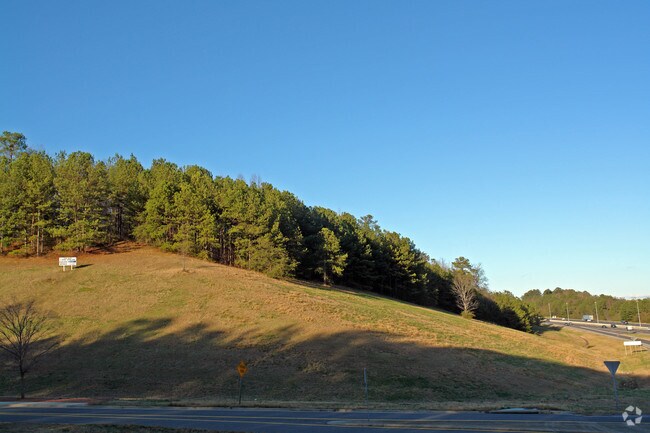
100 Overton Access Rd
28-00-01-3-000-003.000
NW 1/4 OF SW 1/4 LYING N OF I-459 R/W SEC 1 TP 18 R 2 SECT 01 TWSP 18S RANGE 2W
Amusementpark
Jefferson
X
Alabama
01117C0080F
23 AC
0
Hwy 280/Jefferson County
2024
Birmingham
010804
Birmingham-Hoover, AL
DEMOGRAPHICS near 100 Overton Access Rd
1 Mile
3 Mile
5 Mile
2024 Total Population
3,014
36,532
108,967
2029 Population
2,889
35,281
107,745
Pop Growth 2024-2029
(4.15%)
(3.42%)
(1.12%)
Average Age
41
40
39
2024 Total Households
1,044
14,532
47,396
HH Growth 2024-2029
(4.21%)
(3.61%)
(1.13%)
Median Household Inc
$156,428
$108,429
$72,520
Avg Household Size
2.90
2.40
2.20
2024 Avg HH Vehicles
2.00
2.00
2.00
Median Home Value
$535,714
$431,567
$393,966
Median Year Built
1972
1973
1973
Nearby Places
Map Layers
Map Styles
 Street
 Aerial
- Restaurants
- Banks
- Shops
- Fitness
- Groceries
PUBLIC TRANSPORTATION
AIRPORT
Birmingham-Shuttlesworth International
DRIVE
WALK
Distance
Birmingham-Shuttlesworth International
20 min
11.6 mi
Freight Ports
Port of Mobile
DRIVE
WALK
Distance
Port of Mobile
278 min
254.5 mi
SALE & LEASE HISTORY
LISTING DATE
SALE/LEASE

Sep 24, 2016
For Sale
Oct 11, 2017
For Sale
Nearby Properties
Address
Land Use
TOTAL SIZE
Lot Size
Zoning
Address
Land Use
TOTAL SIZE
Lot Size
Zoning
45,868 SF
6.80 AC
CP Y
Address
Land Use
TOTAL SIZE
Lot Size
Zoning
259,316 SF
30 AC
PUD
Address
Land Use
TOTAL SIZE
Lot Size
Zoning
166,863 SF
21 AC
CB2
Address
Land Use
TOTAL SIZE
Lot Size
Zoning
80,288 SF
2.91 AC
CB2
Address
Land Use
TOTAL SIZE
Lot Size
Zoning
361,937 SF
22 AC
R4
Address
Land Use
TOTAL SIZE
Lot Size
Zoning
155,160 SF
14.20 AC
B6
Address
Land Use
TOTAL SIZE
Lot Size
Zoning
423,995 SF
25 AC
R3
Address
Land Use
TOTAL SIZE
Lot Size
Zoning
144,135 SF
31.95 AC
CR5
Address
Land Use
TOTAL SIZE
Lot Size
Zoning
92,913 SF
15 AC
I3
Address
Land Use
TOTAL SIZE
Lot Size
Zoning
68,778 SF
3.40 AC
CP
Address
Land Use
TOTAL SIZE
Lot Size
Zoning
Address
Land Use
TOTAL SIZE
Lot Size
Zoning
68,803 SF
3.93 AC
CP
Address
Land Use
TOTAL SIZE
Lot Size
Zoning
198,270 SF
11.21 AC
CP
Address
Land Use
TOTAL SIZE
Lot Size
Zoning
129,702 SF
8.20 AC
C-1
Address
Land Use
TOTAL SIZE
Lot Size
Zoning
131,319 SF
13.28 AC
CB2
Address
Land Use
TOTAL SIZE
Lot Size
Zoning
235,552 SF
10.13 AC
R3
Address
Land Use
TOTAL SIZE
Lot Size
Zoning
57,938 SF
6.85 AC
CP
Address
Land Use
TOTAL SIZE
Lot Size
Zoning
83,931 SF
5.90 AC
O&I
Address
Land Use
TOTAL SIZE
Lot Size
Zoning
74,154 SF
4.20 AC
R-A
Address
Land Use
TOTAL SIZE
Lot Size
Zoning
83,776 SF
3.79 AC
B6
Address
Land Use
TOTAL SIZE
Lot Size
Zoning
22 AC
CB2
Address
Land Use
TOTAL SIZE
Lot Size
Zoning
210,920 SF
22.41 AC
CB2
Address
Land Use
TOTAL SIZE
Lot Size
Zoning
145,949 SF
10.01 AC
QR6
Address
Land Use
TOTAL SIZE
Lot Size
Zoning
59,108 SF
1.72 AC
CP&C
Address
Land Use
TOTAL SIZE
Lot Size
Zoning
102,748 SF
8.50 AC
CB2
Address
Land Use
TOTAL SIZE
Lot Size
Zoning
8.10 AC
QR6
Address
Land Use
TOTAL SIZE
Lot Size
Zoning
64,390 SF
7.10 AC
Address
Land Use
TOTAL SIZE
Lot Size
Zoning
95,702 SF
20.74 AC
R-B
Address
Land Use
TOTAL SIZE
Lot Size
Zoning
150,750 SF
12.60 AC
CR5
Address
Land Use
TOTAL SIZE
Lot Size
Zoning
47,099 SF
2.03 AC
CP
The World's #1 Commercial Real Estate Marketplace
Connect with us
© 2026 CoStar Group
The information above has been obtained from sources believed reliable. While we do not doubt its accuracy we have not verified it and make no guarantee, warranty or representation about it. It is your responsibility to independently confirm its accuracy and completeness. Any projections, opinions, assumptions, or estimates used are for example only and do not represent the current or future performance of the property. The value of this transaction to you depends on tax and other factors which should be evaluated by your tax, financial, and legal advisors. You and your advisors should conduct a careful, independent investigation of the property to determine to your satisfaction the suitability of the property for your needs.