Property Record
100 Parkhurst Cir, Aptos, CA 95003


Property Detail
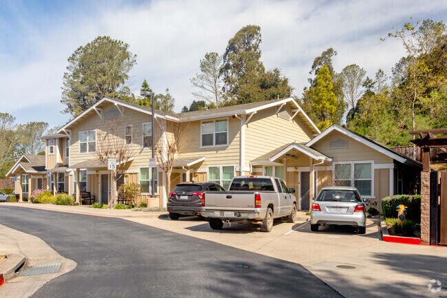
100 Parkhurst Cir
Apartment
Santa Cruz
RA
California
B and X Area of moderate flood hazard, usually the area between the limits of the 100-year and 500-year floods.
5.87 AC
2024
Outlying Santa Cruz County
2025
Santa Cruz/Watsonville
122204
Santa Cruz-Watsonville, CA
77,029 SF
041-271-72-000
NEARBY LISTINGS FOR SALE OR LEASE
-
-
View all Aptos listings for sale on LoopNet.com
DEMOGRAPHICS near 100 Parkhurst Cir
1 mile
3 mile
5 mile
2025 Total Population
1,416
19,809
40,143
2030 Population
1,303
19,453
39,337
Pop Growth 2025-2030
(7.98%)
(1.80%)
(2.01%)
Average Age
44
47
46
2025 Total Households
501
7,994
15,719
HH Growth 2025-2030
(8.78%)
(1.86%)
(2.08%)
Median Household Inc
$129,435
$138,103
$130,813
Avg Household Size
2.80
2.40
2.50
2025 Avg HH Vehicles
3.00
2.00
2.00
Median Home Value
$1,091,477
$1,090,766
$1,063,960
Median Year Built
1978
1975
1974
Nearby Places
Map Layers
Map Styles
 Street
 Aerial
Layers
 Traffic
 Biking
Places
Listings with unknown addresses are not visible on the map
- Restaurants
- Banks
- Shops
- Fitness
- Groceries
PUBLIC TRANSPORTATION
AIRPORT
Monterey Regional
Drive
Walk
Distance
Monterey Regional
45 min
35.5 mi
Norman Y Mineta San Jose International
Drive
Walk
Distance
Norman Y Mineta San Jose International
56 min
41.1 mi
Freight Ports
Port of Redwood City
Drive
Walk
Distance
Port of Redwood City
75 min
56.9 mi
Nearby Properties
Address
Land Use
TOTAL SIZE
Lot Size
Zoning
Address
Land Use
TOTAL SIZE
Lot Size
Zoning
70,818 SF
6.38 AC
C-2
Address
Land Use
TOTAL SIZE
Lot Size
Zoning
52,804 SF
4.17 AC
C-2
Address
Land Use
TOTAL SIZE
Lot Size
Zoning
3.84 AC
RM-4
Address
Land Use
TOTAL SIZE
Lot Size
Zoning
50,600 SF
4.19 AC
SU
Address
Land Use
TOTAL SIZE
Lot Size
Zoning
73,991 SF
9.15 AC
C-1
Address
Land Use
TOTAL SIZE
Lot Size
Zoning
0.35 AC
VA
Address
Land Use
TOTAL SIZE
Lot Size
Zoning
17,952 SF
1.47 AC
RM-3
Address
Land Use
TOTAL SIZE
Lot Size
Zoning
44,868 SF
4.08 AC
C-1
Address
Land Use
TOTAL SIZE
Lot Size
Zoning
27,052 SF
0.44 AC
Address
Land Use
TOTAL SIZE
Lot Size
Zoning
62,592 SF
5.55 AC
RM-2-R-L
Address
Land Use
TOTAL SIZE
Lot Size
Zoning
11,781 SF
76.71 AC
SU
Address
Land Use
TOTAL SIZE
Lot Size
Zoning
1,898 SF
51.55 AC
CA
Address
Land Use
TOTAL SIZE
Lot Size
Zoning
10,091 SF
0.65 AC
PA
Address
Land Use
TOTAL SIZE
Lot Size
Zoning
31,914 SF
29.21 AC
CA
Address
Land Use
TOTAL SIZE
Lot Size
Zoning
54,222 SF
1.25 AC
R-1-20
Address
Land Use
TOTAL SIZE
Lot Size
Zoning
7,859 SF
24.43 AC
CA
Address
Land Use
TOTAL SIZE
Lot Size
Zoning
21,058 SF
0.01 AC
RM-3
Address
Land Use
TOTAL SIZE
Lot Size
Zoning
2,232 SF
50.80 AC
CA
Address
Land Use
TOTAL SIZE
Lot Size
Zoning
12,584 SF
4.61 AC
PF-L
Address
Land Use
TOTAL SIZE
Lot Size
Zoning
3,040 SF
2.02 AC
C-2
Address
Land Use
TOTAL SIZE
Lot Size
Zoning
8,111 SF
18.83 AC
CA
Address
Land Use
TOTAL SIZE
Lot Size
Zoning
25,449 SF
1.77 AC
RM-2.5-H
Address
Land Use
TOTAL SIZE
Lot Size
Zoning
6,546 SF
0.16 AC
Address
Land Use
TOTAL SIZE
Lot Size
Zoning
27,396 SF
55.83 AC
SU
Address
Land Use
TOTAL SIZE
Lot Size
Zoning
18,518 SF
1.02 AC
PA
Address
Land Use
TOTAL SIZE
Lot Size
Zoning
30,290 SF
2.27 AC
SU
Address
Land Use
TOTAL SIZE
Lot Size
Zoning
23,297 SF
2.54 AC
PR
Address
Land Use
TOTAL SIZE
Lot Size
Zoning
7,528 SF
5.46 AC
RA
Address
Land Use
TOTAL SIZE
Lot Size
Zoning
5,378 SF
4.73 AC
SU
The World's #1 Commercial Real Estate Marketplace
Connect with us
© 2026 CoStar Group
The information above has been obtained from sources believed reliable. While we do not doubt its accuracy we have not verified it and make no guarantee, warranty or representation about it. It is your responsibility to independently confirm its accuracy and completeness. Any projections, opinions, assumptions, or estimates used are for example only and do not represent the current or future performance of the property. The value of this transaction to you depends on tax and other factors which should be evaluated by your tax, financial, and legal advisors. You and your advisors should conduct a careful, independent investigation of the property to determine to your satisfaction the suitability of the property for your needs.