Property Record
100 Pennant Dr, Pittsburgh, PA 15239

Save to a Folder
{{folder.Name}}
{{folder.ListingIds.length}} Properties
{{folder.ListingIds.length}} Property
Create a New Folder
Property Detail
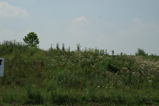
100 Pennant Dr
Pittsburgh, PA
SIXTH REVISION TO THE PLUM-MONROE COMMERCE PARK PLAN IRREG LOT 19=225X450X315X39.27X310X180.64
0740-R-00175-0000-00
Allegheny
Warehouse
Pennsylvania
B and X Area of moderate flood hazard, usually the area between the limits of the 100-year and 500-year floods.
175
2026
3.44 AC
2026
Monroeville
526202
Pittsburgh
NEARBY LISTINGS FOR SALE OR LEASE
-
-
View all Pittsburgh listings for sale on LoopNet.com
DEMOGRAPHICS near 100 Pennant Dr
1 mile
3 mile
5 mile
2025 Total Population
4,293
45,886
122,768
2030 Population
4,222
45,029
120,807
Pop Growth 2025-2030
(1.65%)
(1.87%)
(1.60%)
Average Age
44
44
45
2025 Total Households
1,777
20,334
54,825
HH Growth 2025-2030
(1.69%)
(1.93%)
(1.62%)
Median Household Inc
$98,428
$77,283
$76,647
Avg Household Size
2.40
2.20
2.20
2025 Avg HH Vehicles
2.00
2.00
2.00
Median Home Value
$242,668
$187,934
$189,030
Median Year Built
1964
1965
1962
Nearby Places
Map Layers
Map Styles
 Street
 Aerial
Layers
 Traffic
 Biking
Places
Listings with unknown addresses are not visible on the map
- Restaurants
- Banks
- Shops
- Fitness
- Groceries
PUBLIC TRANSPORTATION
AIRPORT
Arnold Palmer Regional
Drive
Walk
Distance
Arnold Palmer Regional
53 min
31.9 mi
Pittsburgh International
Drive
Walk
Distance
Pittsburgh International
53 min
33.1 mi
Nearby Properties
Address
Land Use
TOTAL SIZE
Lot Size
Zoning
Address
Land Use
TOTAL SIZE
Lot Size
Zoning
16.27 AC
Address
Land Use
TOTAL SIZE
Lot Size
Zoning
43.20 AC
Address
Land Use
TOTAL SIZE
Lot Size
Zoning
58.96 AC
Address
Land Use
TOTAL SIZE
Lot Size
Zoning
Address
Land Use
TOTAL SIZE
Lot Size
Zoning
Address
Land Use
TOTAL SIZE
Lot Size
Zoning
1,274 SF
115.40 AC
Address
Land Use
TOTAL SIZE
Lot Size
Zoning
Address
Land Use
TOTAL SIZE
Lot Size
Zoning
Address
Land Use
TOTAL SIZE
Lot Size
Zoning
46.31 AC
Address
Land Use
TOTAL SIZE
Lot Size
Zoning
34.65 AC
Address
Land Use
TOTAL SIZE
Lot Size
Zoning
23.25 AC
Address
Land Use
TOTAL SIZE
Lot Size
Zoning
37.34 AC
Address
Land Use
TOTAL SIZE
Lot Size
Zoning
42.24 AC
Address
Land Use
TOTAL SIZE
Lot Size
Zoning
148.17 AC
Address
Land Use
TOTAL SIZE
Lot Size
Zoning
Address
Land Use
TOTAL SIZE
Lot Size
Zoning
13.10 AC
Address
Land Use
TOTAL SIZE
Lot Size
Zoning
Address
Land Use
TOTAL SIZE
Lot Size
Zoning
15.99 AC
Address
Land Use
TOTAL SIZE
Lot Size
Zoning
Address
Land Use
TOTAL SIZE
Lot Size
Zoning
Address
Land Use
TOTAL SIZE
Lot Size
Zoning
20.86 AC
Address
Land Use
TOTAL SIZE
Lot Size
Zoning
2.18 AC
Address
Land Use
TOTAL SIZE
Lot Size
Zoning
Address
Land Use
TOTAL SIZE
Lot Size
Zoning
Address
Land Use
TOTAL SIZE
Lot Size
Zoning
25.80 AC
Address
Land Use
TOTAL SIZE
Lot Size
Zoning
50.13 AC
Address
Land Use
TOTAL SIZE
Lot Size
Zoning
30.94 AC
Address
Land Use
TOTAL SIZE
Lot Size
Zoning
Address
Land Use
TOTAL SIZE
Lot Size
Zoning
Address
Land Use
TOTAL SIZE
Lot Size
Zoning
5.06 AC
The World's #1 Commercial Real Estate Marketplace
Connect with us
© 2026 CoStar Group
The information above has been obtained from sources believed reliable. While we do not doubt its accuracy we have not verified it and make no guarantee, warranty or representation about it. It is your responsibility to independently confirm its accuracy and completeness. Any projections, opinions, assumptions, or estimates used are for example only and do not represent the current or future performance of the property. The value of this transaction to you depends on tax and other factors which should be evaluated by your tax, financial, and legal advisors. You and your advisors should conduct a careful, independent investigation of the property to determine to your satisfaction the suitability of the property for your needs.