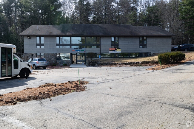
Property Record
100 Perimeter Rd, Nashua, NH 03063


NEARBY LISTINGS FOR SALE OR LEASE
Property Detail
100 Perimeter Rd
Governmentalpublicusegeneral
Hillsborough
X
New Hampshire
33011C0494D
1454
2023
Hillsborough
2024
Boston
010202
Manchester-Nashua, NH
4,964 SF
NASH-000000-000000-001454-000100E
DEMOGRAPHICS near 100 Perimeter Rd
1 Mile
3 Mile
5 Mile
2024 Total Population
5,484
48,833
111,360
2029 Population
5,597
49,941
113,817
Pop Growth 2024-2029
+ 2.06%
+ 2.27%
+ 2.21%
Average Age
41
42
42
2024 Total Households
2,349
20,537
45,052
HH Growth 2024-2029
+ 2.09%
+ 2.32%
+ 2.24%
Median Household Inc
$104,874
$90,466
$94,405
Avg Household Size
2.30
2.30
2.40
2024 Avg HH Vehicles
2.00
2.00
2.00
Median Home Value
$389,769
$354,832
$370,241
Median Year Built
1980
1975
1975
Nearby Places
Map Layers
Map Styles
 Street
 Aerial
- Restaurants
- Banks
- Shops
- Fitness
- Groceries
PUBLIC TRANSPORTATION
AIRPORT
Manchester Boston Regional
DRIVE
WALK
Distance
Manchester Boston Regional
25 min
15.0 mi
Freight Ports
Port of Boston
DRIVE
WALK
Distance
Port of Boston
73 min
51.8 mi
SALE & LEASE HISTORY
LISTING DATE
SALE/LEASE

Sep 30, 2016
For Sale
Sep 30, 2016
For Lease
Mar 05, 2018
For Sale
Nearby Properties
Address
Land Use
TOTAL SIZE
Lot Size
Zoning
Address
Land Use
TOTAL SIZE
Lot Size
Zoning
19.70 AC
RB
Address
Land Use
TOTAL SIZE
Lot Size
Zoning
28.04 AC
PI
Address
Land Use
TOTAL SIZE
Lot Size
Zoning
325.08 AC
AI
Address
Land Use
TOTAL SIZE
Lot Size
Zoning
60.25 AC
PI
Address
Land Use
TOTAL SIZE
Lot Size
Zoning
576,827 SF
446.22 AC
INDUST
Address
Land Use
TOTAL SIZE
Lot Size
Zoning
26.55 AC
INDUST
Address
Land Use
TOTAL SIZE
Lot Size
Zoning
621,927 SF
106.62 AC
INDUST
Address
Land Use
TOTAL SIZE
Lot Size
Zoning
231,216 SF
1.88 AC
GIMU
Address
Land Use
TOTAL SIZE
Lot Size
Zoning
16.12 AC
RC
Address
Land Use
TOTAL SIZE
Lot Size
Zoning
183,432 SF
16.40 AC
GB
Address
Land Use
TOTAL SIZE
Lot Size
Zoning
124,048 SF
23.43 AC
PI
Address
Land Use
TOTAL SIZE
Lot Size
Zoning
66 AC
R18
Address
Land Use
TOTAL SIZE
Lot Size
Zoning
74.50 AC
R9
Address
Land Use
TOTAL SIZE
Lot Size
Zoning
471,525 SF
40.78 AC
INDUST
Address
Land Use
TOTAL SIZE
Lot Size
Zoning
337,000 SF
24.26 AC
PI
Address
Land Use
TOTAL SIZE
Lot Size
Zoning
326,755 SF
43 AC
INDUST
Address
Land Use
TOTAL SIZE
Lot Size
Zoning
123,648 SF
135.87 AC
INDUST
Address
Land Use
TOTAL SIZE
Lot Size
Zoning
261,381 SF
3.78 AC
GIMU
Address
Land Use
TOTAL SIZE
Lot Size
Zoning
33.81 AC
PI
Address
Land Use
TOTAL SIZE
Lot Size
Zoning
9.50 AC
AI
Address
Land Use
TOTAL SIZE
Lot Size
Zoning
130,178 SF
11.07 AC
GB
Address
Land Use
TOTAL SIZE
Lot Size
Zoning
142,207 SF
4.72 AC
PI
Address
Land Use
TOTAL SIZE
Lot Size
Zoning
10.30 AC
RC
Address
Land Use
TOTAL SIZE
Lot Size
Zoning
141,816 SF
21.33 AC
R18
Address
Land Use
TOTAL SIZE
Lot Size
Zoning
9.01 AC
RC
Address
Land Use
TOTAL SIZE
Lot Size
Zoning
243,335 SF
2.71 AC
GIMU
Address
Land Use
TOTAL SIZE
Lot Size
Zoning
8.85 AC
RC
Address
Land Use
TOTAL SIZE
Lot Size
Zoning
127,825 SF
D1MU
Address
Land Use
TOTAL SIZE
Lot Size
Zoning
8.07 AC
RC
Address
Land Use
TOTAL SIZE
Lot Size
Zoning
8.38 AC
RC
The World's #1 Commercial Real Estate Marketplace
Connect with us
© 2025 CoStar Group
The information above has been obtained from sources believed reliable. While we do not doubt its accuracy we have not verified it and make no guarantee, warranty or representation about it. It is your responsibility to independently confirm its accuracy and completeness. Any projections, opinions, assumptions, or estimates used are for example only and do not represent the current or future performance of the property. The value of this transaction to you depends on tax and other factors which should be evaluated by your tax, financial, and legal advisors. You and your advisors should conduct a careful, independent investigation of the property to determine to your satisfaction the suitability of the property for your needs.