Property Record
100 Powell St, San Francisco, CA 94102

Current Lease Availabilities
NEARBY LISTINGS FOR SALE OR LEASE
Property Detail
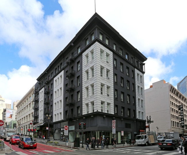
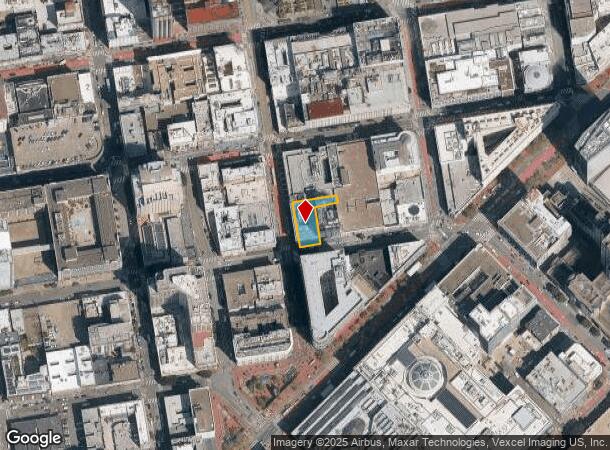
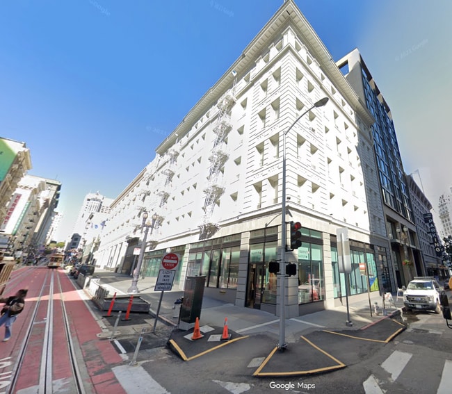
100 Powell St
San Francisco-Redwood City-South San Francisco, CA
Hotel Union Square
0327-012
San Francisco
Hotel
California
2024
58
2025
0.25 AC
011700
San Francisco Market St
10,853 SF
San Francisco
DEMOGRAPHICS near 100 Powell St
1 Mile
3 Mile
5 Mile
2024 Total Population
139,601
428,758
664,871
2029 Population
130,278
400,095
616,079
Pop Growth 2024-2029
(6.68%)
(6.69%)
(7.34%)
Average Age
43
42
42
2024 Total Households
73,574
209,077
294,328
HH Growth 2024-2029
(7.28%)
(7.24%)
(7.72%)
Median Household Inc
$84,233
$130,232
$129,596
Avg Household Size
1.70
1.90
2.10
2024 Avg HH Vehicles
.00
1.00
1.00
Median Home Value
$1,064,192
$1,101,188
$1,102,536
Median Year Built
1965
1949
1949
Nearby Places
- Restaurants
- Banks
- Shops
- Fitness
- Groceries
PUBLIC TRANSPORTATION
TRANSIT/SUBWAY
Powell and Ellis (Powell-Hyde Cable Car - San Francisco Municipal Railway (MUNI Metro), Powell-Mason Cable Car - San Francisco Municipal Railway (MUNI Metro))
DRIVE
WALK
Distance
Powell and Ellis (Powell-Hyde Cable Car - San Francisco Municipal Railway (MUNI Metro), Powell-Mason Cable Car - San Francisco Municipal Railway (MUNI Metro))
1 min
1 min
0.0 mi
O'Farrell and Powell (Powell-Hyde Cable Car - San Francisco Municipal Railway (MUNI Metro), Powell-Mason Cable Car - San Francisco Municipal Railway (MUNI Metro))
DRIVE
WALK
Distance
O'Farrell and Powell (Powell-Hyde Cable Car - San Francisco Municipal Railway (MUNI Metro), Powell-Mason Cable Car - San Francisco Municipal Railway (MUNI Metro))
1 min
1 min
0.0 mi
Powell and O'Farrell (Powell-Hyde Cable Car - San Francisco Municipal Railway (MUNI Metro), Powell-Mason Cable Car - San Francisco Municipal Railway (MUNI Metro))
DRIVE
WALK
Distance
Powell and O'Farrell (Powell-Hyde Cable Car - San Francisco Municipal Railway (MUNI Metro), Powell-Mason Cable Car - San Francisco Municipal Railway (MUNI Metro))
1 min
1 min
0.0 mi
Powell and Market (Powell-Hyde Cable Car - San Francisco Municipal Railway (MUNI Metro), Powell-Mason Cable Car - San Francisco Municipal Railway (MUNI Metro))
DRIVE
WALK
Distance
Powell and Market (Powell-Hyde Cable Car - San Francisco Municipal Railway (MUNI Metro), Powell-Mason Cable Car - San Francisco Municipal Railway (MUNI Metro))
1 min
1 min
0.1 mi
Powell Station (Dublin/Pleasanton - Millbrae - Bay Area Rapid Transit (BART), Fremont - Daly City - Bay Area Rapid Transit (BART), Pittsburg/Bay Point - San Francisco International - Bay Area Rapid Transit (BART), Richmond - Millbrae - Bay Area Rapid Transit (BART))
DRIVE
WALK
Distance
Powell Station (Dublin/Pleasanton - Millbrae - Bay Area Rapid Transit (BART), Fremont - Daly City - Bay Area Rapid Transit (BART), Pittsburg/Bay Point - San Francisco International - Bay Area Rapid Transit (BART), Richmond - Millbrae - Bay Area Rapid Transit (BART))
1 min
2 min
0.1 mi
COMMUTER RAIL
San Francisco 4th & King (Caltrain - Caltrain (Caltrain))
DRIVE
WALK
Distance
San Francisco 4th & King (Caltrain - Caltrain (Caltrain))
6 min
19 min
1.0 mi
22nd Street (Caltrain - Caltrain (Caltrain))
DRIVE
WALK
Distance
22nd Street (Caltrain - Caltrain (Caltrain))
10 min
3.2 mi
AIRPORT
San Francisco International
DRIVE
WALK
Distance
San Francisco International
20 min
13.9 mi
Metro Oakland International
DRIVE
WALK
Distance
Metro Oakland International
30 min
19.2 mi
Freight Ports
Port of San Francisco
DRIVE
WALK
Distance
Port of San Francisco
1 min
1.0 mi
Nearby Properties
Address
Land Use
TOTAL SIZE
Lot Size
Zoning
Address
Land Use
TOTAL SIZE
Lot Size
Zoning
1,015,000 SF
2.43 AC
RC4
Address
Land Use
TOTAL SIZE
Lot Size
Zoning
764,661 SF
0.67 AC
C3OSD
Address
Land Use
TOTAL SIZE
Lot Size
Zoning
750,370 SF
3.25 AC
MBR3
Address
Land Use
TOTAL SIZE
Lot Size
Zoning
1,471,929 SF
1.93 AC
C3O
Address
Land Use
TOTAL SIZE
Lot Size
Zoning
1,300,000 SF
1.74 AC
C3O
Address
Land Use
TOTAL SIZE
Lot Size
Zoning
1,420,430 SF
1.16 AC
C3OSD
Address
Land Use
TOTAL SIZE
Lot Size
Zoning
1,534,312 SF
2.60 AC
C3O
Address
Land Use
TOTAL SIZE
Lot Size
Zoning
914,037 SF
1.36 AC
C3O
Address
Land Use
TOTAL SIZE
Lot Size
Zoning
248,303 SF
4.35 AC
Address
Land Use
TOTAL SIZE
Lot Size
Zoning
717,234 SF
3.47 AC
UMU
Address
Land Use
TOTAL SIZE
Lot Size
Zoning
605,459 SF
0.63 AC
C3O
Address
Land Use
TOTAL SIZE
Lot Size
Zoning
475,791 SF
0.55 AC
C3OSD
Address
Land Use
TOTAL SIZE
Lot Size
Zoning
690,442 SF
0.79 AC
C3O
Address
Land Use
TOTAL SIZE
Lot Size
Zoning
10.92 AC
Address
Land Use
TOTAL SIZE
Lot Size
Zoning
750,491 SF
0.51 AC
C3O
Address
Land Use
TOTAL SIZE
Lot Size
Zoning
432,000 SF
0.35 AC
C3OSD
Address
Land Use
TOTAL SIZE
Lot Size
Zoning
266,143 SF
4 AC
C-3-R
Address
Land Use
TOTAL SIZE
Lot Size
Zoning
885,581 SF
5.20 AC
M2
Address
Land Use
TOTAL SIZE
Lot Size
Zoning
512,395 SF
1.24 AC
C3O
Address
Land Use
TOTAL SIZE
Lot Size
Zoning
508,714 SF
1.29 AC
C3R
Address
Land Use
TOTAL SIZE
Lot Size
Zoning
1,084,662 SF
1.67 AC
C3O
Address
Land Use
TOTAL SIZE
Lot Size
Zoning
505,120 SF
0.41 AC
C3O
Address
Land Use
TOTAL SIZE
Lot Size
Zoning
694,334 SF
1.01 AC
C3O
Address
Land Use
TOTAL SIZE
Lot Size
Zoning
696,431 SF
0.97 AC
C3G
Address
Land Use
TOTAL SIZE
Lot Size
Zoning
139,070 SF
0.64 AC
C3O
Address
Land Use
TOTAL SIZE
Lot Size
Zoning
1.52 AC
C3G
Address
Land Use
TOTAL SIZE
Lot Size
Zoning
1,424,230 SF
2.60 AC
C3G
Address
Land Use
TOTAL SIZE
Lot Size
Zoning
614,740 SF
1.74 AC
C3OSD
Address
Land Use
TOTAL SIZE
Lot Size
Zoning
615,957 SF
0.63 AC
C3O
Address
Land Use
TOTAL SIZE
Lot Size
Zoning
492,980 SF
0.43 AC
C3O
The World's #1 Commercial Real Estate Marketplace
Connect with us
© 2025 CoStar Group
The information above has been obtained from sources believed reliable. While we do not doubt its accuracy we have not verified it and make no guarantee, warranty or representation about it. It is your responsibility to independently confirm its accuracy and completeness. Any projections, opinions, assumptions, or estimates used are for example only and do not represent the current or future performance of the property. The value of this transaction to you depends on tax and other factors which should be evaluated by your tax, financial, and legal advisors. You and your advisors should conduct a careful, independent investigation of the property to determine to your satisfaction the suitability of the property for your needs.