Property Record
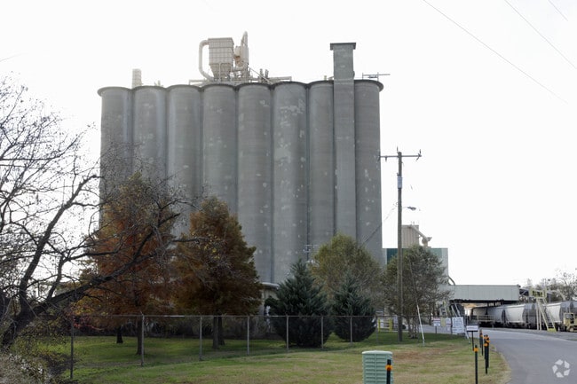
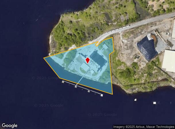
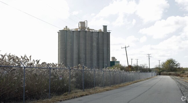
100 Pratt St, Chesapeake, VA 23324
NEARBY LISTINGS FOR SALE OR LEASE
Property Detail
100 Pratt St
1630000000010
South Norfolk - Commercial
Industrialgeneral
SOUTHERN BRANCH 8.35 AC
AE
Chesapeake
5100340024D
Virginia
2024
8.35 AC
2025
Bainbridge
020500
Hampton Roads
160,000 SF
Virginia Beach-Norfolk-Newport News, VA-NC
DEMOGRAPHICS near 100 Pratt St
1 Mile
3 Mile
5 Mile
2024 Total Population
985
70,012
206,199
2029 Population
1,014
71,807
210,541
Pop Growth 2024-2029
+ 2.94%
+ 2.56%
+ 2.11%
Average Age
36
37
38
2024 Total Households
352
26,258
81,046
HH Growth 2024-2029
+ 3.13%
+ 2.65%
+ 2.04%
Median Household Inc
$95,702
$58,937
$62,401
Avg Household Size
2.80
2.60
2.50
2024 Avg HH Vehicles
2.00
2.00
2.00
Median Home Value
$251,010
$217,939
$238,228
Median Year Built
1975
1976
1979
Nearby Places
Map Layers
Map Styles
 Street
 Aerial
- Restaurants
- Banks
- Shops
- Fitness
- Groceries
PUBLIC TRANSPORTATION
COMMUTER RAIL
Norfolk (Northeast Regional - Amtrak)
DRIVE
WALK
Distance
Norfolk (Northeast Regional - Amtrak)
13 min
6.4 mi
AIRPORT
Norfolk International
DRIVE
WALK
Distance
Norfolk International
25 min
12.8 mi
Newport News/Williamsburg International
DRIVE
WALK
Distance
Newport News/Williamsburg International
53 min
34.5 mi
Freight Ports
Virginia Port Authority - Portsmouth
DRIVE
WALK
Distance
Virginia Port Authority - Portsmouth
22 min
10.3 mi
Nearby Properties
Address
Land Use
TOTAL SIZE
Lot Size
Zoning
Address
Land Use
TOTAL SIZE
Lot Size
Zoning
482.38 AC
MULTI: MUL
Address
Land Use
TOTAL SIZE
Lot Size
Zoning
358,908 SF
22.21 AC
MULTI: MUL
Address
Land Use
TOTAL SIZE
Lot Size
Zoning
258,000 SF
1.38 AC
M2: GENERA
Address
Land Use
TOTAL SIZE
Lot Size
Zoning
252,524 SF
20 AC
R8S: RESID
Address
Land Use
TOTAL SIZE
Lot Size
Zoning
32,163 SF
17.59 AC
MULTI: MUL
Address
Land Use
TOTAL SIZE
Lot Size
Zoning
92,723 SF
28.83 AC
R6: RESIDE
Address
Land Use
TOTAL SIZE
Lot Size
Zoning
128,596 SF
16.91 AC
M2: GENERA
Address
Land Use
TOTAL SIZE
Lot Size
Zoning
142,656 SF
22.17 AC
RMF1: MULT
Address
Land Use
TOTAL SIZE
Lot Size
Zoning
178,068 SF
14.72 AC
M1: LIGHT
Address
Land Use
TOTAL SIZE
Lot Size
Zoning
127,755 SF
14.68 AC
PUD: PLANN
Address
Land Use
TOTAL SIZE
Lot Size
Zoning
12,240 SF
20.98 AC
MULTI: MUL
Address
Land Use
TOTAL SIZE
Lot Size
Zoning
28,253 SF
32.34 AC
M3: WATERF
Address
Land Use
TOTAL SIZE
Lot Size
Zoning
144,984 SF
6.34 AC
O-I: OFFIC
Address
Land Use
TOTAL SIZE
Lot Size
Zoning
119,870 SF
12.21 AC
B3: HIGHWA
Address
Land Use
TOTAL SIZE
Lot Size
Zoning
180,000 SF
23.84 AC
M2: GENERA
Address
Land Use
TOTAL SIZE
Lot Size
Zoning
143,220 SF
44.78 AC
M1: LIGHT
Address
Land Use
TOTAL SIZE
Lot Size
Zoning
130,510 SF
33.74 AC
M1: LIGHT
Address
Land Use
TOTAL SIZE
Lot Size
Zoning
2,434 SF
39.25 AC
B2: GENERA
Address
Land Use
TOTAL SIZE
Lot Size
Zoning
1,000 SF
13.68 AC
M2: GENERA
Address
Land Use
TOTAL SIZE
Lot Size
Zoning
118,308 SF
6.07 AC
RMF2: MULT
Address
Land Use
TOTAL SIZE
Lot Size
Zoning
151,250 SF
17.47 AC
M2: GENERA
Address
Land Use
TOTAL SIZE
Lot Size
Zoning
1,352 SF
86 AC
MULTI: MUL
Address
Land Use
TOTAL SIZE
Lot Size
Zoning
3,316 SF
30.19 AC
RMF1: MULT
Address
Land Use
TOTAL SIZE
Lot Size
Zoning
266,400 SF
12.10 AC
MULTI: MUL
Address
Land Use
TOTAL SIZE
Lot Size
Zoning
58,680 SF
8.84 AC
UR
Address
Land Use
TOTAL SIZE
Lot Size
Zoning
387,092 SF
55.92 AC
URM
Address
Land Use
TOTAL SIZE
Lot Size
Zoning
108,303 SF
4.79 AC
O-I: OFFIC
Address
Land Use
TOTAL SIZE
Lot Size
Zoning
36,525 SF
56.65 AC
M2: GENERA
Address
Land Use
TOTAL SIZE
Lot Size
Zoning
126,250 SF
31.69 AC
R10S: RESI
Address
Land Use
TOTAL SIZE
Lot Size
Zoning
228,040 SF
8.71 AC
M2: GENERA
The World's #1 Commercial Real Estate Marketplace
Connect with us
© 2025 CoStar Group
The information above has been obtained from sources believed reliable. While we do not doubt its accuracy we have not verified it and make no guarantee, warranty or representation about it. It is your responsibility to independently confirm its accuracy and completeness. Any projections, opinions, assumptions, or estimates used are for example only and do not represent the current or future performance of the property. The value of this transaction to you depends on tax and other factors which should be evaluated by your tax, financial, and legal advisors. You and your advisors should conduct a careful, independent investigation of the property to determine to your satisfaction the suitability of the property for your needs.