Property Record
100 Precision Dr, Walton, KY 41094


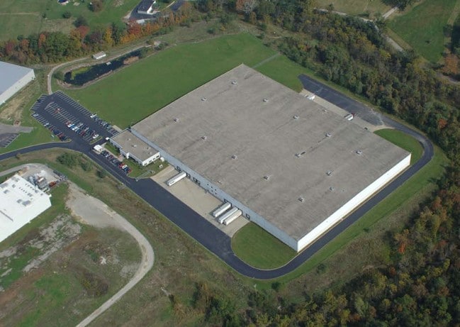

Property Detail
100 Precision Dr
Cincinnati, OH-KY-IN
WALTON INDUSTRIAL PARK SEC 11 LOT 11 26.274 ACS
009-00-00-003.02
Boone
Commercialnec
Kentucky
B and X Area of moderate flood hazard, usually the area between the limits of the 100-year and 500-year floods.
11
2025
26.27 AC
2025
Florence/Richwood
063701
Cincinnati/Dayton
234,400 SF
NEARBY LISTINGS FOR SALE OR LEASE
DEMOGRAPHICS near 100 Precision Dr
1 mile
3 mile
5 mile
2025 Total Population
2,284
9,818
23,400
2030 Population
2,440
10,430
24,609
Pop Growth 2025-2030
+ 6.83%
+ 6.23%
+ 5.17%
Average Age
37
37
39
2025 Total Households
899
3,465
8,331
HH Growth 2025-2030
+ 7.01%
+ 6.35%
+ 5.25%
Median Household Inc
$64,477
$79,735
$90,934
Avg Household Size
2.50
2.80
2.80
2025 Avg HH Vehicles
2.00
2.00
2.00
Median Home Value
$243,975
$282,093
$318,120
Median Year Built
1996
1998
1996
Nearby Places
Map Layers
Map Styles
 Street
 Aerial
Layers
 Traffic
 Biking
Places
Listings with unknown addresses are not visible on the map
- Restaurants
- Banks
- Shops
- Fitness
- Groceries
PUBLIC TRANSPORTATION
AIRPORT
Cincinnati/Northern Kentucky International
Drive
Walk
Distance
Cincinnati/Northern Kentucky International
29 min
16.5 mi
Freight Ports
Port of Toledo
Drive
Walk
Distance
Port of Toledo
271 min
228.5 mi
SALE & LEASE HISTORY
LISTING DATE
SALE/LEASE

Sep 24, 2016
For Sale
Nov 15, 2016
For Lease
Mar 19, 2018
For Sale
Nearby Properties
Address
Land Use
TOTAL SIZE
Lot Size
Zoning
Address
Land Use
TOTAL SIZE
Lot Size
Zoning
54.13 AC
Address
Land Use
TOTAL SIZE
Lot Size
Zoning
37.55 AC
Address
Land Use
TOTAL SIZE
Lot Size
Zoning
76.46 AC
Address
Land Use
TOTAL SIZE
Lot Size
Zoning
16.73 AC
Address
Land Use
TOTAL SIZE
Lot Size
Zoning
112 SF
10.08 AC
Address
Land Use
TOTAL SIZE
Lot Size
Zoning
Address
Land Use
TOTAL SIZE
Lot Size
Zoning
16.80 AC
Address
Land Use
TOTAL SIZE
Lot Size
Zoning
5.57 AC
Address
Land Use
TOTAL SIZE
Lot Size
Zoning
48,440 SF
2 AC
Address
Land Use
TOTAL SIZE
Lot Size
Zoning
115,640 SF
4 AC
Address
Land Use
TOTAL SIZE
Lot Size
Zoning
13,704 SF
18.04 AC
Address
Land Use
TOTAL SIZE
Lot Size
Zoning
13,416 SF
8.78 AC
Address
Land Use
TOTAL SIZE
Lot Size
Zoning
Address
Land Use
TOTAL SIZE
Lot Size
Zoning
67,973 SF
7.10 AC
Address
Land Use
TOTAL SIZE
Lot Size
Zoning
1,456 SF
17.76 AC
Address
Land Use
TOTAL SIZE
Lot Size
Zoning
Address
Land Use
TOTAL SIZE
Lot Size
Zoning
Address
Land Use
TOTAL SIZE
Lot Size
Zoning
8.24 AC
Address
Land Use
TOTAL SIZE
Lot Size
Zoning
4.51 AC
Address
Land Use
TOTAL SIZE
Lot Size
Zoning
2,155 SF
14.28 AC
Address
Land Use
TOTAL SIZE
Lot Size
Zoning
14.09 AC
Address
Land Use
TOTAL SIZE
Lot Size
Zoning
984 SF
55.85 AC
Address
Land Use
TOTAL SIZE
Lot Size
Zoning
80.65 AC
Address
Land Use
TOTAL SIZE
Lot Size
Zoning
24,000 SF
3.54 AC
Address
Land Use
TOTAL SIZE
Lot Size
Zoning
11.48 AC
Address
Land Use
TOTAL SIZE
Lot Size
Zoning
11.50 AC
Address
Land Use
TOTAL SIZE
Lot Size
Zoning
5.48 AC
Address
Land Use
TOTAL SIZE
Lot Size
Zoning
57,944 SF
10.33 AC
Address
Land Use
TOTAL SIZE
Lot Size
Zoning
The World's #1 Commercial Real Estate Marketplace
Connect with us
© 2026 CoStar Group
The information above has been obtained from sources believed reliable. While we do not doubt its accuracy we have not verified it and make no guarantee, warranty or representation about it. It is your responsibility to independently confirm its accuracy and completeness. Any projections, opinions, assumptions, or estimates used are for example only and do not represent the current or future performance of the property. The value of this transaction to you depends on tax and other factors which should be evaluated by your tax, financial, and legal advisors. You and your advisors should conduct a careful, independent investigation of the property to determine to your satisfaction the suitability of the property for your needs.