Property Record
100 Rawstrom Dr, Okatie, SC 29909

Save to a Folder
{{folder.Name}}
{{folder.ListingIds.length}} Properties
{{folder.ListingIds.length}} Property
Create a New Folder
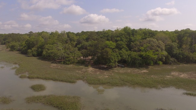
Property Detail
100 Rawstrom Dr
R600-009-000-0030-0000
SUBJ TO ROLL BACK TAX LIEN TIMBERLANDS PLIT 5/99 6.00 AC 9/99SPLIT 5/01 6.00 AC
Agriculturalland
Beaufort
9999
South Carolina
2025
11.66 AC
2025
Hilton Head/Beaufort
002202
Other Market Areas
2,114 SF
Hilton Head Island-Bluffton-Port Royal, SC
NEARBY LISTINGS FOR SALE OR LEASE
DEMOGRAPHICS near 100 Rawstrom Dr
1 mile
3 mile
5 mile
2025 Total Population
475
6,354
18,929
2030 Population
550
7,068
20,796
Pop Growth 2025-2030
+ 15.79%
+ 11.24%
+ 9.86%
Average Age
51
51
50
2025 Total Households
225
2,803
8,431
HH Growth 2025-2030
+ 16.89%
+ 11.56%
+ 10.62%
Median Household Inc
$87,171
$112,333
$96,921
Avg Household Size
2.10
2.20
2.20
2025 Avg HH Vehicles
2.00
2.00
2.00
Median Home Value
$578,767
$769,848
$621,852
Median Year Built
2010
2006
2007
Nearby Places
Map Layers
Map Styles
 Street
 Aerial
Layers
 Traffic
 Biking
Places
Listings with unknown addresses are not visible on the map
- Restaurants
- Banks
- Shops
- Fitness
- Groceries
PUBLIC TRANSPORTATION
AIRPORT
Hilton Head
Drive
Walk
Distance
Hilton Head
36 min
24.4 mi
Savannah/Hilton Head International
Drive
Walk
Distance
Savannah/Hilton Head International
50 min
35.4 mi
Freight Ports
Georgia Ports - Savannah
Drive
Walk
Distance
Georgia Ports - Savannah
45 min
33.8 mi
SALE & LEASE HISTORY
LISTING DATE
SALE/LEASE

Sep 24, 2016
For Sale
Sep 23, 2019
For Sale
Nearby Properties
Address
Land Use
TOTAL SIZE
Lot Size
Zoning
Address
Land Use
TOTAL SIZE
Lot Size
Zoning
17.80 AC
Address
Land Use
TOTAL SIZE
Lot Size
Zoning
896 SF
70.66 AC
Address
Land Use
TOTAL SIZE
Lot Size
Zoning
1,120 SF
5 AC
RC
Address
Land Use
TOTAL SIZE
Lot Size
Zoning
1,120 SF
5 AC
RC
Address
Land Use
TOTAL SIZE
Lot Size
Zoning
77,813 SF
22.12 AC
Address
Land Use
TOTAL SIZE
Lot Size
Zoning
980 SF
0.59 AC
RC
Address
Land Use
TOTAL SIZE
Lot Size
Zoning
238,240 SF
23.27 AC
6106
Address
Land Use
TOTAL SIZE
Lot Size
Zoning
76,410 SF
27.89 AC
6616
Address
Land Use
TOTAL SIZE
Lot Size
Zoning
3,604 SF
5.10 AC
R1
Address
Land Use
TOTAL SIZE
Lot Size
Zoning
64,173 SF
563.49 AC
6816
Address
Land Use
TOTAL SIZE
Lot Size
Zoning
3,008 SF
1 AC
RC
Address
Land Use
TOTAL SIZE
Lot Size
Zoning
15.59 AC
Address
Land Use
TOTAL SIZE
Lot Size
Zoning
0.69 AC
6106
Address
Land Use
TOTAL SIZE
Lot Size
Zoning
40,537 SF
319.78 AC
9999
Address
Land Use
TOTAL SIZE
Lot Size
Zoning
Address
Land Use
TOTAL SIZE
Lot Size
Zoning
35,305 SF
5.93 AC
6606
Address
Land Use
TOTAL SIZE
Lot Size
Zoning
28,658 SF
254.31 AC
6616
Address
Land Use
TOTAL SIZE
Lot Size
Zoning
3,883 SF
0.50 AC
RC
Address
Land Use
TOTAL SIZE
Lot Size
Zoning
1,960 SF
5.78 AC
RC
Address
Land Use
TOTAL SIZE
Lot Size
Zoning
2,022 SF
0.14 AC
Address
Land Use
TOTAL SIZE
Lot Size
Zoning
12,658 SF
5.69 AC
6616
Address
Land Use
TOTAL SIZE
Lot Size
Zoning
65.92 AC
4206
Address
Land Use
TOTAL SIZE
Lot Size
Zoning
46,750 SF
21.77 AC
6616
Address
Land Use
TOTAL SIZE
Lot Size
Zoning
56 AC
4206
Address
Land Use
TOTAL SIZE
Lot Size
Zoning
1,960 SF
13.91 AC
RC
Address
Land Use
TOTAL SIZE
Lot Size
Zoning
91.47 AC
6106
Address
Land Use
TOTAL SIZE
Lot Size
Zoning
16,455 SF
6.22 AC
Address
Land Use
TOTAL SIZE
Lot Size
Zoning
1,120 SF
25.60 AC
R1
Address
Land Use
TOTAL SIZE
Lot Size
Zoning
1,440 SF
41.46 AC
9999
Address
Land Use
TOTAL SIZE
Lot Size
Zoning
10,505 SF
2.14 AC
6616
The World's #1 Commercial Real Estate Marketplace
Connect with us
© 2026 CoStar Group
The information above has been obtained from sources believed reliable. While we do not doubt its accuracy we have not verified it and make no guarantee, warranty or representation about it. It is your responsibility to independently confirm its accuracy and completeness. Any projections, opinions, assumptions, or estimates used are for example only and do not represent the current or future performance of the property. The value of this transaction to you depends on tax and other factors which should be evaluated by your tax, financial, and legal advisors. You and your advisors should conduct a careful, independent investigation of the property to determine to your satisfaction the suitability of the property for your needs.