Property Record
100 Rolling Meadows Dr, Delaware, OH 43015


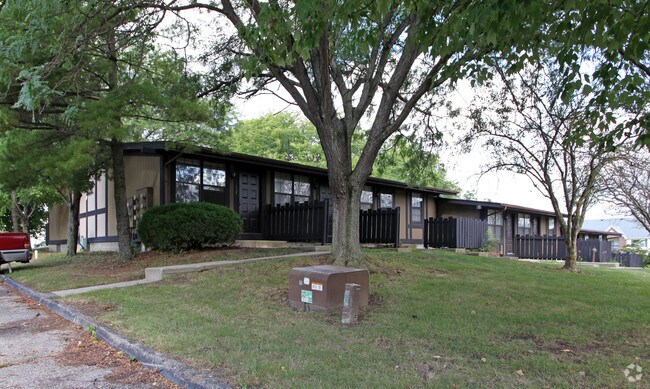
Property Detail
100 Rolling Meadows Dr
519-323-01-035-000
LANDS 19 5 3 27
Apartment
DELAWARE
B and X Area of moderate flood hazard, usually the area between the limits of the 100-year and 500-year floods.
Ohio
2024
5 AC
2024
Delaware County
010421
Columbus
13,920 SF
Columbus, OH
NEARBY LISTINGS FOR SALE OR LEASE
-
-
View all Delaware listings for sale on LoopNet.com
DEMOGRAPHICS near 100 Rolling Meadows Dr
1 mile
3 mile
5 mile
2025 Total Population
8,904
31,225
50,394
2030 Population
9,738
34,045
55,215
Pop Growth 2025-2030
+ 9.37%
+ 9.03%
+ 9.57%
Average Age
39
39
40
2025 Total Households
3,447
12,182
19,787
HH Growth 2025-2030
+ 9.46%
+ 9.08%
+ 9.63%
Median Household Inc
$90,624
$86,999
$87,195
Avg Household Size
2.50
2.40
2.40
2025 Avg HH Vehicles
2.00
2.00
2.00
Median Home Value
$329,106
$306,897
$320,249
Median Year Built
2001
1991
1992
Nearby Places
Map Layers
Map Styles
 Street
 Aerial
Layers
 Traffic
 Biking
Places
Listings with unknown addresses are not visible on the map
- Restaurants
- Banks
- Shops
- Fitness
- Groceries
PUBLIC TRANSPORTATION
AIRPORT
John Glenn Columbus International
Drive
Walk
Distance
John Glenn Columbus International
46 min
35.4 mi
Freight Ports
Port of Toledo
Drive
Walk
Distance
Port of Toledo
152 min
122.4 mi
Nearby Properties
Address
Land Use
TOTAL SIZE
Lot Size
Zoning
Address
Land Use
TOTAL SIZE
Lot Size
Zoning
349,949 SF
22.53 AC
Address
Land Use
TOTAL SIZE
Lot Size
Zoning
202,185 SF
7.97 AC
Address
Land Use
TOTAL SIZE
Lot Size
Zoning
376,140 SF
28.71 AC
Address
Land Use
TOTAL SIZE
Lot Size
Zoning
213,294 SF
27.58 AC
Address
Land Use
TOTAL SIZE
Lot Size
Zoning
154,070 SF
29.10 AC
Address
Land Use
TOTAL SIZE
Lot Size
Zoning
242,045 SF
47.87 AC
Address
Land Use
TOTAL SIZE
Lot Size
Zoning
421,200 SF
33.08 AC
Address
Land Use
TOTAL SIZE
Lot Size
Zoning
234,776 SF
15.94 AC
Address
Land Use
TOTAL SIZE
Lot Size
Zoning
271,443 SF
15.63 AC
Address
Land Use
TOTAL SIZE
Lot Size
Zoning
113,813 SF
1.99 AC
Address
Land Use
TOTAL SIZE
Lot Size
Zoning
135,780 SF
17.32 AC
Address
Land Use
TOTAL SIZE
Lot Size
Zoning
79,389 SF
15.51 AC
Address
Land Use
TOTAL SIZE
Lot Size
Zoning
202,800 SF
14.03 AC
Address
Land Use
TOTAL SIZE
Lot Size
Zoning
48,054 SF
20.06 AC
Address
Land Use
TOTAL SIZE
Lot Size
Zoning
162,878 SF
3.18 AC
Address
Land Use
TOTAL SIZE
Lot Size
Zoning
75,278 SF
2.34 AC
Address
Land Use
TOTAL SIZE
Lot Size
Zoning
362,100 SF
26 AC
Address
Land Use
TOTAL SIZE
Lot Size
Zoning
33,704 SF
10.65 AC
Address
Land Use
TOTAL SIZE
Lot Size
Zoning
159,435 SF
20 AC
Address
Land Use
TOTAL SIZE
Lot Size
Zoning
88,191 SF
34.68 AC
Address
Land Use
TOTAL SIZE
Lot Size
Zoning
51,288 SF
1.19 AC
Address
Land Use
TOTAL SIZE
Lot Size
Zoning
147,000 SF
9.05 AC
Address
Land Use
TOTAL SIZE
Lot Size
Zoning
147,000 SF
8.53 AC
Address
Land Use
TOTAL SIZE
Lot Size
Zoning
105,099 SF
3.73 AC
Address
Land Use
TOTAL SIZE
Lot Size
Zoning
147,120 SF
14.70 AC
Address
Land Use
TOTAL SIZE
Lot Size
Zoning
215,220 SF
22.88 AC
Address
Land Use
TOTAL SIZE
Lot Size
Zoning
62,578 SF
4.09 AC
Address
Land Use
TOTAL SIZE
Lot Size
Zoning
109,000 SF
17.16 AC
Address
Land Use
TOTAL SIZE
Lot Size
Zoning
Address
Land Use
TOTAL SIZE
Lot Size
Zoning
81,279 SF
1.25 AC
The World's #1 Commercial Real Estate Marketplace
Connect with us
© 2026 CoStar Group
The information above has been obtained from sources believed reliable. While we do not doubt its accuracy we have not verified it and make no guarantee, warranty or representation about it. It is your responsibility to independently confirm its accuracy and completeness. Any projections, opinions, assumptions, or estimates used are for example only and do not represent the current or future performance of the property. The value of this transaction to you depends on tax and other factors which should be evaluated by your tax, financial, and legal advisors. You and your advisors should conduct a careful, independent investigation of the property to determine to your satisfaction the suitability of the property for your needs.