Property Record
151 N 80Th St, Kansas City, KS 66111
NEARBY LISTINGS FOR SALE OR LEASE
Property Detail
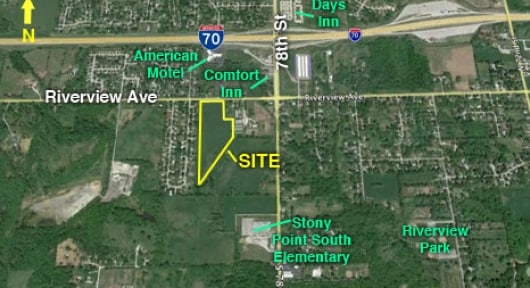
151 N 80Th St
Kansas City, MO-KS
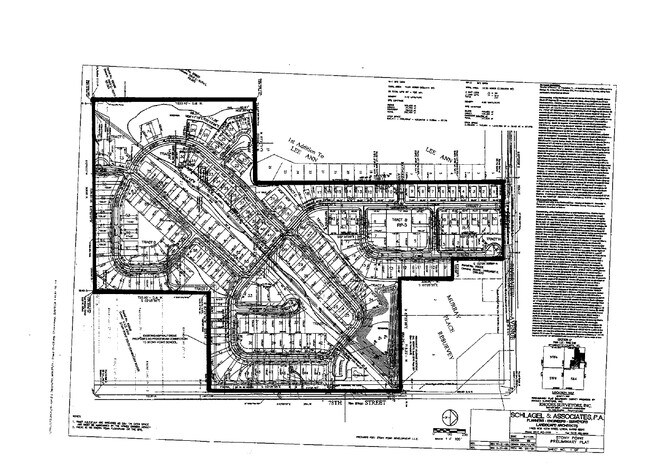
Stony Point
298818
STONY POINT, S17, T11, R24, ACRES 1.93, L19 TO L24 & L30 TO L32
Agriculturalland
Wyandotte
X
Kansas
20209C0132D
19
2024
2 AC
2024
Kansas City KS
044002
Kansas City
84,770 SF
DEMOGRAPHICS near 151 N 80Th St
1 Mile
3 Mile
5 Mile
2024 Total Population
4,089
29,245
71,855
2029 Population
3,962
28,412
69,999
Pop Growth 2024-2029
(3.11%)
(2.85%)
(2.58%)
Average Age
39
39
39
2024 Total Households
1,490
11,247
26,821
HH Growth 2024-2029
(3.22%)
(2.86%)
(2.61%)
Median Household Inc
$63,264
$56,974
$65,347
Avg Household Size
2.70
2.50
2.60
2024 Avg HH Vehicles
2.00
2.00
2.00
Median Home Value
$147,455
$149,680
$165,305
Median Year Built
1961
1969
1968
Nearby Places
- Restaurants
- Banks
- Shops
- Fitness
- Groceries
PUBLIC TRANSPORTATION
AIRPORT
Kansas City International
DRIVE
WALK
Distance
Kansas City International
31 min
24.4 mi
Freight Ports
Tulsa Port Of Catoosa
DRIVE
WALK
Distance
Tulsa Port Of Catoosa
268 min
240.3 mi
SALE & LEASE HISTORY
LISTING DATE
SALE/LEASE

Sep 24, 2016
For Sale
Nearby Properties
Address
Land Use
TOTAL SIZE
Lot Size
Zoning
Address
Land Use
TOTAL SIZE
Lot Size
Zoning
920,306 SF
90.21 AC
Address
Land Use
TOTAL SIZE
Lot Size
Zoning
872,064 SF
119.39 AC
Address
Land Use
TOTAL SIZE
Lot Size
Zoning
141,921 SF
16.88 AC
Address
Land Use
TOTAL SIZE
Lot Size
Zoning
542,696 SF
28.12 AC
Address
Land Use
TOTAL SIZE
Lot Size
Zoning
309,440 SF
120.73 AC
KR1
Address
Land Use
TOTAL SIZE
Lot Size
Zoning
346,224 SF
28.44 AC
Address
Land Use
TOTAL SIZE
Lot Size
Zoning
407,936 SF
37.46 AC
1
Address
Land Use
TOTAL SIZE
Lot Size
Zoning
396,532 SF
31.98 AC
Address
Land Use
TOTAL SIZE
Lot Size
Zoning
51,739 SF
46.71 AC
Address
Land Use
TOTAL SIZE
Lot Size
Zoning
75,027 SF
13.51 AC
Address
Land Use
TOTAL SIZE
Lot Size
Zoning
88,396 SF
23.79 AC
Address
Land Use
TOTAL SIZE
Lot Size
Zoning
241,816 SF
20.03 AC
Address
Land Use
TOTAL SIZE
Lot Size
Zoning
67,830 SF
7.88 AC
Address
Land Use
TOTAL SIZE
Lot Size
Zoning
48,278 SF
14.62 AC
Address
Land Use
TOTAL SIZE
Lot Size
Zoning
108,385 SF
22.86 AC
KAG
Address
Land Use
TOTAL SIZE
Lot Size
Zoning
54,578 SF
12.01 AC
KR1
Address
Land Use
TOTAL SIZE
Lot Size
Zoning
139,495 SF
35.01 AC
KR1
Address
Land Use
TOTAL SIZE
Lot Size
Zoning
158,011 SF
26.66 AC
Address
Land Use
TOTAL SIZE
Lot Size
Zoning
186,293 SF
63.45 AC
Address
Land Use
TOTAL SIZE
Lot Size
Zoning
40,016 SF
5.20 AC
Address
Land Use
TOTAL SIZE
Lot Size
Zoning
59,256 SF
22.06 AC
KR1
Address
Land Use
TOTAL SIZE
Lot Size
Zoning
39,012 SF
13.38 AC
Address
Land Use
TOTAL SIZE
Lot Size
Zoning
19,392 SF
2.77 AC
KCP1
Address
Land Use
TOTAL SIZE
Lot Size
Zoning
239,205 SF
17.52 AC
Address
Land Use
TOTAL SIZE
Lot Size
Zoning
164,462 SF
23.15 AC
Address
Land Use
TOTAL SIZE
Lot Size
Zoning
43,922 SF
5.81 AC
Address
Land Use
TOTAL SIZE
Lot Size
Zoning
97,100 SF
19.57 AC
KR1
Address
Land Use
TOTAL SIZE
Lot Size
Zoning
201,976 SF
17.70 AC
Address
Land Use
TOTAL SIZE
Lot Size
Zoning
15,264 SF
73.01 AC
KR1
Address
Land Use
TOTAL SIZE
Lot Size
Zoning
39,221 SF
10.44 AC
The World's #1 Commercial Real Estate Marketplace
Connect with us
© 2025 CoStar Group
The information above has been obtained from sources believed reliable. While we do not doubt its accuracy we have not verified it and make no guarantee, warranty or representation about it. It is your responsibility to independently confirm its accuracy and completeness. Any projections, opinions, assumptions, or estimates used are for example only and do not represent the current or future performance of the property. The value of this transaction to you depends on tax and other factors which should be evaluated by your tax, financial, and legal advisors. You and your advisors should conduct a careful, independent investigation of the property to determine to your satisfaction the suitability of the property for your needs.