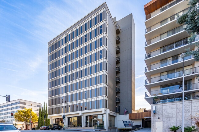
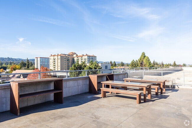
Property Record
100 S Ellsworth Ave, San Mateo, CA 94401

Current Lease Availabilities
NEARBY LISTINGS FOR SALE OR LEASE
Property Detail
100 S Ellsworth Ave
034-151-080
Map Of The Town Of San Mateo
Miscellaneous
2.30 AC MOL ON SLY COR OF BALDWIN AVE & ELLSWORTH AVE ACREAGE CITY OF SAN MATEO
X
San Mateo
06081C0154G
California
2024
2.29 AC
2025
San Mateo
606300
San Francisco
246,457 SF
San Francisco-Redwood City-South San Francisco, CA
DEMOGRAPHICS near 100 S Ellsworth Ave
1 Mile
3 Mile
5 Mile
2024 Total Population
35,854
129,757
231,186
2029 Population
34,234
124,246
220,775
Pop Growth 2024-2029
(4.52%)
(4.25%)
(4.50%)
Average Age
41
41
42
2024 Total Households
13,560
49,535
87,270
HH Growth 2024-2029
(4.73%)
(4.43%)
(4.72%)
Median Household Inc
$118,193
$142,083
$153,199
Avg Household Size
2.50
2.50
2.60
2024 Avg HH Vehicles
2.00
2.00
2.00
Median Home Value
$1,095,768
$1,119,736
$1,127,145
Median Year Built
1962
1964
1967
Nearby Places
Map Layers
Map Styles
 Street
 Aerial
- Restaurants
- Banks
- Shops
- Fitness
- Groceries
PUBLIC TRANSPORTATION
COMMUTER RAIL
San Mateo (Caltrain - Caltrain (Caltrain), Express - Caltrain (Caltrain), Limited - Caltrain (Caltrain), Local Weekday - Caltrain (Caltrain), Local Weekend - Caltrain (Caltrain))
DRIVE
WALK
Distance
San Mateo (Caltrain - Caltrain (Caltrain), Express - Caltrain (Caltrain), Limited - Caltrain (Caltrain), Local Weekday - Caltrain (Caltrain), Local Weekend - Caltrain (Caltrain))
1 min
3 min
0.2 mi
Hayward Park (Caltrain - Caltrain (Caltrain), Local Weekday - Caltrain (Caltrain), Local Weekend - Caltrain (Caltrain))
DRIVE
WALK
Distance
Hayward Park (Caltrain - Caltrain (Caltrain), Local Weekday - Caltrain (Caltrain), Local Weekend - Caltrain (Caltrain))
4 min
1.9 mi
AIRPORT
San Francisco International
DRIVE
WALK
Distance
San Francisco International
12 min
6.1 mi
Metro Oakland International
DRIVE
WALK
Distance
Metro Oakland International
34 min
26.2 mi
Norman Y Mineta San Jose International
DRIVE
WALK
Distance
Norman Y Mineta San Jose International
35 min
27.7 mi
Freight Ports
Port of Redwood City
DRIVE
WALK
Distance
Port of Redwood City
16 min
10.5 mi
Nearby Properties
Address
Land Use
TOTAL SIZE
Lot Size
Zoning
Address
Land Use
TOTAL SIZE
Lot Size
Zoning
1,068,445 SF
39.82 AC
Address
Land Use
TOTAL SIZE
Lot Size
Zoning
8.65 AC
Address
Land Use
TOTAL SIZE
Lot Size
Zoning
239,107 SF
2.37 AC
Address
Land Use
TOTAL SIZE
Lot Size
Zoning
354,800 SF
6 AC
Address
Land Use
TOTAL SIZE
Lot Size
Zoning
5.73 AC
Address
Land Use
TOTAL SIZE
Lot Size
Zoning
277,784 SF
10.85 AC
Address
Land Use
TOTAL SIZE
Lot Size
Zoning
215,318 SF
3.42 AC
Address
Land Use
TOTAL SIZE
Lot Size
Zoning
568,423 SF
16.07 AC
Address
Land Use
TOTAL SIZE
Lot Size
Zoning
311,952 SF
3.68 AC
Address
Land Use
TOTAL SIZE
Lot Size
Zoning
399,422 SF
5.94 AC
Address
Land Use
TOTAL SIZE
Lot Size
Zoning
260,547 SF
2.23 AC
Address
Land Use
TOTAL SIZE
Lot Size
Zoning
634,000 SF
8.62 AC
M10000
Address
Land Use
TOTAL SIZE
Lot Size
Zoning
397,793 SF
10.48 AC
CL00C1
Address
Land Use
TOTAL SIZE
Lot Size
Zoning
295,000 SF
4.02 AC
Address
Land Use
TOTAL SIZE
Lot Size
Zoning
400,000 SF
4.39 AC
C10000
Address
Land Use
TOTAL SIZE
Lot Size
Zoning
219,318 SF
4.77 AC
Address
Land Use
TOTAL SIZE
Lot Size
Zoning
2,020 SF
2.64 AC
Address
Land Use
TOTAL SIZE
Lot Size
Zoning
337,459 SF
17.16 AC
EA0000
Address
Land Use
TOTAL SIZE
Lot Size
Zoning
547,306 SF
3.93 AC
Address
Land Use
TOTAL SIZE
Lot Size
Zoning
326,432 SF
10.27 AC
CL0C21
Address
Land Use
TOTAL SIZE
Lot Size
Zoning
245,260 SF
9.08 AC
Address
Land Use
TOTAL SIZE
Lot Size
Zoning
218,249 SF
2.15 AC
Address
Land Use
TOTAL SIZE
Lot Size
Zoning
177,000 SF
6.24 AC
Address
Land Use
TOTAL SIZE
Lot Size
Zoning
395,010 SF
15.11 AC
R003S3
Address
Land Use
TOTAL SIZE
Lot Size
Zoning
Address
Land Use
TOTAL SIZE
Lot Size
Zoning
0.93 AC
CL00C2
Address
Land Use
TOTAL SIZE
Lot Size
Zoning
196,504 SF
1.98 AC
Address
Land Use
TOTAL SIZE
Lot Size
Zoning
192,054 SF
4.54 AC
Address
Land Use
TOTAL SIZE
Lot Size
Zoning
589,128 SF
11.23 AC
Address
Land Use
TOTAL SIZE
Lot Size
Zoning
233,788 SF
3.35 AC
The World's #1 Commercial Real Estate Marketplace
Connect with us
© 2025 CoStar Group
The information above has been obtained from sources believed reliable. While we do not doubt its accuracy we have not verified it and make no guarantee, warranty or representation about it. It is your responsibility to independently confirm its accuracy and completeness. Any projections, opinions, assumptions, or estimates used are for example only and do not represent the current or future performance of the property. The value of this transaction to you depends on tax and other factors which should be evaluated by your tax, financial, and legal advisors. You and your advisors should conduct a careful, independent investigation of the property to determine to your satisfaction the suitability of the property for your needs.