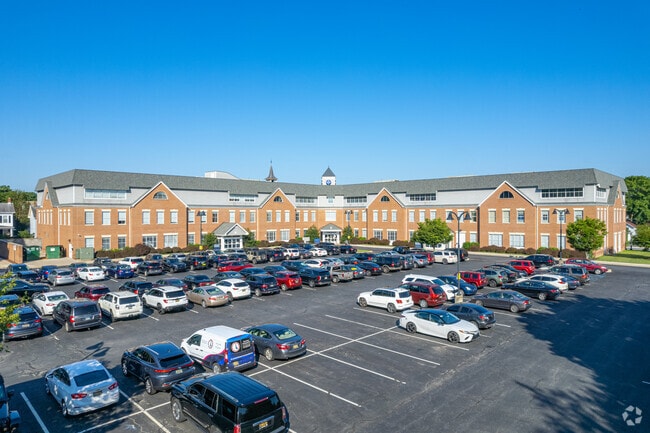
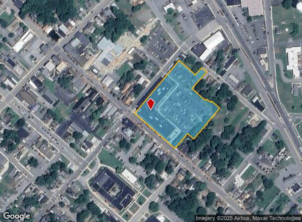
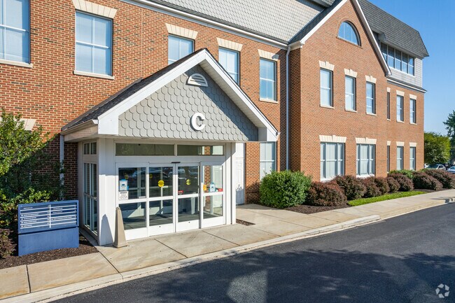
Property Record
100 S Main St, Smyrna, DE 19977
NEARBY LISTINGS FOR SALE OR LEASE
Property Detail
100 S Main St
1-17-01018-01-0300-000
PAR 2 - NE SD MAIN ST S 3.446 A 100 SOUTH MAIN STREET
Commercialnec
Kent
X
Delaware
10003C0436K
3.44 AC
2025
Kent County
2025
Philadelphia
040204
Dover, DE
113,094 SF
DEMOGRAPHICS near 100 S Main St
1 Mile
3 Mile
5 Mile
2024 Total Population
7,892
27,379
39,493
2029 Population
8,404
29,508
42,596
Pop Growth 2024-2029
+ 6.49%
+ 7.78%
+ 7.86%
Average Age
38
39
40
2024 Total Households
2,939
9,815
13,964
HH Growth 2024-2029
+ 6.74%
+ 8.14%
+ 8.22%
Median Household Inc
$62,048
$76,705
$78,259
Avg Household Size
2.60
2.70
2.70
2024 Avg HH Vehicles
2.00
2.00
2.00
Median Home Value
$235,794
$265,957
$279,714
Median Year Built
1991
2003
2003
Nearby Places
Map Layers
Map Styles
 Street
 Aerial
- Restaurants
- Banks
- Shops
- Fitness
- Groceries
SALE & LEASE HISTORY
LISTING DATE
SALE/LEASE

Sep 25, 2016
For Lease
Sep 24, 2016
For Sale
Aug 03, 2017
For Lease
Nearby Properties
Address
Land Use
TOTAL SIZE
Lot Size
Zoning
Address
Land Use
TOTAL SIZE
Lot Size
Zoning
388,647 SF
119.70 AC
I&R
Address
Land Use
TOTAL SIZE
Lot Size
Zoning
189 AC
IORP
Address
Land Use
TOTAL SIZE
Lot Size
Zoning
3,000 SF
543.36 AC
SR
Address
Land Use
TOTAL SIZE
Lot Size
Zoning
1,590 SF
188.40 AC
A
Address
Land Use
TOTAL SIZE
Lot Size
Zoning
Address
Land Use
TOTAL SIZE
Lot Size
Zoning
6,760 SF
80.30 AC
MHP
Address
Land Use
TOTAL SIZE
Lot Size
Zoning
86,973 SF
24.80 AC
R
Address
Land Use
TOTAL SIZE
Lot Size
Zoning
74,160 SF
7.20 AC
R3
Address
Land Use
TOTAL SIZE
Lot Size
Zoning
40,043 SF
43.70 AC
NA
Address
Land Use
TOTAL SIZE
Lot Size
Zoning
378,374 SF
41.02 AC
I
Address
Land Use
TOTAL SIZE
Lot Size
Zoning
30,200 SF
22.42 AC
H-C
Address
Land Use
TOTAL SIZE
Lot Size
Zoning
1,440 SF
51.10 AC
RMH
Address
Land Use
TOTAL SIZE
Lot Size
Zoning
Address
Land Use
TOTAL SIZE
Lot Size
Zoning
3,816 SF
56.40 AC
RMH
Address
Land Use
TOTAL SIZE
Lot Size
Zoning
Address
Land Use
TOTAL SIZE
Lot Size
Zoning
57,200 SF
7.50 AC
R3
Address
Land Use
TOTAL SIZE
Lot Size
Zoning
113,479 SF
8.20 AC
R1
Address
Land Use
TOTAL SIZE
Lot Size
Zoning
Address
Land Use
TOTAL SIZE
Lot Size
Zoning
52,000 SF
10 AC
R3
Address
Land Use
TOTAL SIZE
Lot Size
Zoning
55,732 SF
16.30 AC
R-2A
Address
Land Use
TOTAL SIZE
Lot Size
Zoning
80,172 SF
9.50 AC
R3
Address
Land Use
TOTAL SIZE
Lot Size
Zoning
57.10 AC
I&R
Address
Land Use
TOTAL SIZE
Lot Size
Zoning
59,375 SF
13 AC
IORP
Address
Land Use
TOTAL SIZE
Lot Size
Zoning
65,280 SF
11.40 AC
H-C
Address
Land Use
TOTAL SIZE
Lot Size
Zoning
33,561 SF
35.40 AC
RS
Address
Land Use
TOTAL SIZE
Lot Size
Zoning
50,309 SF
19.90 AC
MULTI
Address
Land Use
TOTAL SIZE
Lot Size
Zoning
Address
Land Use
TOTAL SIZE
Lot Size
Zoning
58,179 SF
16 AC
I&R
Address
Land Use
TOTAL SIZE
Lot Size
Zoning
53,376 SF
11.50 AC
R
The World's #1 Commercial Real Estate Marketplace
Connect with us
© 2025 CoStar Group
The information above has been obtained from sources believed reliable. While we do not doubt its accuracy we have not verified it and make no guarantee, warranty or representation about it. It is your responsibility to independently confirm its accuracy and completeness. Any projections, opinions, assumptions, or estimates used are for example only and do not represent the current or future performance of the property. The value of this transaction to you depends on tax and other factors which should be evaluated by your tax, financial, and legal advisors. You and your advisors should conduct a careful, independent investigation of the property to determine to your satisfaction the suitability of the property for your needs.