Property Record
100 Shafer Dr, Romeo, MI 48065

NEARBY LISTINGS FOR SALE OR LEASE
Property Detail
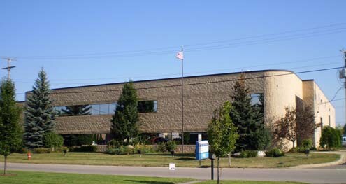
100 Shafer Dr
Detroit-Warren-Dearborn, MI
Village
27-01-36-426-009
T5N R12E SEC 36 ROMEO INDUSTRIAL PARK NO. 2 LOT 19 `VILLAGE OF ROMEO MANATRON #: 043-036-032-10
Lightindustrial
Macomb
X
Michigan
26099C0136G
19
2025
1.40 AC
2025
St Clair & Lapeer Counties
206700
Detroit
37,939 SF
DEMOGRAPHICS near 100 Shafer Dr
1 Mile
3 Mile
5 Mile
2024 Total Population
221
10,876
20,515
2029 Population
220
10,803
20,357
Pop Growth 2024-2029
(0.45%)
(0.67%)
(0.77%)
Average Age
44
42
43
2024 Total Households
75
4,164
7,587
HH Growth 2024-2029
(1.33%)
(0.74%)
(0.86%)
Median Household Inc
$102,778
$79,963
$98,146
Avg Household Size
2.80
2.50
2.60
2024 Avg HH Vehicles
3.00
2.00
2.00
Median Home Value
$396,666
$306,358
$373,062
Median Year Built
1984
1979
1984
Nearby Places
Map Layers
Map Styles
 Street
 Aerial
- Restaurants
- Banks
- Shops
- Fitness
- Groceries
Nearby Properties
Address
Land Use
TOTAL SIZE
Lot Size
Zoning
Address
Land Use
TOTAL SIZE
Lot Size
Zoning
1,937,172 SF
252.22 AC
IND VLG CK
Address
Land Use
TOTAL SIZE
Lot Size
Zoning
81,488 SF
14.54 AC
VILLAGE
Address
Land Use
TOTAL SIZE
Lot Size
Zoning
142,894 SF
IFT
Address
Land Use
TOTAL SIZE
Lot Size
Zoning
77,006 SF
12.52 AC
M-1
Address
Land Use
TOTAL SIZE
Lot Size
Zoning
49,800 SF
2.81 AC
IND VLG CK
Address
Land Use
TOTAL SIZE
Lot Size
Zoning
58,233 SF
17.47 AC
IND
Address
Land Use
TOTAL SIZE
Lot Size
Zoning
174,277 SF
67.47 AC
M-1
Address
Land Use
TOTAL SIZE
Lot Size
Zoning
Address
Land Use
TOTAL SIZE
Lot Size
Zoning
131,594 SF
4.90 AC
IND VLG CK
Address
Land Use
TOTAL SIZE
Lot Size
Zoning
75,808 SF
Address
Land Use
TOTAL SIZE
Lot Size
Zoning
79,775 SF
4.71 AC
M-1
Address
Land Use
TOTAL SIZE
Lot Size
Zoning
74,013 SF
4.41 AC
VERIFY
Address
Land Use
TOTAL SIZE
Lot Size
Zoning
123,624 SF
13.05 AC
VILLAGE
Address
Land Use
TOTAL SIZE
Lot Size
Zoning
80,000 SF
IFT
Address
Land Use
TOTAL SIZE
Lot Size
Zoning
106,097 SF
6.21 AC
IND VLG CK
Address
Land Use
TOTAL SIZE
Lot Size
Zoning
127,018 SF
4.50 AC
IND VLG CK
Address
Land Use
TOTAL SIZE
Lot Size
Zoning
71,874 SF
3.90 AC
IND VLG CK
Address
Land Use
TOTAL SIZE
Lot Size
Zoning
94,422 SF
24.90 AC
MI
Address
Land Use
TOTAL SIZE
Lot Size
Zoning
106,998 SF
12.54 AC
M-1
Address
Land Use
TOTAL SIZE
Lot Size
Zoning
53,525 SF
IFT
Address
Land Use
TOTAL SIZE
Lot Size
Zoning
24,660 SF
2.65 AC
GC
Address
Land Use
TOTAL SIZE
Lot Size
Zoning
46,548 SF
40.49 AC
M-1
Address
Land Use
TOTAL SIZE
Lot Size
Zoning
76,438 SF
11.87 AC
C-2
Address
Land Use
TOTAL SIZE
Lot Size
Zoning
45,089 SF
13.70 AC
MI
Address
Land Use
TOTAL SIZE
Lot Size
Zoning
58,636 SF
4.08 AC
IND VLG CK
Address
Land Use
TOTAL SIZE
Lot Size
Zoning
40,800 SF
Address
Land Use
TOTAL SIZE
Lot Size
Zoning
72,025 SF
7.74 AC
GC
Address
Land Use
TOTAL SIZE
Lot Size
Zoning
46,181 SF
2.61 AC
IND VLG CK
Address
Land Use
TOTAL SIZE
Lot Size
Zoning
72,104 SF
8.37 AC
GC
Address
Land Use
TOTAL SIZE
Lot Size
Zoning
33,780 SF
2.70 AC
IND VLG CK
The World's #1 Commercial Real Estate Marketplace
Connect with us
© 2025 CoStar Group
The information above has been obtained from sources believed reliable. While we do not doubt its accuracy we have not verified it and make no guarantee, warranty or representation about it. It is your responsibility to independently confirm its accuracy and completeness. Any projections, opinions, assumptions, or estimates used are for example only and do not represent the current or future performance of the property. The value of this transaction to you depends on tax and other factors which should be evaluated by your tax, financial, and legal advisors. You and your advisors should conduct a careful, independent investigation of the property to determine to your satisfaction the suitability of the property for your needs.