Property Record
100 Smith Level Rd, Carrboro, NC 27510
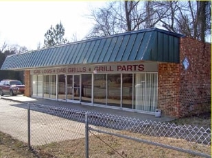


Property Detail
100 Smith Level Rd
9778820701
W/S SR 1919
Commercialnec
Orange
OA
North Carolina
AE The base floodplain where base flood elevations are provided. AE Zones are now used on new format FIRMs instead of A1-A30 Zones.
0.41 AC
2025
Orange County
2025
Raleigh/Durham
010710
Durham-Chapel Hill, NC
2,088 SF
NEARBY LISTINGS FOR SALE OR LEASE
DEMOGRAPHICS near 100 Smith Level Rd
1 mile
3 mile
5 mile
2025 Total Population
14,413
58,308
107,834
2030 Population
14,966
60,221
111,843
Pop Growth 2025-2030
+ 3.84%
+ 3.28%
+ 3.72%
Average Age
35
34
38
2025 Total Households
6,680
21,193
42,149
HH Growth 2025-2030
+ 3.91%
+ 3.80%
+ 4.17%
Median Household Inc
$59,859
$72,423
$95,100
Avg Household Size
2.10
2.20
2.30
2025 Avg HH Vehicles
2.00
2.00
2.00
Median Home Value
$610,206
$633,667
$638,205
Median Year Built
1984
1984
1990
Nearby Places
Map Layers
Map Styles
 Street
 Aerial
Transit
 Traffic
 Biking
Places
Listings with unknown addresses are not visible on the map
- Restaurants
- Banks
- Shops
- Fitness
- Groceries
PUBLIC TRANSPORTATION
AIRPORT
Raleigh-Durham International
Drive
Walk
Distance
Raleigh-Durham International
30 min
19.0 mi
Freight Ports
Port of Wilmington
Drive
Walk
Distance
Port of Wilmington
190 min
163.1 mi
Nearby Properties
Address
Land Use
TOTAL SIZE
Lot Size
Zoning
Address
Land Use
TOTAL SIZE
Lot Size
Zoning
215,860 SF
12.28 AC
Address
Land Use
TOTAL SIZE
Lot Size
Zoning
264,710 SF
32.50 AC
R1
Address
Land Use
TOTAL SIZE
Lot Size
Zoning
4,128 SF
678.68 AC
R1
Address
Land Use
TOTAL SIZE
Lot Size
Zoning
81,191 SF
12.33 AC
OI4
Address
Land Use
TOTAL SIZE
Lot Size
Zoning
55,318 SF
9.05 AC
R4
Address
Land Use
TOTAL SIZE
Lot Size
Zoning
238,990 SF
2.43 AC
Address
Land Use
TOTAL SIZE
Lot Size
Zoning
134,448 SF
59.23 AC
Address
Land Use
TOTAL SIZE
Lot Size
Zoning
119,585 SF
62.30 AC
Address
Land Use
TOTAL SIZE
Lot Size
Zoning
21,078 SF
227.43 AC
OI3R2
Address
Land Use
TOTAL SIZE
Lot Size
Zoning
135,540 SF
4.34 AC
Address
Land Use
TOTAL SIZE
Lot Size
Zoning
26,328 SF
13.86 AC
OR3
Address
Land Use
TOTAL SIZE
Lot Size
Zoning
361,420 SF
1.68 AC
Address
Land Use
TOTAL SIZE
Lot Size
Zoning
85,652 SF
16.49 AC
R1R5
Address
Land Use
TOTAL SIZE
Lot Size
Zoning
119,517 SF
28.28 AC
R20
Address
Land Use
TOTAL SIZE
Lot Size
Zoning
24,820 SF
1 AC
Address
Land Use
TOTAL SIZE
Lot Size
Zoning
143,750 SF
1.32 AC
OI3OI4
Address
Land Use
TOTAL SIZE
Lot Size
Zoning
174,922 SF
4.59 AC
OI4
Address
Land Use
TOTAL SIZE
Lot Size
Zoning
15,916 SF
46.02 AC
R10RSIR
Address
Land Use
TOTAL SIZE
Lot Size
Zoning
12,328 SF
16.37 AC
R75
Address
Land Use
TOTAL SIZE
Lot Size
Zoning
78,028 SF
32.60 AC
Address
Land Use
TOTAL SIZE
Lot Size
Zoning
22,328 SF
19.48 AC
Address
Land Use
TOTAL SIZE
Lot Size
Zoning
82,064 SF
1.41 AC
Address
Land Use
TOTAL SIZE
Lot Size
Zoning
42,628 SF
6.12 AC
Address
Land Use
TOTAL SIZE
Lot Size
Zoning
45,320 SF
0.66 AC
TC1TC2
Address
Land Use
TOTAL SIZE
Lot Size
Zoning
71,856 SF
20.37 AC
R10R3
Address
Land Use
TOTAL SIZE
Lot Size
Zoning
12,014 SF
10.38 AC
R75
Address
Land Use
TOTAL SIZE
Lot Size
Zoning
48,690 SF
15.69 AC
OR3R75
Address
Land Use
TOTAL SIZE
Lot Size
Zoning
102,399 SF
11.69 AC
R20
Address
Land Use
TOTAL SIZE
Lot Size
Zoning
35,988 SF
14.52 AC
R75
Address
Land Use
TOTAL SIZE
Lot Size
Zoning
86,478 SF
8.60 AC
B1CCT
The World's #1 Commercial Real Estate Marketplace
Connect with us
© 2026 CoStar Group
The information above has been obtained from sources believed reliable. While we do not doubt its accuracy we have not verified it and make no guarantee, warranty or representation about it. It is your responsibility to independently confirm its accuracy and completeness. Any projections, opinions, assumptions, or estimates used are for example only and do not represent the current or future performance of the property. The value of this transaction to you depends on tax and other factors which should be evaluated by your tax, financial, and legal advisors. You and your advisors should conduct a careful, independent investigation of the property to determine to your satisfaction the suitability of the property for your needs.