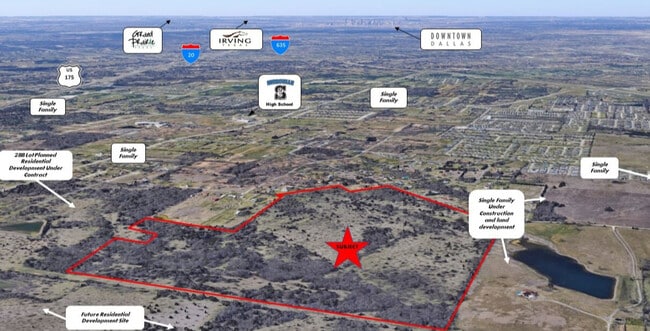
Property Record
100 Stark Rd, Seagoville, TX 75159


NEARBY LISTINGS FOR SALE OR LEASE
Property Detail
100 Stark Rd
Dallas-Fort Worth-Arlington, TX
Herman Heider
65054142010030000
HERMAN HEIDER ABST 541 PG 420 TR 3 ACS 146.4300 INT202400211212 DD10162024 CO-DC 0541420100300 4CJ05414201
Commercialacreage
Dallas
X
Texas
48257C0150E
146.43 AC
2024
Mesquite/Forney/Terrell
2025
Dallas/Ft Worth
017006
DEMOGRAPHICS near 100 Stark Rd
1 Mile
3 Mile
5 Mile
2024 Total Population
6,522
45,871
94,528
2029 Population
6,659
46,247
95,046
Pop Growth 2024-2029
+ 2.10%
+ 0.82%
+ 0.55%
Average Age
30
33
34
2024 Total Households
1,726
12,681
26,890
HH Growth 2024-2029
+ 1.85%
+ 0.69%
+ 0.39%
Median Household Inc
$49,528
$51,189
$59,641
Avg Household Size
3.60
3.40
3.40
2024 Avg HH Vehicles
2.00
2.00
2.00
Median Home Value
$166,065
$171,949
$201,417
Median Year Built
2001
1998
1995
Nearby Places
Map Layers
Map Styles
 Street
 Aerial
- Restaurants
- Banks
- Shops
- Fitness
- Groceries
PUBLIC TRANSPORTATION
AIRPORT
Dallas Love Field
DRIVE
WALK
Distance
Dallas Love Field
35 min
22.6 mi
Freight Ports
Port of Shreveport
DRIVE
WALK
Distance
Port of Shreveport
201 min
185.4 mi
SALE & LEASE HISTORY
LISTING DATE
SALE/LEASE

May 24, 2021
For Sale
Nearby Properties
Address
Land Use
TOTAL SIZE
Lot Size
Zoning
Address
Land Use
TOTAL SIZE
Lot Size
Zoning
457,110 SF
100.05 AC
Z293
Address
Land Use
TOTAL SIZE
Lot Size
Zoning
361,155 SF
14.64 AC
Z308
Address
Land Use
TOTAL SIZE
Lot Size
Zoning
200,000 SF
8.11 AC
Address
Land Use
TOTAL SIZE
Lot Size
Zoning
257,696 SF
9.62 AC
Address
Land Use
TOTAL SIZE
Lot Size
Zoning
372,456 SF
17.34 AC
Z116
Address
Land Use
TOTAL SIZE
Lot Size
Zoning
109,472 SF
6.98 AC
Address
Land Use
TOTAL SIZE
Lot Size
Zoning
400 SF
50.76 AC
MFA
Address
Land Use
TOTAL SIZE
Lot Size
Zoning
321 SF
40.51 AC
MFA
Address
Land Use
TOTAL SIZE
Lot Size
Zoning
190,150 SF
13.39 AC
Z236
Address
Land Use
TOTAL SIZE
Lot Size
Zoning
106,462 SF
9.58 AC
Z236
Address
Land Use
TOTAL SIZE
Lot Size
Zoning
215 SF
29.95 AC
A
Address
Land Use
TOTAL SIZE
Lot Size
Zoning
248 SF
32.79 AC
MFA
Address
Land Use
TOTAL SIZE
Lot Size
Zoning
208 SF
24.50 AC
Z06
Address
Land Use
TOTAL SIZE
Lot Size
Zoning
122,352 SF
6.05 AC
Z46
Address
Land Use
TOTAL SIZE
Lot Size
Zoning
377,133 SF
16.71 AC
Z131
Address
Land Use
TOTAL SIZE
Lot Size
Zoning
88,320 SF
4.48 AC
Z72
Address
Land Use
TOTAL SIZE
Lot Size
Zoning
183 SF
23.14 AC
Z06
Address
Land Use
TOTAL SIZE
Lot Size
Zoning
70,000 SF
25.26 AC
Z06
Address
Land Use
TOTAL SIZE
Lot Size
Zoning
216,327 SF
26.31 AC
Address
Land Use
TOTAL SIZE
Lot Size
Zoning
319 SF
37.74 AC
SUP1
Address
Land Use
TOTAL SIZE
Lot Size
Zoning
72,341 SF
13 AC
Z236
Address
Land Use
TOTAL SIZE
Lot Size
Zoning
146 SF
18.02 AC
MFA
Address
Land Use
TOTAL SIZE
Lot Size
Zoning
172,068 SF
17.25 AC
Z137
Address
Land Use
TOTAL SIZE
Lot Size
Zoning
156 SF
17.11 AC
MFA
Address
Land Use
TOTAL SIZE
Lot Size
Zoning
28,126 SF
166.45 AC
Z05
Address
Land Use
TOTAL SIZE
Lot Size
Zoning
96 SF
14.18 AC
I2
Address
Land Use
TOTAL SIZE
Lot Size
Zoning
89,044 SF
5.04 AC
Z163
Address
Land Use
TOTAL SIZE
Lot Size
Zoning
133 SF
19.87 AC
MFA
Address
Land Use
TOTAL SIZE
Lot Size
Zoning
19,641 SF
4.37 AC
Z236
Address
Land Use
TOTAL SIZE
Lot Size
Zoning
83,266 SF
6.73 AC
Z131
The World's #1 Commercial Real Estate Marketplace
Connect with us
© 2025 CoStar Group
The information above has been obtained from sources believed reliable. While we do not doubt its accuracy we have not verified it and make no guarantee, warranty or representation about it. It is your responsibility to independently confirm its accuracy and completeness. Any projections, opinions, assumptions, or estimates used are for example only and do not represent the current or future performance of the property. The value of this transaction to you depends on tax and other factors which should be evaluated by your tax, financial, and legal advisors. You and your advisors should conduct a careful, independent investigation of the property to determine to your satisfaction the suitability of the property for your needs.