Property Record
100 Strickland Dr, Roebuck, SC 29376
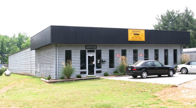

Property Detail
100 Strickland Dr
Spartanburg, SC
LOT A JACE ENTERPRISES SUR PB 48-216 PB 81-287 PB 183-790 PB 186-85
6-30-00-006.04
SPARTANBURG
Commercialnec
South Carolina
B and X Area of moderate flood hazard, usually the area between the limits of the 100-year and 500-year floods.
a
2024
2.22 AC
2025
Lower Spartanburg Cty
022003
Greenville/Spartanburg
4,670 SF
NEARBY LISTINGS FOR SALE OR LEASE
DEMOGRAPHICS near 100 Strickland Dr
1 mile
3 mile
5 mile
2025 Total Population
2,463
30,850
84,097
2030 Population
2,768
34,486
94,018
Pop Growth 2025-2030
+ 12.38%
+ 11.79%
+ 11.80%
Average Age
38
39
39
2025 Total Households
892
12,299
33,545
HH Growth 2025-2030
+ 12.56%
+ 11.86%
+ 11.95%
Median Household Inc
$57,799
$52,208
$55,297
Avg Household Size
2.70
2.40
2.40
2025 Avg HH Vehicles
2.00
2.00
2.00
Median Home Value
$221,470
$213,318
$230,991
Median Year Built
1993
1979
1979
Nearby Places
Map Layers
Map Styles
 Street
 Aerial
Layers
 Traffic
 Biking
Places
Listings with unknown addresses are not visible on the map
- Restaurants
- Banks
- Shops
- Fitness
- Groceries
PUBLIC TRANSPORTATION
COMMUTER RAIL
Spartanburg Amtrak Station (Crescent - Amtrak)
Drive
Walk
Distance
Spartanburg Amtrak Station (Crescent - Amtrak)
12 min
5.6 mi
AIRPORT
Greenville Spartanburg International
Drive
Walk
Distance
Greenville Spartanburg International
35 min
21.6 mi
Freight Ports
North Charleston Terminal
Drive
Walk
Distance
North Charleston Terminal
214 min
190.5 mi
Nearby Properties
Address
Land Use
TOTAL SIZE
Lot Size
Zoning
Address
Land Use
TOTAL SIZE
Lot Size
Zoning
2,112 SF
5.26 AC
Address
Land Use
TOTAL SIZE
Lot Size
Zoning
6,148 SF
4.18 AC
Address
Land Use
TOTAL SIZE
Lot Size
Zoning
7,245 SF
18.10 AC
Address
Land Use
TOTAL SIZE
Lot Size
Zoning
2,100 SF
10.12 AC
Address
Land Use
TOTAL SIZE
Lot Size
Zoning
30,016 SF
1.07 AC
Address
Land Use
TOTAL SIZE
Lot Size
Zoning
3,072 SF
5.60 AC
Address
Land Use
TOTAL SIZE
Lot Size
Zoning
25,380 SF
0.75 AC
Address
Land Use
TOTAL SIZE
Lot Size
Zoning
1,475 SF
9.27 AC
Address
Land Use
TOTAL SIZE
Lot Size
Zoning
10,216 SF
3.03 AC
Address
Land Use
TOTAL SIZE
Lot Size
Zoning
5,622 SF
50.27 AC
Address
Land Use
TOTAL SIZE
Lot Size
Zoning
6,163 SF
0.53 AC
Address
Land Use
TOTAL SIZE
Lot Size
Zoning
7,406 SF
0.74 AC
Address
Land Use
TOTAL SIZE
Lot Size
Zoning
3,982 SF
0.48 AC
Address
Land Use
TOTAL SIZE
Lot Size
Zoning
5,913 SF
0.95 AC
Address
Land Use
TOTAL SIZE
Lot Size
Zoning
20,844 SF
15 AC
Address
Land Use
TOTAL SIZE
Lot Size
Zoning
3,884 SF
10.50 AC
Address
Land Use
TOTAL SIZE
Lot Size
Zoning
9,941 SF
7.04 AC
Address
Land Use
TOTAL SIZE
Lot Size
Zoning
3,272 SF
Address
Land Use
TOTAL SIZE
Lot Size
Zoning
3,204 SF
0.25 AC
Address
Land Use
TOTAL SIZE
Lot Size
Zoning
3,335 SF
0.33 AC
Address
Land Use
TOTAL SIZE
Lot Size
Zoning
2,985 SF
0.14 AC
Address
Land Use
TOTAL SIZE
Lot Size
Zoning
3,372 SF
0.16 AC
Address
Land Use
TOTAL SIZE
Lot Size
Zoning
9,044 SF
12.40 AC
Address
Land Use
TOTAL SIZE
Lot Size
Zoning
1,152 SF
5.11 AC
Address
Land Use
TOTAL SIZE
Lot Size
Zoning
38,100 SF
9.74 AC
Address
Land Use
TOTAL SIZE
Lot Size
Zoning
56,000 SF
7.99 AC
Address
Land Use
TOTAL SIZE
Lot Size
Zoning
2,454 SF
0.38 AC
Address
Land Use
TOTAL SIZE
Lot Size
Zoning
2,429 SF
1.33 AC
Address
Land Use
TOTAL SIZE
Lot Size
Zoning
86,674 SF
4.14 AC
Address
Land Use
TOTAL SIZE
Lot Size
Zoning
209,570 SF
24.36 AC
The World's #1 Commercial Real Estate Marketplace
Connect with us
© 2026 CoStar Group
The information above has been obtained from sources believed reliable. While we do not doubt its accuracy we have not verified it and make no guarantee, warranty or representation about it. It is your responsibility to independently confirm its accuracy and completeness. Any projections, opinions, assumptions, or estimates used are for example only and do not represent the current or future performance of the property. The value of this transaction to you depends on tax and other factors which should be evaluated by your tax, financial, and legal advisors. You and your advisors should conduct a careful, independent investigation of the property to determine to your satisfaction the suitability of the property for your needs.