Property Record
100 Ville Dr, Boulder City, NV 89005


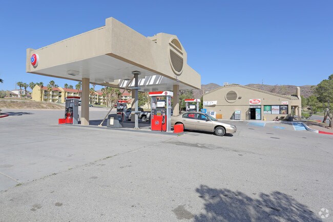

Property Detail
100 Ville Dr
186-04-501-002
PARCEL MAP FILE 45 PAGE 75 LOT 1
Storebuilding
Clark
C2
Nevada
AE The base floodplain where base flood elevations are provided. AE Zones are now used on new format FIRMs instead of A1-A30 Zones.
1
2026
1.10 AC
2026
Southeast Las Vegas
005501
Las Vegas
3,507 SF
Las Vegas-Henderson-North Las Vegas, NV
NEARBY LISTINGS FOR SALE OR LEASE
DEMOGRAPHICS near 100 Ville Dr
1 mile
3 mile
5 mile
2025 Total Population
3,769
16,038
16,160
2030 Population
4,033
16,949
17,072
Pop Growth 2025-2030
+ 7.00%
+ 5.68%
+ 5.64%
Average Age
56
49
49
2025 Total Households
1,845
7,177
7,226
HH Growth 2025-2030
+ 6.99%
+ 5.74%
+ 5.72%
Median Household Inc
$84,417
$76,027
$76,287
Avg Household Size
2.00
2.20
2.20
2025 Avg HH Vehicles
2.00
2.00
2.00
Median Home Value
$572,265
$470,456
$471,155
Median Year Built
1989
1980
1980
Nearby Places
Map Layers
Map Styles
 Street
 Aerial
Layers
 Traffic
 Biking
Places
Listings with unknown addresses are not visible on the map
- Restaurants
- Banks
- Shops
- Fitness
- Groceries
PUBLIC TRANSPORTATION
AIRPORT
Boulder City Municipal
Drive
Walk
Distance
Boulder City Municipal
9 min
4.4 mi
Harry Reid International
Drive
Walk
Distance
Harry Reid International
33 min
24.6 mi
Freight Ports
Port of Long Beach
Drive
Walk
Distance
Port of Long Beach
330 min
293.2 mi
Nearby Properties
Address
Land Use
TOTAL SIZE
Lot Size
Zoning
Address
Land Use
TOTAL SIZE
Lot Size
Zoning
30.74 AC
H
Address
Land Use
TOTAL SIZE
Lot Size
Zoning
48.81 AC
C2
Address
Land Use
TOTAL SIZE
Lot Size
Zoning
36.90 AC
GM
Address
Land Use
TOTAL SIZE
Lot Size
Zoning
43.62 AC
Address
Land Use
TOTAL SIZE
Lot Size
Zoning
89,666 SF
38.65 AC
R18
Address
Land Use
TOTAL SIZE
Lot Size
Zoning
29.94 AC
S
Address
Land Use
TOTAL SIZE
Lot Size
Zoning
73,468 SF
11.34 AC
H
Address
Land Use
TOTAL SIZE
Lot Size
Zoning
640 SF
10.96 AC
H1
Address
Land Use
TOTAL SIZE
Lot Size
Zoning
22.31 AC
GM
Address
Land Use
TOTAL SIZE
Lot Size
Zoning
61,720 SF
6.39 AC
H
Address
Land Use
TOTAL SIZE
Lot Size
Zoning
51,423 SF
4.01 AC
Address
Land Use
TOTAL SIZE
Lot Size
Zoning
150.88 AC
S
Address
Land Use
TOTAL SIZE
Lot Size
Zoning
53,578 SF
1.35 AC
C2
Address
Land Use
TOTAL SIZE
Lot Size
Zoning
48,033 SF
4.89 AC
C2
Address
Land Use
TOTAL SIZE
Lot Size
Zoning
18,592 SF
8.76 AC
R17
Address
Land Use
TOTAL SIZE
Lot Size
Zoning
5,238 SF
5.97 AC
C2
Address
Land Use
TOTAL SIZE
Lot Size
Zoning
61,972 SF
3.85 AC
C2
Address
Land Use
TOTAL SIZE
Lot Size
Zoning
94,810 SF
3.65 AC
C2
Address
Land Use
TOTAL SIZE
Lot Size
Zoning
13.88 AC
CM
Address
Land Use
TOTAL SIZE
Lot Size
Zoning
Address
Land Use
TOTAL SIZE
Lot Size
Zoning
9.93 AC
GP
Address
Land Use
TOTAL SIZE
Lot Size
Zoning
4,806 SF
11.86 AC
RV
Address
Land Use
TOTAL SIZE
Lot Size
Zoning
3,268 SF
0.65 AC
C2
Address
Land Use
TOTAL SIZE
Lot Size
Zoning
12.90 AC
CM
Address
Land Use
TOTAL SIZE
Lot Size
Zoning
9,600 SF
4.37 AC
GM
Address
Land Use
TOTAL SIZE
Lot Size
Zoning
46.04 AC
BC
Address
Land Use
TOTAL SIZE
Lot Size
Zoning
10.88 AC
C1
Address
Land Use
TOTAL SIZE
Lot Size
Zoning
23,589 SF
5.46 AC
R17
Address
Land Use
TOTAL SIZE
Lot Size
Zoning
46,668 SF
2.96 AC
C2
Address
Land Use
TOTAL SIZE
Lot Size
Zoning
16,846 SF
2.06 AC
C2
The World's #1 Commercial Real Estate Marketplace
Connect with us
© 2026 CoStar Group
The information above has been obtained from sources believed reliable. While we do not doubt its accuracy we have not verified it and make no guarantee, warranty or representation about it. It is your responsibility to independently confirm its accuracy and completeness. Any projections, opinions, assumptions, or estimates used are for example only and do not represent the current or future performance of the property. The value of this transaction to you depends on tax and other factors which should be evaluated by your tax, financial, and legal advisors. You and your advisors should conduct a careful, independent investigation of the property to determine to your satisfaction the suitability of the property for your needs.