Property Record
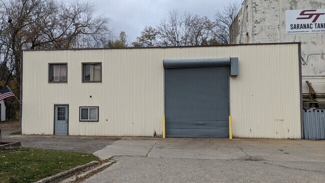
100 W Main St, Saranac, MI 48881


Property Detail
100 W Main St
Grand Rapids-Wyoming-Kentwood, MI
VILLAGE OF SARANAC COM 40.37FT W OF NE COR LOT 41, TH S1*18'30E 137.67FT
021-012-000-542-47
Ionia
Industrialgeneral
Michigan
A Areas with a 1% annual chance of flooding and a 26% chance of flooding over the life of a 30-year mortgage.
41
2025
0.38 AC
2025
Ionia County
031301
West Michigan
4,596 SF
NEARBY LISTINGS FOR SALE OR LEASE
-
-
View all Saranac listings for sale on LoopNet.com
DEMOGRAPHICS near 100 W Main St
1 mile
3 mile
5 mile
2025 Total Population
1,768
4,133
8,198
2030 Population
1,748
4,083
8,146
Pop Growth 2025-2030
(1.13%)
(1.21%)
(0.63%)
Average Age
40
40
40
2025 Total Households
670
1,560
3,084
HH Growth 2025-2030
(1.04%)
(1.22%)
(0.65%)
Median Household Inc
$77,778
$76,777
$79,225
Avg Household Size
2.60
2.60
2.60
2025 Avg HH Vehicles
3.00
2.00
2.00
Median Home Value
$241,983
$251,851
$261,621
Median Year Built
1979
1983
1983
Nearby Places
Map Layers
Map Styles
 Street
 Aerial
Layers
 Traffic
 Biking
Places
Listings with unknown addresses are not visible on the map
- Restaurants
- Banks
- Shops
- Fitness
- Groceries
PUBLIC TRANSPORTATION
AIRPORT
Gerald R Ford International
Drive
Walk
Distance
Gerald R Ford International
37 min
23.9 mi
Freight Ports
Port of Toledo
Drive
Walk
Distance
Port of Toledo
198 min
168.2 mi
SALE & LEASE HISTORY
LISTING DATE
SALE/LEASE

Nov 10, 2020
For Sale
Nearby Properties
Address
Land Use
TOTAL SIZE
Lot Size
Zoning
Address
Land Use
TOTAL SIZE
Lot Size
Zoning
2,490 SF
80 AC
Address
Land Use
TOTAL SIZE
Lot Size
Zoning
34,050 SF
8.36 AC
Address
Land Use
TOTAL SIZE
Lot Size
Zoning
156.68 AC
Address
Land Use
TOTAL SIZE
Lot Size
Zoning
51,858 SF
12.82 AC
Address
Land Use
TOTAL SIZE
Lot Size
Zoning
63 AC
Address
Land Use
TOTAL SIZE
Lot Size
Zoning
196.52 AC
0
Address
Land Use
TOTAL SIZE
Lot Size
Zoning
2,668 SF
58.50 AC
Address
Land Use
TOTAL SIZE
Lot Size
Zoning
1,844 SF
156.68 AC
R1
Address
Land Use
TOTAL SIZE
Lot Size
Zoning
Address
Land Use
TOTAL SIZE
Lot Size
Zoning
412.32 AC
Address
Land Use
TOTAL SIZE
Lot Size
Zoning
348.03 AC
Address
Land Use
TOTAL SIZE
Lot Size
Zoning
2,236 SF
80 AC
Address
Land Use
TOTAL SIZE
Lot Size
Zoning
1,997 SF
80 AC
Address
Land Use
TOTAL SIZE
Lot Size
Zoning
2,700 SF
40 AC
Address
Land Use
TOTAL SIZE
Lot Size
Zoning
1,528 SF
40 AC
Address
Land Use
TOTAL SIZE
Lot Size
Zoning
10,560 SF
2.92 AC
Address
Land Use
TOTAL SIZE
Lot Size
Zoning
1,100 SF
77.48 AC
Address
Land Use
TOTAL SIZE
Lot Size
Zoning
1,792 SF
89.50 AC
Address
Land Use
TOTAL SIZE
Lot Size
Zoning
2,176 SF
79.78 AC
Address
Land Use
TOTAL SIZE
Lot Size
Zoning
2,640 SF
29.82 AC
Address
Land Use
TOTAL SIZE
Lot Size
Zoning
1,812 SF
50 AC
Address
Land Use
TOTAL SIZE
Lot Size
Zoning
1,500 SF
64.31 AC
Address
Land Use
TOTAL SIZE
Lot Size
Zoning
2,348 SF
75.30 AC
Address
Land Use
TOTAL SIZE
Lot Size
Zoning
624 SF
99.62 AC
Address
Land Use
TOTAL SIZE
Lot Size
Zoning
1,440 SF
57 AC
Address
Land Use
TOTAL SIZE
Lot Size
Zoning
2,290 SF
33 AC
Address
Land Use
TOTAL SIZE
Lot Size
Zoning
1,327 SF
82.50 AC
Address
Land Use
TOTAL SIZE
Lot Size
Zoning
14,788 SF
1.38 AC
Address
Land Use
TOTAL SIZE
Lot Size
Zoning
2,560 SF
55.64 AC
Address
Land Use
TOTAL SIZE
Lot Size
Zoning
1,422 SF
77.63 AC
The World's #1 Commercial Real Estate Marketplace
Connect with us
© 2026 CoStar Group
The information above has been obtained from sources believed reliable. While we do not doubt its accuracy we have not verified it and make no guarantee, warranty or representation about it. It is your responsibility to independently confirm its accuracy and completeness. Any projections, opinions, assumptions, or estimates used are for example only and do not represent the current or future performance of the property. The value of this transaction to you depends on tax and other factors which should be evaluated by your tax, financial, and legal advisors. You and your advisors should conduct a careful, independent investigation of the property to determine to your satisfaction the suitability of the property for your needs.