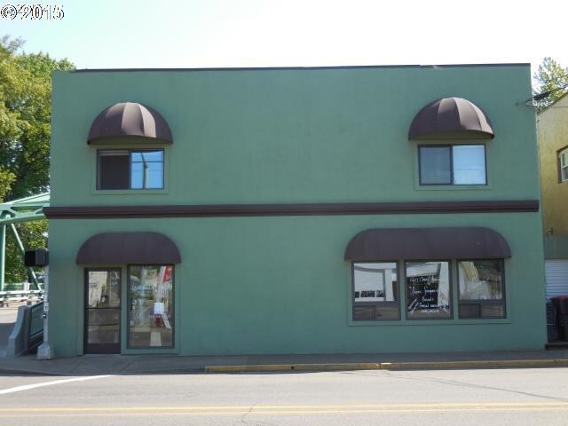
Property Record
100 W Main St, Sheridan, OR 97378


NEARBY LISTINGS FOR SALE OR LEASE
-
-
View all Sheridan listings for sale on LoopNet.com
Property Detail
100 W Main St
220898
SEE METES & BOUNDS
Commercialbuilding
Yamhill
AE
Oregon
41071C0557D
0.05 AC
2025
Yamhill County
2025
Portland
0305023050
Portland-Vancouver-Hillsboro, OR-WA
DEMOGRAPHICS near 100 W Main St
1 Mile
3 Mile
5 Mile
2024 Total Population
4,699
7,008
10,144
2029 Population
4,757
7,085
10,316
Pop Growth 2024-2029
+ 1.23%
+ 1.10%
+ 1.70%
Average Age
40
41
41
2024 Total Households
1,586
1,942
2,976
HH Growth 2024-2029
+ 1.26%
+ 1.18%
+ 1.95%
Median Household Inc
$62,758
$62,102
$61,689
Avg Household Size
2.70
2.70
2.70
2024 Avg HH Vehicles
2.00
2.00
2.00
Median Home Value
$243,261
$262,592
$292,003
Median Year Built
1977
1978
1976
Nearby Places
Map Layers
Map Styles
 Street
 Aerial
- Restaurants
- Banks
- Shops
- Fitness
- Groceries
SALE & LEASE HISTORY
LISTING DATE
SALE/LEASE

Sep 24, 2016
For Sale
Nearby Properties
Address
Land Use
TOTAL SIZE
Lot Size
Zoning
Address
Land Use
TOTAL SIZE
Lot Size
Zoning
4,500 SF
34.70 AC
F80 PAI
Address
Land Use
TOTAL SIZE
Lot Size
Zoning
928 SF
1.78 AC
R3
Address
Land Use
TOTAL SIZE
Lot Size
Zoning
3 AC
R3
Address
Land Use
TOTAL SIZE
Lot Size
Zoning
9.96 AC
I
Address
Land Use
TOTAL SIZE
Lot Size
Zoning
Address
Land Use
TOTAL SIZE
Lot Size
Zoning
10.13 AC
RC
Address
Land Use
TOTAL SIZE
Lot Size
Zoning
3.70 AC
R2
Address
Land Use
TOTAL SIZE
Lot Size
Zoning
1,560 SF
4 AC
R2
Address
Land Use
TOTAL SIZE
Lot Size
Zoning
10.59 AC
I
Address
Land Use
TOTAL SIZE
Lot Size
Zoning
10,393 SF
5 AC
EF-80
Address
Land Use
TOTAL SIZE
Lot Size
Zoning
14.15 AC
P
Address
Land Use
TOTAL SIZE
Lot Size
Zoning
1.15 AC
HC
Address
Land Use
TOTAL SIZE
Lot Size
Zoning
0.40 AC
R2
Address
Land Use
TOTAL SIZE
Lot Size
Zoning
12.30 AC
HI
Address
Land Use
TOTAL SIZE
Lot Size
Zoning
6.10 AC
HI
Address
Land Use
TOTAL SIZE
Lot Size
Zoning
2.07 AC
R2
Address
Land Use
TOTAL SIZE
Lot Size
Zoning
17.62 AC
P
Address
Land Use
TOTAL SIZE
Lot Size
Zoning
0.79 AC
R2
Address
Land Use
TOTAL SIZE
Lot Size
Zoning
2.19 AC
R3
Address
Land Use
TOTAL SIZE
Lot Size
Zoning
2.50 AC
R3
Address
Land Use
TOTAL SIZE
Lot Size
Zoning
Address
Land Use
TOTAL SIZE
Lot Size
Zoning
0.72 AC
P
Address
Land Use
TOTAL SIZE
Lot Size
Zoning
4,463 SF
5 AC
EF-80
Address
Land Use
TOTAL SIZE
Lot Size
Zoning
1.34 AC
R3
Address
Land Use
TOTAL SIZE
Lot Size
Zoning
2,150 SF
1.49 AC
I
Address
Land Use
TOTAL SIZE
Lot Size
Zoning
12,233 SF
57 AC
EFU
Address
Land Use
TOTAL SIZE
Lot Size
Zoning
2,872 SF
11.12 AC
EF-80
Address
Land Use
TOTAL SIZE
Lot Size
Zoning
181.50 AC
P
The World's #1 Commercial Real Estate Marketplace
Connect with us
© 2026 CoStar Group
The information above has been obtained from sources believed reliable. While we do not doubt its accuracy we have not verified it and make no guarantee, warranty or representation about it. It is your responsibility to independently confirm its accuracy and completeness. Any projections, opinions, assumptions, or estimates used are for example only and do not represent the current or future performance of the property. The value of this transaction to you depends on tax and other factors which should be evaluated by your tax, financial, and legal advisors. You and your advisors should conduct a careful, independent investigation of the property to determine to your satisfaction the suitability of the property for your needs.