Property Record
100 W Marks St, Greenville, MI 48838


NEARBY LISTINGS FOR SALE OR LEASE
-
-
View all Greenville listings for sale on LoopNet.com
Property Detail
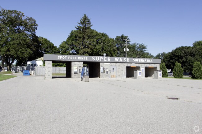
100 W Marks St
Grand Rapids-Wyoming, MI
DESCRIPTION CORRECTED 1/17/12 THAT PT OF NE 1/4 OF NE 1/4 OF SEC 9, T9N, R8W, COM NE COR SD SEC; S 00 DEG. 18' 13" E 58.00 FT
052-700-012-00
Montcalm
Commercialnec
Michigan
2025
0.58 AC
2025
Other Market Areas
971200
DEMOGRAPHICS near 100 W Marks St
1 Mile
3 Mile
5 Mile
2024 Total Population
4,035
13,077
18,258
2029 Population
4,184
13,643
19,041
Pop Growth 2024-2029
+ 3.69%
+ 4.33%
+ 4.29%
Average Age
38
40
41
2024 Total Households
1,599
5,199
7,210
HH Growth 2024-2029
+ 3.56%
+ 4.19%
+ 4.16%
Median Household Inc
$48,690
$50,422
$54,394
Avg Household Size
2.40
2.40
2.40
2024 Avg HH Vehicles
2.00
2.00
2.00
Median Home Value
$134,278
$157,841
$171,318
Median Year Built
1954
1972
1975
Nearby Places
Map Layers
Map Styles
 Street
 Aerial
- Restaurants
- Banks
- Shops
- Fitness
- Groceries
PUBLIC TRANSPORTATION
AIRPORT
Gerald R Ford International
DRIVE
WALK
Distance
Gerald R Ford International
61 min
40.5 mi
Nearby Properties
Address
Land Use
TOTAL SIZE
Lot Size
Zoning
Address
Land Use
TOTAL SIZE
Lot Size
Zoning
Address
Land Use
TOTAL SIZE
Lot Size
Zoning
Address
Land Use
TOTAL SIZE
Lot Size
Zoning
37.29 AC
R-1
Address
Land Use
TOTAL SIZE
Lot Size
Zoning
31.05 AC
C-2
Address
Land Use
TOTAL SIZE
Lot Size
Zoning
11.06 AC
Address
Land Use
TOTAL SIZE
Lot Size
Zoning
10.39 AC
R-1
Address
Land Use
TOTAL SIZE
Lot Size
Zoning
42.80 AC
IND
Address
Land Use
TOTAL SIZE
Lot Size
Zoning
96.66 AC
IND
Address
Land Use
TOTAL SIZE
Lot Size
Zoning
6.03 AC
IND
Address
Land Use
TOTAL SIZE
Lot Size
Zoning
11.90 AC
C-2
Address
Land Use
TOTAL SIZE
Lot Size
Zoning
7.57 AC
IND
Address
Land Use
TOTAL SIZE
Lot Size
Zoning
1.65 AC
Address
Land Use
TOTAL SIZE
Lot Size
Zoning
7.88 AC
C-2
Address
Land Use
TOTAL SIZE
Lot Size
Zoning
Address
Land Use
TOTAL SIZE
Lot Size
Zoning
5.64 AC
IND
Address
Land Use
TOTAL SIZE
Lot Size
Zoning
11.61 AC
IND
Address
Land Use
TOTAL SIZE
Lot Size
Zoning
2.40 AC
IND
Address
Land Use
TOTAL SIZE
Lot Size
Zoning
4.67 AC
Address
Land Use
TOTAL SIZE
Lot Size
Zoning
3.42 AC
C-2
Address
Land Use
TOTAL SIZE
Lot Size
Zoning
13.45 AC
PC
Address
Land Use
TOTAL SIZE
Lot Size
Zoning
Address
Land Use
TOTAL SIZE
Lot Size
Zoning
Address
Land Use
TOTAL SIZE
Lot Size
Zoning
9.61 AC
IND
Address
Land Use
TOTAL SIZE
Lot Size
Zoning
6.09 AC
IND
Address
Land Use
TOTAL SIZE
Lot Size
Zoning
4.95 AC
OSC-2
Address
Land Use
TOTAL SIZE
Lot Size
Zoning
4.46 AC
IND
Address
Land Use
TOTAL SIZE
Lot Size
Zoning
2.78 AC
C-2
Address
Land Use
TOTAL SIZE
Lot Size
Zoning
4.88 AC
Address
Land Use
TOTAL SIZE
Lot Size
Zoning
11.50 AC
R-3
Address
Land Use
TOTAL SIZE
Lot Size
Zoning
1.71 AC
C-2
The World's #1 Commercial Real Estate Marketplace
Connect with us
© 2025 CoStar Group
The information above has been obtained from sources believed reliable. While we do not doubt its accuracy we have not verified it and make no guarantee, warranty or representation about it. It is your responsibility to independently confirm its accuracy and completeness. Any projections, opinions, assumptions, or estimates used are for example only and do not represent the current or future performance of the property. The value of this transaction to you depends on tax and other factors which should be evaluated by your tax, financial, and legal advisors. You and your advisors should conduct a careful, independent investigation of the property to determine to your satisfaction the suitability of the property for your needs.