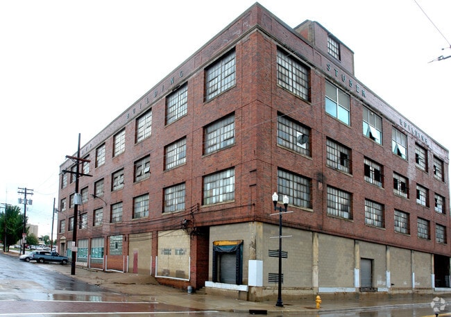
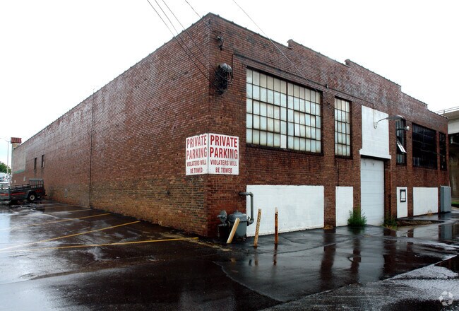
Property Record
100 Walnut St, Peoria, IL 61602

Property Detail
100 Walnut St
Peoria
BIGELOW & UNDERHILLS ADD SE 1/4 SEC 9-8N-8E LOTS 7-8 BLK 38 (EXC BEG MOST ELY COR SD LOT 8: TH NW 171 SW 22 SE TO LOT LN NE 2.8 TO POB); ALSO SE 1/2 VAC ALLEY LYING NW & ADJ THERETO
Peoria, IL
Peoria
18-09-403-005
Illinois
Industrialgeneral
7-8,8
2024
0.48 AC
2024
CBD
000900
NEARBY LISTINGS FOR SALE OR LEASE
-
-
View all Peoria listings for sale on LoopNet.com
DEMOGRAPHICS near 100 Walnut St
1 mile
3 mile
5 mile
2025 Total Population
5,885
65,975
121,518
2030 Population
6,038
67,057
122,267
Pop Growth 2025-2030
+ 2.60%
+ 1.64%
+ 0.62%
Average Age
37
37
40
2025 Total Households
2,945
26,983
51,756
HH Growth 2025-2030
+ 2.75%
+ 1.61%
+ 0.55%
Median Household Inc
$15,963
$39,028
$49,424
Avg Household Size
1.80
2.20
2.20
2025 Avg HH Vehicles
1.00
1.00
2.00
Median Home Value
$125,233
$81,008
$115,704
Median Year Built
1971
1948
1955
Nearby Places
Map Layers
Map Styles
 Street
 Aerial
Layers
 Traffic
 Biking
Places
Listings with unknown addresses are not visible on the map
- Restaurants
- Banks
- Shops
- Fitness
- Groceries
PUBLIC TRANSPORTATION
AIRPORT
General Downing - Peoria International
Drive
Walk
Distance
General Downing - Peoria International
15 min
7.2 mi
Nearby Properties
Address
Land Use
TOTAL SIZE
Lot Size
Zoning
Address
Land Use
TOTAL SIZE
Lot Size
Zoning
22.13 AC
Address
Land Use
TOTAL SIZE
Lot Size
Zoning
232,535 SF
3.45 AC
Address
Land Use
TOTAL SIZE
Lot Size
Zoning
0.91 AC
Address
Land Use
TOTAL SIZE
Lot Size
Zoning
85,556 SF
8.46 AC
Address
Land Use
TOTAL SIZE
Lot Size
Zoning
Address
Land Use
TOTAL SIZE
Lot Size
Zoning
142,321 SF
15.92 AC
Address
Land Use
TOTAL SIZE
Lot Size
Zoning
Address
Land Use
TOTAL SIZE
Lot Size
Zoning
49.61 AC
Address
Land Use
TOTAL SIZE
Lot Size
Zoning
80 SF
14.30 AC
Address
Land Use
TOTAL SIZE
Lot Size
Zoning
196,582 SF
16.62 AC
Address
Land Use
TOTAL SIZE
Lot Size
Zoning
0.57 AC
Address
Land Use
TOTAL SIZE
Lot Size
Zoning
0.44 AC
Address
Land Use
TOTAL SIZE
Lot Size
Zoning
161,535 SF
4.76 AC
Address
Land Use
TOTAL SIZE
Lot Size
Zoning
186,472 SF
2.19 AC
Address
Land Use
TOTAL SIZE
Lot Size
Zoning
132.43 AC
Address
Land Use
TOTAL SIZE
Lot Size
Zoning
0.22 AC
Address
Land Use
TOTAL SIZE
Lot Size
Zoning
Address
Land Use
TOTAL SIZE
Lot Size
Zoning
51,190 SF
3.74 AC
Address
Land Use
TOTAL SIZE
Lot Size
Zoning
21.18 AC
Address
Land Use
TOTAL SIZE
Lot Size
Zoning
135,233 SF
9.85 AC
Address
Land Use
TOTAL SIZE
Lot Size
Zoning
12.12 AC
Address
Land Use
TOTAL SIZE
Lot Size
Zoning
137,853 SF
11.92 AC
Address
Land Use
TOTAL SIZE
Lot Size
Zoning
Address
Land Use
TOTAL SIZE
Lot Size
Zoning
0.89 AC
Address
Land Use
TOTAL SIZE
Lot Size
Zoning
28.18 AC
Address
Land Use
TOTAL SIZE
Lot Size
Zoning
24,318 SF
2.83 AC
Address
Land Use
TOTAL SIZE
Lot Size
Zoning
Address
Land Use
TOTAL SIZE
Lot Size
Zoning
2.32 AC
Address
Land Use
TOTAL SIZE
Lot Size
Zoning
Address
Land Use
TOTAL SIZE
Lot Size
Zoning
0.48 AC
The World's #1 Commercial Real Estate Marketplace
Connect with us
© 2026 CoStar Group
The information above has been obtained from sources believed reliable. While we do not doubt its accuracy we have not verified it and make no guarantee, warranty or representation about it. It is your responsibility to independently confirm its accuracy and completeness. Any projections, opinions, assumptions, or estimates used are for example only and do not represent the current or future performance of the property. The value of this transaction to you depends on tax and other factors which should be evaluated by your tax, financial, and legal advisors. You and your advisors should conduct a careful, independent investigation of the property to determine to your satisfaction the suitability of the property for your needs.