Property Record
100 Wynfield Trce, Peachtree Corners, GA 30092
NEARBY LISTINGS FOR SALE OR LEASE
-
-
View all Peachtree Corners listings for sale on LoopNet.com
Property Detail
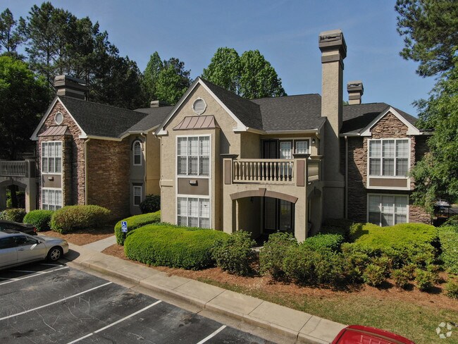
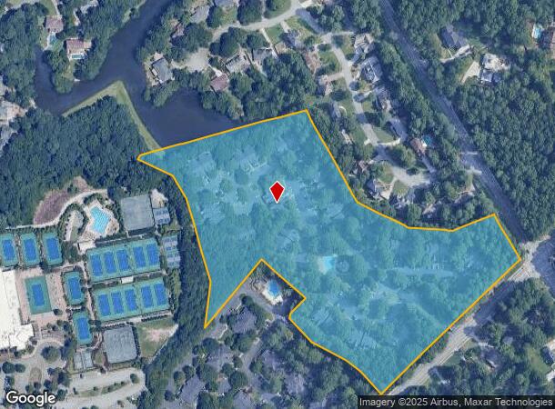
100 Wynfield Trce
6-304-317
Peachtree
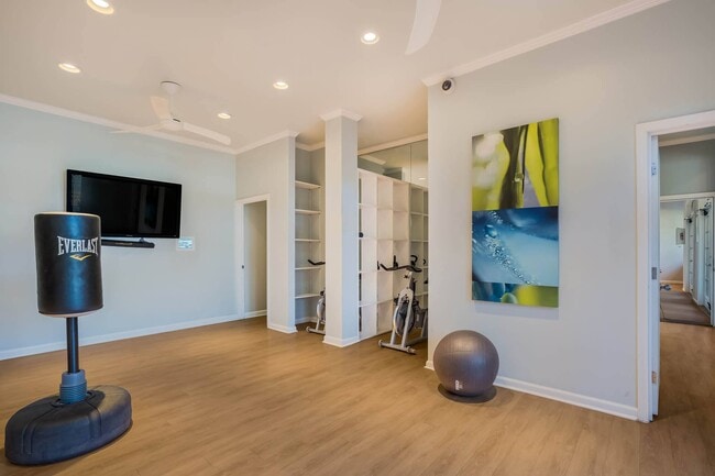
Apartment
PEACHTREE CORNERS CIR
X
Gwinnett
13135C0066H
Georgia
2025
13.42 AC
2025
Peachtree Corners
050335
Atlanta
159,666 SF
Atlanta-Sandy Springs-Roswell, GA
DEMOGRAPHICS near 100 Wynfield Trce
1 mile
3 mile
5 mile
2024 Total Population
10,071
69,616
215,741
2029 Population
10,425
71,774
220,640
Pop Growth 2024-2029
+ 3.52%
+ 3.10%
+ 2.27%
Average Age
40
39
38
2024 Total Households
4,250
26,844
80,697
HH Growth 2024-2029
+ 3.55%
+ 3.11%
+ 2.24%
Median Household Inc
$68,779
$81,612
$75,077
Avg Household Size
2.30
2.50
2.60
2024 Avg HH Vehicles
2.00
2.00
2.00
Median Home Value
$400,225
$455,802
$439,123
Median Year Built
1983
1986
1987
Nearby Places
Map Layers
Map Styles
 Street
 Aerial
Transit
 Traffic
 Biking
Places
Listings with unknown addresses are not visible on the map
- Restaurants
- Banks
- Shops
- Fitness
- Groceries
PUBLIC TRANSPORTATION
AIRPORT
Hartsfield - Jackson Atlanta International
Drive
Walk
Distance
Hartsfield - Jackson Atlanta International
45 min
31.5 mi
Freight Ports
Georgia Ports - Savannah
Drive
Walk
Distance
Georgia Ports - Savannah
300 min
265.9 mi
Nearby Properties
Address
Land Use
TOTAL SIZE
Lot Size
Zoning
Address
Land Use
TOTAL SIZE
Lot Size
Zoning
599,105 SF
9.13 AC
M1
Address
Land Use
TOTAL SIZE
Lot Size
Zoning
524,000 SF
44.93 AC
RM
Address
Land Use
TOTAL SIZE
Lot Size
Zoning
545,074 SF
53.40 AC
RM8
Address
Land Use
TOTAL SIZE
Lot Size
Zoning
286,481 SF
20.06 AC
M1
Address
Land Use
TOTAL SIZE
Lot Size
Zoning
358,622 SF
31.01 AC
RM13
Address
Land Use
TOTAL SIZE
Lot Size
Zoning
231,192 SF
12.88 AC
RM13
Address
Land Use
TOTAL SIZE
Lot Size
Zoning
303,866 SF
20.13 AC
RM
Address
Land Use
TOTAL SIZE
Lot Size
Zoning
424,948 SF
39.03 AC
RM13
Address
Land Use
TOTAL SIZE
Lot Size
Zoning
1,196,908 SF
30.28 AC
OI
Address
Land Use
TOTAL SIZE
Lot Size
Zoning
1,423,656 SF
15.44 AC
OI
Address
Land Use
TOTAL SIZE
Lot Size
Zoning
426,839 SF
37.47 AC
MUD
Address
Land Use
TOTAL SIZE
Lot Size
Zoning
250,886 SF
22.93 AC
RM13
Address
Land Use
TOTAL SIZE
Lot Size
Zoning
483,279 SF
8.27 AC
BH
Address
Land Use
TOTAL SIZE
Lot Size
Zoning
475,389 SF
5.37 AC
NX
Address
Land Use
TOTAL SIZE
Lot Size
Zoning
249,766 SF
25.34 AC
RM100
Address
Land Use
TOTAL SIZE
Lot Size
Zoning
220,150 SF
21.08 AC
RM13
Address
Land Use
TOTAL SIZE
Lot Size
Zoning
459,745 SF
50.72 AC
RM10
Address
Land Use
TOTAL SIZE
Lot Size
Zoning
420,576 SF
27.06 AC
M2
Address
Land Use
TOTAL SIZE
Lot Size
Zoning
6,769,095 SF
21.82 AC
OI
Address
Land Use
TOTAL SIZE
Lot Size
Zoning
220,915 SF
2.38 AC
HX
Address
Land Use
TOTAL SIZE
Lot Size
Zoning
390,776 SF
43.96 AC
RM8
Address
Land Use
TOTAL SIZE
Lot Size
Zoning
225,314 SF
68.32 AC
OI
Address
Land Use
TOTAL SIZE
Lot Size
Zoning
205,850 SF
24.63 AC
RM10
Address
Land Use
TOTAL SIZE
Lot Size
Zoning
204,333 SF
39.43 AC
RM10
Address
Land Use
TOTAL SIZE
Lot Size
Zoning
428,933 SF
50.01 AC
PRD
Address
Land Use
TOTAL SIZE
Lot Size
Zoning
336,694 SF
32.05 AC
RM10
Address
Land Use
TOTAL SIZE
Lot Size
Zoning
228,548 SF
16.50 AC
RM10
Address
Land Use
TOTAL SIZE
Lot Size
Zoning
419,868 SF
3.63 AC
MUD
Address
Land Use
TOTAL SIZE
Lot Size
Zoning
1,676,766 SF
23 AC
OIC
Address
Land Use
TOTAL SIZE
Lot Size
Zoning
2,849,264 SF
21 AC
OI
The World's #1 Commercial Real Estate Marketplace
Connect with us
© 2026 CoStar Group
The information above has been obtained from sources believed reliable. While we do not doubt its accuracy we have not verified it and make no guarantee, warranty or representation about it. It is your responsibility to independently confirm its accuracy and completeness. Any projections, opinions, assumptions, or estimates used are for example only and do not represent the current or future performance of the property. The value of this transaction to you depends on tax and other factors which should be evaluated by your tax, financial, and legal advisors. You and your advisors should conduct a careful, independent investigation of the property to determine to your satisfaction the suitability of the property for your needs.