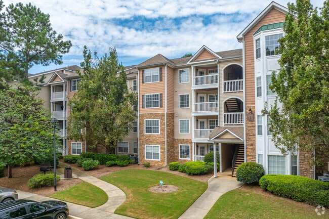
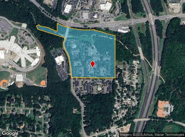
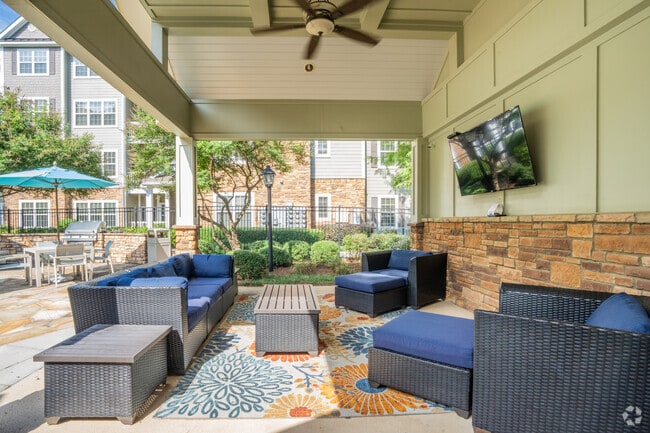
Property Record
1000 Avonlea Pl, Woodstock, GA 30189
NEARBY LISTINGS FOR SALE OR LEASE
-
-
View all Woodstock listings for sale on LoopNet.com
Property Detail
1000 Avonlea Pl
015N11-00000-008-000-0000
LL 1071 15TH D
Nightclub
Cherokee
AE
Georgia
13057C0331E
25.86 AC
2025
Cherokee County
2025
Atlanta
091012
Atlanta-Sandy Springs-Roswell, GA
188,105 SF
DEMOGRAPHICS near 1000 Avonlea Pl
1 Mile
3 Mile
5 Mile
2024 Total Population
12,706
72,066
180,219
2029 Population
14,760
81,378
198,658
Pop Growth 2024-2029
+ 16.17%
+ 12.92%
+ 10.23%
Average Age
39
39
39
2024 Total Households
5,230
27,158
66,124
HH Growth 2024-2029
+ 16.21%
+ 13.22%
+ 10.47%
Median Household Inc
$71,865
$89,516
$94,651
Avg Household Size
2.40
2.60
2.60
2024 Avg HH Vehicles
2.00
2.00
2.00
Median Home Value
$299,367
$325,804
$319,622
Median Year Built
1999
1996
1994
Nearby Places
- Restaurants
- Banks
- Shops
- Fitness
- Groceries
Nearby Properties
Address
Land Use
TOTAL SIZE
Lot Size
Zoning
Address
Land Use
TOTAL SIZE
Lot Size
Zoning
523,803 SF
148.37 AC
R-40
Address
Land Use
TOTAL SIZE
Lot Size
Zoning
189,621 SF
12.16 AC
R-40
Address
Land Use
TOTAL SIZE
Lot Size
Zoning
228,644 SF
7.88 AC
DT-CBD
Address
Land Use
TOTAL SIZE
Lot Size
Zoning
309,011 SF
64.20 AC
PUD
Address
Land Use
TOTAL SIZE
Lot Size
Zoning
175,587 SF
17.71 AC
RTH
Address
Land Use
TOTAL SIZE
Lot Size
Zoning
197,890 SF
14.60 AC
R-4
Address
Land Use
TOTAL SIZE
Lot Size
Zoning
181,704 SF
17.56 AC
DT-MRA
Address
Land Use
TOTAL SIZE
Lot Size
Zoning
349,911 SF
18.11 AC
LI
Address
Land Use
TOTAL SIZE
Lot Size
Zoning
399,085 SF
38.48 AC
LI
Address
Land Use
TOTAL SIZE
Lot Size
Zoning
157,013 SF
18.53 AC
IN-VIL
Address
Land Use
TOTAL SIZE
Lot Size
Zoning
128,196 SF
24.68 AC
R-4
Address
Land Use
TOTAL SIZE
Lot Size
Zoning
266,487 SF
21.69 AC
R-4
Address
Land Use
TOTAL SIZE
Lot Size
Zoning
201,331 SF
15.48 AC
RM16
Address
Land Use
TOTAL SIZE
Lot Size
Zoning
346,900 SF
104.10 AC
CD
Address
Land Use
TOTAL SIZE
Lot Size
Zoning
235,861 SF
31.92 AC
RM10
Address
Land Use
TOTAL SIZE
Lot Size
Zoning
238,600 SF
21.10 AC
R-3
Address
Land Use
TOTAL SIZE
Lot Size
Zoning
91,547 SF
18.48 AC
R-3
Address
Land Use
TOTAL SIZE
Lot Size
Zoning
255,460 SF
20.28 AC
RM16
Address
Land Use
TOTAL SIZE
Lot Size
Zoning
189,456 SF
28.35 AC
NC-TCT
Address
Land Use
TOTAL SIZE
Lot Size
Zoning
113,849 SF
7.46 AC
R-5
Address
Land Use
TOTAL SIZE
Lot Size
Zoning
186,426 SF
32.52 AC
NC-TCT
Address
Land Use
TOTAL SIZE
Lot Size
Zoning
85,166 SF
3.41 AC
DT-CBD
Address
Land Use
TOTAL SIZE
Lot Size
Zoning
85,671 SF
12.25 AC
RM10
Address
Land Use
TOTAL SIZE
Lot Size
Zoning
194,729 SF
29.67 AC
GC
Address
Land Use
TOTAL SIZE
Lot Size
Zoning
134,017 SF
32.51 AC
AG
Address
Land Use
TOTAL SIZE
Lot Size
Zoning
63,264 SF
8 AC
PUD
Address
Land Use
TOTAL SIZE
Lot Size
Zoning
132,022 SF
12.69 AC
GC
Address
Land Use
TOTAL SIZE
Lot Size
Zoning
86,307 SF
13.49 AC
GC
Address
Land Use
TOTAL SIZE
Lot Size
Zoning
156,752 SF
16.34 AC
NC-TCT
The World's #1 Commercial Real Estate Marketplace
Connect with us
© 2025 CoStar Group
The information above has been obtained from sources believed reliable. While we do not doubt its accuracy we have not verified it and make no guarantee, warranty or representation about it. It is your responsibility to independently confirm its accuracy and completeness. Any projections, opinions, assumptions, or estimates used are for example only and do not represent the current or future performance of the property. The value of this transaction to you depends on tax and other factors which should be evaluated by your tax, financial, and legal advisors. You and your advisors should conduct a careful, independent investigation of the property to determine to your satisfaction the suitability of the property for your needs.