Property Record
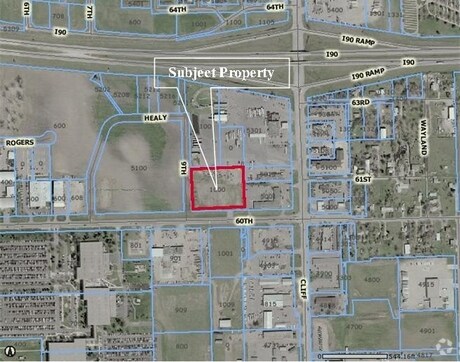
5010 N 9Th Ave N, Sioux Falls, SD 57104


NEARBY LISTINGS FOR SALE OR LEASE
Property Detail
5010 N 9Th Ave N
Sioux Falls, SD-MN
Rogers Sub
44762
S41` LOT 2 & ALL 3 BLOCK 3 ROGERS SUBD NO. 2 IN CITY OF SIOUX FALLS
Autorepair
Minnehaha
X
South Dakota
46099C0452F
2
2024
3.79 AC
2024
Sioux Falls
000100
Other Market Areas
11,040 SF
DEMOGRAPHICS near 5010 N 9Th Ave N
1 mile
3 mile
5 mile
2024 Total Population
810
8,456
69,038
2029 Population
871
8,984
74,936
Pop Growth 2024-2029
+ 7.53%
+ 6.24%
+ 8.54%
Average Age
42
41
38
2024 Total Households
329
2,826
28,672
HH Growth 2024-2029
+ 7.60%
+ 7.15%
+ 9.05%
Median Household Inc
$76,866
$55,212
$58,834
Avg Household Size
2.50
2.40
2.20
2024 Avg HH Vehicles
2.00
2.00
2.00
Median Home Value
$285,332
$180,571
$195,895
Median Year Built
1992
1976
1974
Nearby Places
Map Layers
Map Styles
 Street
 Aerial
Transit
 Traffic
 Biking
Places
Listings with unknown addresses are not visible on the map
- Restaurants
- Banks
- Shops
- Fitness
- Groceries
PUBLIC TRANSPORTATION
AIRPORT
Joe Foss Field
Drive
Walk
Distance
Joe Foss Field
23 min
6.4 mi
SALE & LEASE HISTORY
LISTING DATE
SALE/LEASE

Sep 24, 2016
For Sale
Nearby Properties
Address
Land Use
TOTAL SIZE
Lot Size
Zoning
Address
Land Use
TOTAL SIZE
Lot Size
Zoning
348,059 SF
32.99 AC
Address
Land Use
TOTAL SIZE
Lot Size
Zoning
14,820 SF
80.57 AC
FP;FP
Address
Land Use
TOTAL SIZE
Lot Size
Zoning
300,920 SF
90.58 AC
Address
Land Use
TOTAL SIZE
Lot Size
Zoning
41.01 AC
FP;FP
Address
Land Use
TOTAL SIZE
Lot Size
Zoning
Address
Land Use
TOTAL SIZE
Lot Size
Zoning
50,160 SF
24.88 AC
Address
Land Use
TOTAL SIZE
Lot Size
Zoning
145,014 SF
14.41 AC
Address
Land Use
TOTAL SIZE
Lot Size
Zoning
35,688 SF
8.27 AC
FP;FP
Address
Land Use
TOTAL SIZE
Lot Size
Zoning
149,520 SF
22.50 AC
Address
Land Use
TOTAL SIZE
Lot Size
Zoning
173,235 SF
10 AC
Address
Land Use
TOTAL SIZE
Lot Size
Zoning
33,416 SF
9.87 AC
Address
Land Use
TOTAL SIZE
Lot Size
Zoning
127,332 SF
28.18 AC
Address
Land Use
TOTAL SIZE
Lot Size
Zoning
18.37 AC
Address
Land Use
TOTAL SIZE
Lot Size
Zoning
23.87 AC
Address
Land Use
TOTAL SIZE
Lot Size
Zoning
134,102 SF
11.77 AC
Address
Land Use
TOTAL SIZE
Lot Size
Zoning
58,825 SF
20.09 AC
Address
Land Use
TOTAL SIZE
Lot Size
Zoning
238,875 SF
21.92 AC
NO;SPECIAL
Address
Land Use
TOTAL SIZE
Lot Size
Zoning
127,500 SF
13.04 AC
Address
Land Use
TOTAL SIZE
Lot Size
Zoning
85,272 SF
4.83 AC
Address
Land Use
TOTAL SIZE
Lot Size
Zoning
1,806 SF
170.92 AC
FP;FP
Address
Land Use
TOTAL SIZE
Lot Size
Zoning
13.08 AC
Address
Land Use
TOTAL SIZE
Lot Size
Zoning
144,152 SF
12.89 AC
Address
Land Use
TOTAL SIZE
Lot Size
Zoning
5,040 SF
7.06 AC
Address
Land Use
TOTAL SIZE
Lot Size
Zoning
12,454 SF
13.30 AC
Address
Land Use
TOTAL SIZE
Lot Size
Zoning
111,104 SF
9.65 AC
NO;SPECIAL
Address
Land Use
TOTAL SIZE
Lot Size
Zoning
212,500 SF
12 AC
Address
Land Use
TOTAL SIZE
Lot Size
Zoning
46,944 SF
6.50 AC
Address
Land Use
TOTAL SIZE
Lot Size
Zoning
175,340 SF
5.23 AC
Address
Land Use
TOTAL SIZE
Lot Size
Zoning
95,002 SF
8.32 AC
Address
Land Use
TOTAL SIZE
Lot Size
Zoning
137,336 SF
13.59 AC
The World's #1 Commercial Real Estate Marketplace
Connect with us
© 2026 CoStar Group
The information above has been obtained from sources believed reliable. While we do not doubt its accuracy we have not verified it and make no guarantee, warranty or representation about it. It is your responsibility to independently confirm its accuracy and completeness. Any projections, opinions, assumptions, or estimates used are for example only and do not represent the current or future performance of the property. The value of this transaction to you depends on tax and other factors which should be evaluated by your tax, financial, and legal advisors. You and your advisors should conduct a careful, independent investigation of the property to determine to your satisfaction the suitability of the property for your needs.