Property Record
1000 E King Ave, Kingsland, GA 31548


NEARBY LISTINGS FOR SALE OR LEASE
Property Detail
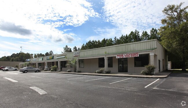
1000 E King Ave
095-002P
Hwy 40
Commercialnec
COMM (RETAIL/WHSE)/L S/S HWY 40
X
Camden
13039C0391G
Georgia
2025
2.17 AC
2025
Brunswick/Kingsland
010303
Other Market Areas
12,000 SF
Kingsland, GA
DEMOGRAPHICS near 1000 E King Ave
1 Mile
3 Mile
5 Mile
2024 Total Population
3,380
17,888
27,450
2029 Population
3,714
19,691
30,230
Pop Growth 2024-2029
+ 9.88%
+ 10.08%
+ 10.13%
Average Age
37
35
37
2024 Total Households
1,321
6,647
10,333
HH Growth 2024-2029
+ 9.99%
+ 10.20%
+ 10.23%
Median Household Inc
$45,345
$55,100
$62,219
Avg Household Size
2.50
2.60
2.60
2024 Avg HH Vehicles
2.00
2.00
2.00
Median Home Value
$151,397
$180,198
$208,646
Median Year Built
1996
1996
1998
Nearby Places
Map Layers
Map Styles
 Street
 Aerial
- Restaurants
- Banks
- Shops
- Fitness
- Groceries
PUBLIC TRANSPORTATION
AIRPORT
Jacksonville International
DRIVE
WALK
Distance
Jacksonville International
33 min
26.3 mi
Freight Ports
Georgia Ports - Brunswick
DRIVE
WALK
Distance
Georgia Ports - Brunswick
39 min
31.0 mi
SALE & LEASE HISTORY
LISTING DATE
SALE/LEASE

Sep 26, 2023
For Lease
Mar 22, 2019
For Lease
Jul 12, 2018
For Sale
Nearby Properties
Address
Land Use
TOTAL SIZE
Lot Size
Zoning
Address
Land Use
TOTAL SIZE
Lot Size
Zoning
256,459 SF
38.54 AC
R-1
Address
Land Use
TOTAL SIZE
Lot Size
Zoning
184,547 SF
34.90 AC
R-1
Address
Land Use
TOTAL SIZE
Lot Size
Zoning
94,156 SF
74.30 AC
PD/R-1
Address
Land Use
TOTAL SIZE
Lot Size
Zoning
144,338 SF
35 AC
R-1
Address
Land Use
TOTAL SIZE
Lot Size
Zoning
79,447 SF
25 AC
PD/R-1
Address
Land Use
TOTAL SIZE
Lot Size
Zoning
80,714 SF
26.12 AC
R1
Address
Land Use
TOTAL SIZE
Lot Size
Zoning
123,108 SF
11.83 AC
R-3
Address
Land Use
TOTAL SIZE
Lot Size
Zoning
76,769 SF
26 AC
R-1
Address
Land Use
TOTAL SIZE
Lot Size
Zoning
3,879 SF
10.72 AC
PD/R-3
Address
Land Use
TOTAL SIZE
Lot Size
Zoning
8,544 SF
18.64 AC
C2
Address
Land Use
TOTAL SIZE
Lot Size
Zoning
139,255 SF
16.27 AC
I-L
Address
Land Use
TOTAL SIZE
Lot Size
Zoning
16,598 SF
24.13 AC
PD/R-3
Address
Land Use
TOTAL SIZE
Lot Size
Zoning
95,196 SF
8.64 AC
C2
Address
Land Use
TOTAL SIZE
Lot Size
Zoning
2,833 SF
22.34 AC
PD/C2
Address
Land Use
TOTAL SIZE
Lot Size
Zoning
15,590 SF
0.71 AC
C-4
Address
Land Use
TOTAL SIZE
Lot Size
Zoning
51,948 SF
2.08 AC
C-4
Address
Land Use
TOTAL SIZE
Lot Size
Zoning
55,497 SF
1.68 AC
C-4
Address
Land Use
TOTAL SIZE
Lot Size
Zoning
16,768 SF
8.96 AC
R-3
Address
Land Use
TOTAL SIZE
Lot Size
Zoning
56,037 SF
8.66 AC
C2
Address
Land Use
TOTAL SIZE
Lot Size
Zoning
9,530 SF
10.71 AC
PD/R-3
Address
Land Use
TOTAL SIZE
Lot Size
Zoning
3,712 SF
4.12 AC
PD/C-2
Address
Land Use
TOTAL SIZE
Lot Size
Zoning
49,008 SF
1.61 AC
C-4
Address
Land Use
TOTAL SIZE
Lot Size
Zoning
22,670 SF
16.51 AC
C-2
Address
Land Use
TOTAL SIZE
Lot Size
Zoning
66,000 SF
3.72 AC
R-3
Address
Land Use
TOTAL SIZE
Lot Size
Zoning
22,046 SF
4.50 AC
R-1
Address
Land Use
TOTAL SIZE
Lot Size
Zoning
19,600 SF
1.51 AC
C-4
Address
Land Use
TOTAL SIZE
Lot Size
Zoning
32,108 SF
1.23 AC
C-4
Address
Land Use
TOTAL SIZE
Lot Size
Zoning
43,213 SF
1.73 AC
C-4
Address
Land Use
TOTAL SIZE
Lot Size
Zoning
10,496 SF
20 AC
C-4
Address
Land Use
TOTAL SIZE
Lot Size
Zoning
11,870 SF
22 AC
C-4
The World's #1 Commercial Real Estate Marketplace
Connect with us
© 2026 CoStar Group
The information above has been obtained from sources believed reliable. While we do not doubt its accuracy we have not verified it and make no guarantee, warranty or representation about it. It is your responsibility to independently confirm its accuracy and completeness. Any projections, opinions, assumptions, or estimates used are for example only and do not represent the current or future performance of the property. The value of this transaction to you depends on tax and other factors which should be evaluated by your tax, financial, and legal advisors. You and your advisors should conduct a careful, independent investigation of the property to determine to your satisfaction the suitability of the property for your needs.