Property Record
1000 E Us Highway 80 Rd, Bloomingdale, GA 31302


NEARBY LISTINGS FOR SALE OR LEASE
Property Detail
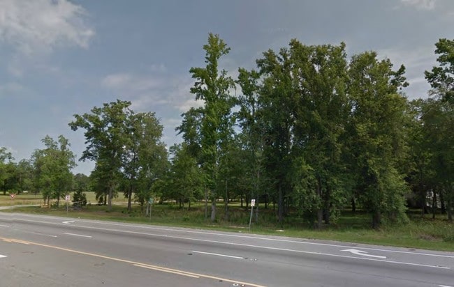
1000 E Us Highway 80 Rd
8104301020
West Side 1
Vacantlandnec
PT OF TRACT ON NE CORNER LOUISVI LLE RD AND STAGECOACH RD 10.934
AE
Chatham
13103C0364E
Georgia
2024
10.86 AC
2025
Bloomingdale/Pooler
010801
Savannah
1,518 SF
Savannah, GA
DEMOGRAPHICS near 1000 E Us Highway 80 Rd
1 Mile
3 Mile
5 Mile
2024 Total Population
525
7,959
43,274
2029 Population
579
8,653
46,769
Pop Growth 2024-2029
+ 10.29%
+ 8.72%
+ 8.08%
Average Age
41
40
38
2024 Total Households
195
3,005
16,755
HH Growth 2024-2029
+ 10.26%
+ 8.35%
+ 7.66%
Median Household Inc
$65,795
$71,742
$82,273
Avg Household Size
2.70
2.60
2.50
2024 Avg HH Vehicles
2.00
2.00
2.00
Median Home Value
$261,538
$225,485
$239,019
Median Year Built
1995
1998
2005
Nearby Places
Map Layers
Map Styles
 Street
 Aerial
- Restaurants
- Banks
- Shops
- Fitness
- Groceries
PUBLIC TRANSPORTATION
AIRPORT
Savannah/Hilton Head International
DRIVE
WALK
Distance
Savannah/Hilton Head International
22 min
10.8 mi
Freight Ports
Georgia Ports - Savannah
DRIVE
WALK
Distance
Georgia Ports - Savannah
23 min
13.5 mi
SALE & LEASE HISTORY
LISTING DATE
SALE/LEASE

Sep 08, 2017
For Sale
Aug 02, 2018
For Sale
Nearby Properties
Address
Land Use
TOTAL SIZE
Lot Size
Zoning
Address
Land Use
TOTAL SIZE
Lot Size
Zoning
1,080,000 SF
71.17 AC
PUD
Address
Land Use
TOTAL SIZE
Lot Size
Zoning
1,460,340 SF
89.96 AC
RA-1
Address
Land Use
TOTAL SIZE
Lot Size
Zoning
1,193,920 SF
84.08 AC
PUD
Address
Land Use
TOTAL SIZE
Lot Size
Zoning
707,608 SF
78.02 AC
PUD
Address
Land Use
TOTAL SIZE
Lot Size
Zoning
920,550 SF
50.12 AC
I-1
Address
Land Use
TOTAL SIZE
Lot Size
Zoning
4,800 SF
35.20 AC
I-1
Address
Land Use
TOTAL SIZE
Lot Size
Zoning
234,700 SF
52.22 AC
PUD
Address
Land Use
TOTAL SIZE
Lot Size
Zoning
33.46 AC
PUD
Address
Land Use
TOTAL SIZE
Lot Size
Zoning
33.42 AC
PUD
Address
Land Use
TOTAL SIZE
Lot Size
Zoning
8,464 SF
32.62 AC
RA1
Address
Land Use
TOTAL SIZE
Lot Size
Zoning
290,524 SF
21.52 AC
Address
Land Use
TOTAL SIZE
Lot Size
Zoning
357,760 SF
21.19 AC
RA-1
Address
Land Use
TOTAL SIZE
Lot Size
Zoning
280,000 SF
19.20 AC
Address
Land Use
TOTAL SIZE
Lot Size
Zoning
253,638 SF
27.02 AC
PUD
Address
Land Use
TOTAL SIZE
Lot Size
Zoning
8,464 SF
7.77 AC
C-1
Address
Land Use
TOTAL SIZE
Lot Size
Zoning
153,000 SF
9.10 AC
PUD
Address
Land Use
TOTAL SIZE
Lot Size
Zoning
150,450 SF
172 AC
RA-1
Address
Land Use
TOTAL SIZE
Lot Size
Zoning
31,800 SF
22.13 AC
I-L
Address
Land Use
TOTAL SIZE
Lot Size
Zoning
58.15 AC
RA-1
Address
Land Use
TOTAL SIZE
Lot Size
Zoning
48,190 SF
75 AC
Address
Land Use
TOTAL SIZE
Lot Size
Zoning
1,800 SF
52.54 AC
I-1
Address
Land Use
TOTAL SIZE
Lot Size
Zoning
18,010 SF
20.43 AC
RA-1
Address
Land Use
TOTAL SIZE
Lot Size
Zoning
1,338.42 AC
AR-1 & PD-
Address
Land Use
TOTAL SIZE
Lot Size
Zoning
5,374 SF
6.25 AC
B-3
Address
Land Use
TOTAL SIZE
Lot Size
Zoning
4,490 SF
5.87 AC
C2
Address
Land Use
TOTAL SIZE
Lot Size
Zoning
15,360 SF
4.14 AC
C-1
Address
Land Use
TOTAL SIZE
Lot Size
Zoning
703 SF
768.61 AC
B-2
Address
Land Use
TOTAL SIZE
Lot Size
Zoning
4,440 SF
3.14 AC
C-2
Address
Land Use
TOTAL SIZE
Lot Size
Zoning
1,170 SF
8.60 AC
RI
Address
Land Use
TOTAL SIZE
Lot Size
Zoning
10,368 SF
4.55 AC
C-1
The World's #1 Commercial Real Estate Marketplace
Connect with us
© 2026 CoStar Group
The information above has been obtained from sources believed reliable. While we do not doubt its accuracy we have not verified it and make no guarantee, warranty or representation about it. It is your responsibility to independently confirm its accuracy and completeness. Any projections, opinions, assumptions, or estimates used are for example only and do not represent the current or future performance of the property. The value of this transaction to you depends on tax and other factors which should be evaluated by your tax, financial, and legal advisors. You and your advisors should conduct a careful, independent investigation of the property to determine to your satisfaction the suitability of the property for your needs.