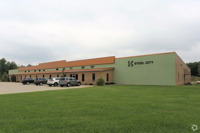
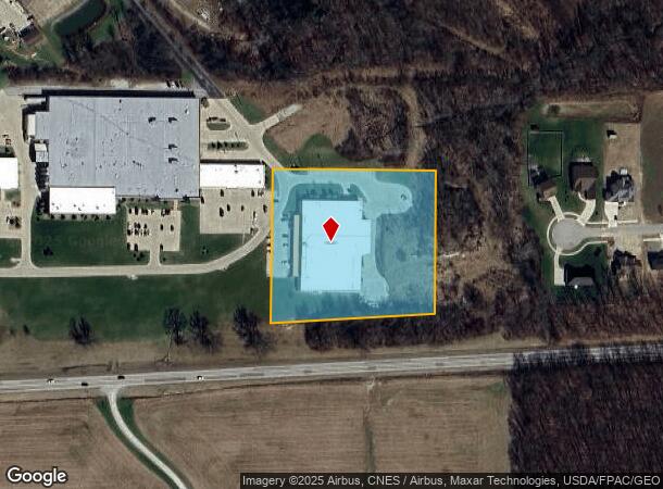
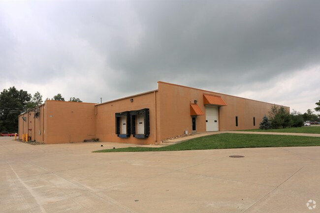
Property Record
1000 Hedstrom Dr, Ashland, OH 44805
NEARBY LISTINGS FOR SALE OR LEASE
Property Detail
1000 Hedstrom Dr
P44-085-0-0023-03
1000 HEDSTROM R=85 PARCEL (FORMERLY FOODTOWN, 1971 S BANEY RD)
Lightindustrial
Ashland
X
Ohio
39005C0227E
4.02 AC
2024
Ohio North Area
2024
Other Market Areas
970700
Ashland, OH
45,294 SF
DEMOGRAPHICS near 1000 Hedstrom Dr
1 Mile
3 Mile
5 Mile
2024 Total Population
3,483
20,758
26,508
2029 Population
3,513
20,853
26,642
Pop Growth 2024-2029
+ 0.86%
+ 0.46%
+ 0.51%
Average Age
47
41
42
2024 Total Households
1,549
8,651
10,905
HH Growth 2024-2029
+ 0.77%
+ 0.43%
+ 0.50%
Median Household Inc
$61,577
$55,982
$56,920
Avg Household Size
2.20
2.20
2.30
2024 Avg HH Vehicles
2.00
2.00
2.00
Median Home Value
$176,100
$140,829
$145,664
Median Year Built
1981
1958
1962
Nearby Places
Map Layers
Map Styles
 Street
 Aerial
- Restaurants
- Banks
- Shops
- Fitness
- Groceries
SALE & LEASE HISTORY
LISTING DATE
SALE/LEASE

Jun 01, 2017
For Lease
Nearby Properties
Address
Land Use
TOTAL SIZE
Lot Size
Zoning
Address
Land Use
TOTAL SIZE
Lot Size
Zoning
7,737 SF
16.67 AC
Address
Land Use
TOTAL SIZE
Lot Size
Zoning
125,000 SF
2.57 AC
Address
Land Use
TOTAL SIZE
Lot Size
Zoning
3,988 SF
15.28 AC
Address
Land Use
TOTAL SIZE
Lot Size
Zoning
792 SF
47.90 AC
Address
Land Use
TOTAL SIZE
Lot Size
Zoning
104,076 SF
5 AC
Address
Land Use
TOTAL SIZE
Lot Size
Zoning
37,974 SF
7.35 AC
Address
Land Use
TOTAL SIZE
Lot Size
Zoning
39,229 SF
13.47 AC
Address
Land Use
TOTAL SIZE
Lot Size
Zoning
62,667 SF
2.80 AC
Address
Land Use
TOTAL SIZE
Lot Size
Zoning
0.22 AC
Address
Land Use
TOTAL SIZE
Lot Size
Zoning
242,225 SF
20 AC
Address
Land Use
TOTAL SIZE
Lot Size
Zoning
95,413 SF
0.20 AC
Address
Land Use
TOTAL SIZE
Lot Size
Zoning
71,621 SF
6.19 AC
Address
Land Use
TOTAL SIZE
Lot Size
Zoning
57,097 SF
25.50 AC
Address
Land Use
TOTAL SIZE
Lot Size
Zoning
14,296 SF
5.45 AC
Address
Land Use
TOTAL SIZE
Lot Size
Zoning
46,137 SF
0.20 AC
Address
Land Use
TOTAL SIZE
Lot Size
Zoning
40,091 SF
0.17 AC
Address
Land Use
TOTAL SIZE
Lot Size
Zoning
8,283 SF
9 AC
Address
Land Use
TOTAL SIZE
Lot Size
Zoning
19,069 SF
8.09 AC
Address
Land Use
TOTAL SIZE
Lot Size
Zoning
10,224 SF
2.81 AC
Address
Land Use
TOTAL SIZE
Lot Size
Zoning
4,164 SF
0.44 AC
Address
Land Use
TOTAL SIZE
Lot Size
Zoning
37,400 SF
1.51 AC
Address
Land Use
TOTAL SIZE
Lot Size
Zoning
7,116 SF
9.32 AC
Address
Land Use
TOTAL SIZE
Lot Size
Zoning
48,392 SF
0.66 AC
Address
Land Use
TOTAL SIZE
Lot Size
Zoning
40,689 SF
4.91 AC
Address
Land Use
TOTAL SIZE
Lot Size
Zoning
58,320 SF
0.10 AC
Address
Land Use
TOTAL SIZE
Lot Size
Zoning
4,200 SF
19.81 AC
Address
Land Use
TOTAL SIZE
Lot Size
Zoning
25,119 SF
1.83 AC
Address
Land Use
TOTAL SIZE
Lot Size
Zoning
33,909 SF
4.49 AC
Address
Land Use
TOTAL SIZE
Lot Size
Zoning
4,714 SF
0.73 AC
Address
Land Use
TOTAL SIZE
Lot Size
Zoning
3,064 SF
3.56 AC
The World's #1 Commercial Real Estate Marketplace
Connect with us
© 2026 CoStar Group
The information above has been obtained from sources believed reliable. While we do not doubt its accuracy we have not verified it and make no guarantee, warranty or representation about it. It is your responsibility to independently confirm its accuracy and completeness. Any projections, opinions, assumptions, or estimates used are for example only and do not represent the current or future performance of the property. The value of this transaction to you depends on tax and other factors which should be evaluated by your tax, financial, and legal advisors. You and your advisors should conduct a careful, independent investigation of the property to determine to your satisfaction the suitability of the property for your needs.