Property Record
1000 Highway 59, Mandeville, LA 70448
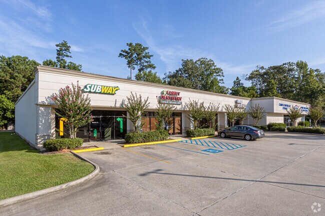


Property Detail
1000 Highway 59
Slidell-Mandeville-Covington, LA
PARCEL #4 CONTS 1.4818 ACS BEING 64545 SQ FT SQ 144 MANDEVILLE CB 884 368 INST NO 1120799 INST NO 1225086 INST NO 1249209 INS
39400
Saint Tammany
Commercialnec
Louisiana
2025
1.48 AC
2025
Mandeville/Covington
041301
New Orleans/Metairie/Kenner
14,220 SF
NEARBY LISTINGS FOR SALE OR LEASE
DEMOGRAPHICS near 1000 Highway 59
1 mile
3 mile
5 mile
2025 Total Population
6,507
34,122
52,512
2030 Population
6,662
34,810
53,663
Pop Growth 2025-2030
+ 2.38%
+ 2.02%
+ 2.19%
Average Age
42
41
41
2025 Total Households
2,659
13,098
20,131
HH Growth 2025-2030
+ 2.52%
+ 2.15%
+ 2.29%
Median Household Inc
$80,232
$93,808
$92,132
Avg Household Size
2.40
2.60
2.60
2025 Avg HH Vehicles
2.00
2.00
2.00
Median Home Value
$357,037
$369,368
$370,660
Median Year Built
1990
1994
1993
Nearby Places
Map Layers
Map Styles
 Street
 Aerial
Layers
 Traffic
 Biking
Places
Listings with unknown addresses are not visible on the map
- Restaurants
- Banks
- Shops
- Fitness
- Groceries
PUBLIC TRANSPORTATION
AIRPORT
Louis Armstrong New Orleans International
Drive
Walk
Distance
Louis Armstrong New Orleans International
50 min
36.3 mi
Freight Ports
Port of New Orleans
Drive
Walk
Distance
Port of New Orleans
55 min
37.3 mi
SALE & LEASE HISTORY
LISTING DATE
SALE/LEASE

Sep 24, 2019
For Lease
Sep 24, 2019
For Sale
Feb 20, 2019
For Lease
Nearby Properties
Address
Land Use
TOTAL SIZE
Lot Size
Zoning
Address
Land Use
TOTAL SIZE
Lot Size
Zoning
Address
Land Use
TOTAL SIZE
Lot Size
Zoning
229,994 SF
30 AC
Address
Land Use
TOTAL SIZE
Lot Size
Zoning
220,860 SF
25.07 AC
Address
Land Use
TOTAL SIZE
Lot Size
Zoning
154,751 SF
14.96 AC
Address
Land Use
TOTAL SIZE
Lot Size
Zoning
199,706 SF
158.55 AC
Address
Land Use
TOTAL SIZE
Lot Size
Zoning
165,168 SF
18.16 AC
Address
Land Use
TOTAL SIZE
Lot Size
Zoning
43,301 SF
3.26 AC
Address
Land Use
TOTAL SIZE
Lot Size
Zoning
147,457 SF
8.90 AC
Address
Land Use
TOTAL SIZE
Lot Size
Zoning
119,452 SF
10.34 AC
Address
Land Use
TOTAL SIZE
Lot Size
Zoning
128,819 SF
34.92 AC
Address
Land Use
TOTAL SIZE
Lot Size
Zoning
93,800 SF
10.35 AC
Address
Land Use
TOTAL SIZE
Lot Size
Zoning
206,403 SF
9.06 AC
Address
Land Use
TOTAL SIZE
Lot Size
Zoning
50,560 SF
6.32 AC
Address
Land Use
TOTAL SIZE
Lot Size
Zoning
56,162 SF
5.30 AC
Address
Land Use
TOTAL SIZE
Lot Size
Zoning
100,734 SF
23.66 AC
Address
Land Use
TOTAL SIZE
Lot Size
Zoning
40,064 SF
3.66 AC
Address
Land Use
TOTAL SIZE
Lot Size
Zoning
90,603 SF
6.50 AC
Address
Land Use
TOTAL SIZE
Lot Size
Zoning
88,002 SF
10 AC
Address
Land Use
TOTAL SIZE
Lot Size
Zoning
86,799 SF
28.55 AC
Address
Land Use
TOTAL SIZE
Lot Size
Zoning
82,479 SF
5.95 AC
Address
Land Use
TOTAL SIZE
Lot Size
Zoning
59,702 SF
5.97 AC
Address
Land Use
TOTAL SIZE
Lot Size
Zoning
48,307 SF
4.60 AC
Address
Land Use
TOTAL SIZE
Lot Size
Zoning
48,307 SF
4.79 AC
Address
Land Use
TOTAL SIZE
Lot Size
Zoning
50,608 SF
2.82 AC
Address
Land Use
TOTAL SIZE
Lot Size
Zoning
67,550 SF
3.66 AC
Address
Land Use
TOTAL SIZE
Lot Size
Zoning
60,971 SF
4.80 AC
Address
Land Use
TOTAL SIZE
Lot Size
Zoning
96,475 SF
6.10 AC
Address
Land Use
TOTAL SIZE
Lot Size
Zoning
49,690 SF
4.02 AC
Address
Land Use
TOTAL SIZE
Lot Size
Zoning
36,030 SF
30 AC
Address
Land Use
TOTAL SIZE
Lot Size
Zoning
40,832 SF
24 AC
The World's #1 Commercial Real Estate Marketplace
Connect with us
© 2026 CoStar Group
The information above has been obtained from sources believed reliable. While we do not doubt its accuracy we have not verified it and make no guarantee, warranty or representation about it. It is your responsibility to independently confirm its accuracy and completeness. Any projections, opinions, assumptions, or estimates used are for example only and do not represent the current or future performance of the property. The value of this transaction to you depends on tax and other factors which should be evaluated by your tax, financial, and legal advisors. You and your advisors should conduct a careful, independent investigation of the property to determine to your satisfaction the suitability of the property for your needs.