Property Record
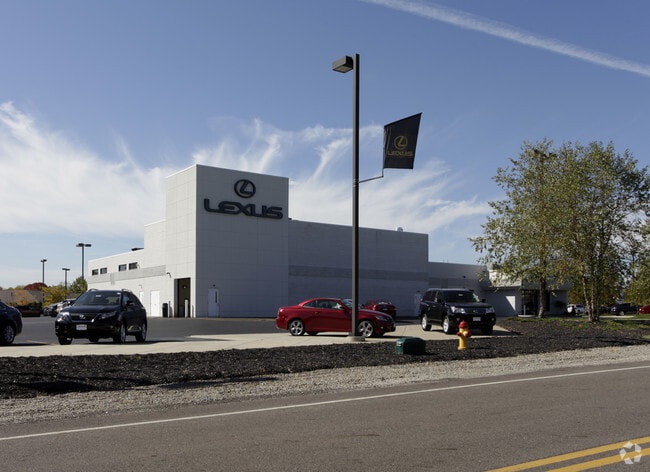
1000 Interstate Pky, Akron, OH 44312


Property Detail
1000 Interstate Pky
Akron, OH
INTERSTATE BUSINESS PARK LOTS 10 & 12 ALL
28-14330
Summit
Vehiclerentalsvehiclesales
Ohio
B and X Area of moderate flood hazard, usually the area between the limits of the 100-year and 500-year floods.
10,12
2023
5.89 AC
2025
Akron
531406
Cleveland
36,493 SF
NEARBY LISTINGS FOR SALE OR LEASE
DEMOGRAPHICS near 1000 Interstate Pky
1 mile
3 mile
5 mile
2025 Total Population
3,824
31,079
92,384
2030 Population
3,900
31,271
92,506
Pop Growth 2025-2030
+ 1.99%
+ 0.62%
+ 0.13%
Average Age
42
44
42
2025 Total Households
1,618
13,205
39,098
HH Growth 2025-2030
+ 2.04%
+ 0.62%
+ 0.14%
Median Household Inc
$98,329
$85,159
$69,023
Avg Household Size
2.30
2.30
2.30
2025 Avg HH Vehicles
2.00
2.00
2.00
Median Home Value
$339,182
$266,542
$200,378
Median Year Built
1999
1978
1967
Nearby Places
Map Layers
Map Styles
 Street
 Aerial
Layers
 Traffic
 Biking
Places
Listings with unknown addresses are not visible on the map
- Restaurants
- Banks
- Shops
- Fitness
- Groceries
PUBLIC TRANSPORTATION
COMMUTER RAIL
Drive
Walk
Distance
16 min
9.0 mi
AIRPORT
Akron-Canton Regional
Drive
Walk
Distance
Akron-Canton Regional
12 min
6.8 mi
Cleveland-Hopkins International
Drive
Walk
Distance
Cleveland-Hopkins International
67 min
48.8 mi
Nearby Properties
Address
Land Use
TOTAL SIZE
Lot Size
Zoning
Address
Land Use
TOTAL SIZE
Lot Size
Zoning
Address
Land Use
TOTAL SIZE
Lot Size
Zoning
242,719 SF
50.20 AC
Address
Land Use
TOTAL SIZE
Lot Size
Zoning
1,049.17 AC
Address
Land Use
TOTAL SIZE
Lot Size
Zoning
57,369 SF
93.97 AC
Address
Land Use
TOTAL SIZE
Lot Size
Zoning
Address
Land Use
TOTAL SIZE
Lot Size
Zoning
Address
Land Use
TOTAL SIZE
Lot Size
Zoning
Address
Land Use
TOTAL SIZE
Lot Size
Zoning
116,456 SF
76.66 AC
Address
Land Use
TOTAL SIZE
Lot Size
Zoning
209,516 SF
46.70 AC
Address
Land Use
TOTAL SIZE
Lot Size
Zoning
63,913 SF
10.34 AC
Address
Land Use
TOTAL SIZE
Lot Size
Zoning
133,899 SF
45.88 AC
Address
Land Use
TOTAL SIZE
Lot Size
Zoning
Address
Land Use
TOTAL SIZE
Lot Size
Zoning
128,295 SF
30.74 AC
Address
Land Use
TOTAL SIZE
Lot Size
Zoning
Address
Land Use
TOTAL SIZE
Lot Size
Zoning
22,589 SF
31.65 AC
Address
Land Use
TOTAL SIZE
Lot Size
Zoning
42,750 SF
24.99 AC
Address
Land Use
TOTAL SIZE
Lot Size
Zoning
72,614 SF
14.91 AC
Address
Land Use
TOTAL SIZE
Lot Size
Zoning
Address
Land Use
TOTAL SIZE
Lot Size
Zoning
Address
Land Use
TOTAL SIZE
Lot Size
Zoning
Address
Land Use
TOTAL SIZE
Lot Size
Zoning
147,708 SF
4.76 AC
Address
Land Use
TOTAL SIZE
Lot Size
Zoning
34,972 SF
5.24 AC
Address
Land Use
TOTAL SIZE
Lot Size
Zoning
2.08 AC
Address
Land Use
TOTAL SIZE
Lot Size
Zoning
78,302 SF
19.73 AC
Address
Land Use
TOTAL SIZE
Lot Size
Zoning
Address
Land Use
TOTAL SIZE
Lot Size
Zoning
16,604 SF
248.86 AC
Address
Land Use
TOTAL SIZE
Lot Size
Zoning
57,782 SF
10.13 AC
Address
Land Use
TOTAL SIZE
Lot Size
Zoning
69,372 SF
7.86 AC
Address
Land Use
TOTAL SIZE
Lot Size
Zoning
187,454 SF
12.59 AC
Address
Land Use
TOTAL SIZE
Lot Size
Zoning
243,424 SF
13.24 AC
The World's #1 Commercial Real Estate Marketplace
Connect with us
© 2026 CoStar Group
The information above has been obtained from sources believed reliable. While we do not doubt its accuracy we have not verified it and make no guarantee, warranty or representation about it. It is your responsibility to independently confirm its accuracy and completeness. Any projections, opinions, assumptions, or estimates used are for example only and do not represent the current or future performance of the property. The value of this transaction to you depends on tax and other factors which should be evaluated by your tax, financial, and legal advisors. You and your advisors should conduct a careful, independent investigation of the property to determine to your satisfaction the suitability of the property for your needs.