Property Record
1000 Konica Dr, Elkton, MD 21921


Save to a Folder
{{folder.Name}}
{{folder.ListingIds.length}} Properties
{{folder.ListingIds.length}} Property
Create a New Folder
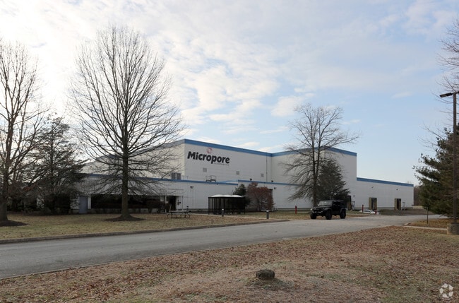
This Property Is For Sale
Property Detail
1000 Konica Dr
03-089428
LOT 1 - 14.6547 ACRE 1000 KONICA DRIVE S/E OF ELKTON
Manufacturinglight
Cecil
BI
Maryland
B and X Area of moderate flood hazard, usually the area between the limits of the 100-year and 500-year floods.
1
2025
14.66 AC
2025
Cecil County
030505
Baltimore
94,871 SF
Philadelphia-Camden-Wilmington, PA-NJ-DE-MD
NEARBY LISTINGS FOR SALE OR LEASE
DEMOGRAPHICS near 1000 Konica Dr
1 mile
3 mile
5 mile
2025 Total Population
5,178
33,552
79,330
2030 Population
5,212
34,232
81,190
Pop Growth 2025-2030
+ 0.66%
+ 2.03%
+ 2.34%
Average Age
40
40
40
2025 Total Households
1,916
12,324
29,874
HH Growth 2025-2030
+ 0.57%
+ 2.07%
+ 2.42%
Median Household Inc
$86,948
$90,996
$90,320
Avg Household Size
2.70
2.60
2.60
2025 Avg HH Vehicles
2.00
2.00
2.00
Median Home Value
$286,962
$360,233
$356,436
Median Year Built
1986
1991
1991
Nearby Places
Map Layers
Map Styles
 Street
 Aerial
Layers
 Traffic
 Biking
Places
Listings with unknown addresses are not visible on the map
- Restaurants
- Banks
- Shops
- Fitness
- Groceries
PUBLIC TRANSPORTATION
COMMUTER RAIL
Newark (R2 - Southeastern Pennsylvania Transportation Authority Regional Rail (SEPTA Regional Rail))
Drive
Walk
Distance
Newark (R2 - Southeastern Pennsylvania Transportation Authority Regional Rail (SEPTA Regional Rail))
14 min
7.8 mi
AIRPORT
Philadelphia International
Drive
Walk
Distance
Philadelphia International
56 min
39.8 mi
Freight Ports
Port Newark Container Terminal
Drive
Walk
Distance
Port Newark Container Terminal
25 min
12.0 mi
Nearby Properties
Address
Land Use
TOTAL SIZE
Lot Size
Zoning
Address
Land Use
TOTAL SIZE
Lot Size
Zoning
226,878 SF
73.68 AC
CR
Address
Land Use
TOTAL SIZE
Lot Size
Zoning
161,018 SF
97.88 AC
OR
Address
Land Use
TOTAL SIZE
Lot Size
Zoning
766,520 SF
69.52 AC
BI
Address
Land Use
TOTAL SIZE
Lot Size
Zoning
193,004 SF
3.67 AC
C1
Address
Land Use
TOTAL SIZE
Lot Size
Zoning
200,880 SF
49.83 AC
R3
Address
Land Use
TOTAL SIZE
Lot Size
Zoning
266,818 SF
64.16 AC
BP
Address
Land Use
TOTAL SIZE
Lot Size
Zoning
281.01 AC
BP
Address
Land Use
TOTAL SIZE
Lot Size
Zoning
15,168 SF
7.85 AC
NCAP
Address
Land Use
TOTAL SIZE
Lot Size
Zoning
392,955 SF
16.87 AC
NCAP
Address
Land Use
TOTAL SIZE
Lot Size
Zoning
20,250 SF
71.16 AC
S
Address
Land Use
TOTAL SIZE
Lot Size
Zoning
263,500 SF
15.28 AC
BI
Address
Land Use
TOTAL SIZE
Lot Size
Zoning
82,688 SF
11.30 AC
BI
Address
Land Use
TOTAL SIZE
Lot Size
Zoning
65,668 SF
4.52 AC
C2
Address
Land Use
TOTAL SIZE
Lot Size
Zoning
267,840 SF
20.35 AC
BI
Address
Land Use
TOTAL SIZE
Lot Size
Zoning
47.77 AC
OR
Address
Land Use
TOTAL SIZE
Lot Size
Zoning
153,556 SF
30.12 AC
OR
Address
Land Use
TOTAL SIZE
Lot Size
Zoning
3,680 SF
138.68 AC
S
Address
Land Use
TOTAL SIZE
Lot Size
Zoning
31,350 SF
8.89 AC
R2
Address
Land Use
TOTAL SIZE
Lot Size
Zoning
205,955 SF
24.91 AC
BI
Address
Land Use
TOTAL SIZE
Lot Size
Zoning
165,961 SF
8.95 AC
BP
Address
Land Use
TOTAL SIZE
Lot Size
Zoning
17.50 AC
R3
Address
Land Use
TOTAL SIZE
Lot Size
Zoning
55,200 SF
11.72 AC
ON
Address
Land Use
TOTAL SIZE
Lot Size
Zoning
9,660 SF
16.90 AC
BP
Address
Land Use
TOTAL SIZE
Lot Size
Zoning
18,415 SF
23.33 AC
OR
Address
Land Use
TOTAL SIZE
Lot Size
Zoning
3,734 SF
15.86 AC
CN
Address
Land Use
TOTAL SIZE
Lot Size
Zoning
85,924 SF
2.95 AC
C1
Address
Land Use
TOTAL SIZE
Lot Size
Zoning
28,874 SF
13.72 AC
S
Address
Land Use
TOTAL SIZE
Lot Size
Zoning
159,038 SF
22.52 AC
R3
Address
Land Use
TOTAL SIZE
Lot Size
Zoning
62,900 SF
30.54 AC
S
Address
Land Use
TOTAL SIZE
Lot Size
Zoning
182,424 SF
11.80 AC
BP
The World's #1 Commercial Real Estate Marketplace
Connect with us
© 2026 CoStar Group
The information above has been obtained from sources believed reliable. While we do not doubt its accuracy we have not verified it and make no guarantee, warranty or representation about it. It is your responsibility to independently confirm its accuracy and completeness. Any projections, opinions, assumptions, or estimates used are for example only and do not represent the current or future performance of the property. The value of this transaction to you depends on tax and other factors which should be evaluated by your tax, financial, and legal advisors. You and your advisors should conduct a careful, independent investigation of the property to determine to your satisfaction the suitability of the property for your needs.