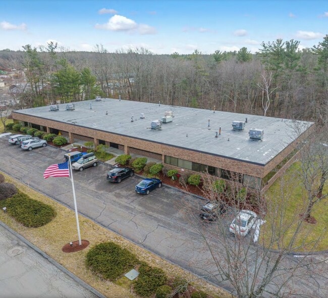
Property Record
1000 Mount Laurel Cir, Shirley, MA 01464
Current Lease Availabilities
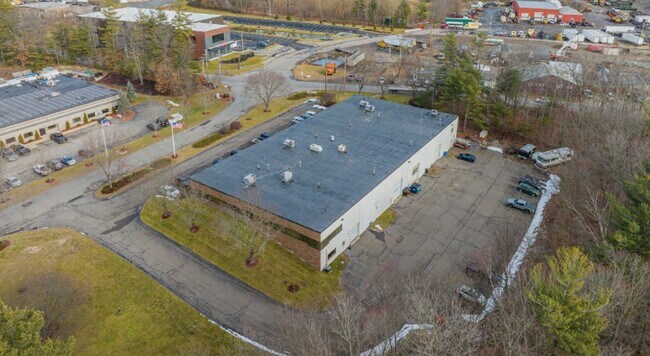
NEARBY LISTINGS FOR SALE OR LEASE
Property Detail
1000 Mount Laurel Cir
Industrialcondominium
Middlesex
X
Massachusetts
25027C0293F
3-71
2025
Groton/Townsend
2025
Boston
388200
Boston-Cambridge-Newton, MA-NH
7,634 SF
SHIR-000002-A000000-000003-000071
DEMOGRAPHICS near 1000 Mount Laurel Cir
1 mile
3 mile
5 mile
2024 Total Population
1,605
10,330
49,683
2029 Population
1,591
10,311
49,406
Pop Growth 2024-2029
(0.87%)
(0.18%)
(0.56%)
Average Age
42
43
42
2024 Total Households
407
2,962
18,682
HH Growth 2024-2029
(0.74%)
+ 0.20%
(0.57%)
Median Household Inc
$91,527
$112,691
$85,861
Avg Household Size
2.40
2.50
2.40
2024 Avg HH Vehicles
2.00
2.00
2.00
Median Home Value
$343,650
$409,359
$368,003
Median Year Built
1948
1973
1966
Nearby Places
Map Layers
Map Styles
 Street
 Aerial
Transit
 Traffic
 Biking
Places
Listings with unknown addresses are not visible on the map
- Restaurants
- Banks
- Shops
- Fitness
- Groceries
PUBLIC TRANSPORTATION
COMMUTER RAIL
Shirley (Fitchburg/South Acton Line - Massachusetts Bay Transportation Authority Commuter Rail (Purple Line))
Drive
Walk
Distance
Shirley (Fitchburg/South Acton Line - Massachusetts Bay Transportation Authority Commuter Rail (Purple Line))
3 min
1.7 mi
North Leominster (Fitchburg/South Acton Line - Massachusetts Bay Transportation Authority Commuter Rail (Purple Line))
Drive
Walk
Distance
North Leominster (Fitchburg/South Acton Line - Massachusetts Bay Transportation Authority Commuter Rail (Purple Line))
9 min
5.8 mi
AIRPORT
Worcester Regional
Drive
Walk
Distance
Worcester Regional
43 min
29.9 mi
Freight Ports
Port of Boston
Drive
Walk
Distance
Port of Boston
62 min
40.9 mi
Nearby Properties
Address
Land Use
TOTAL SIZE
Lot Size
Zoning
Address
Land Use
TOTAL SIZE
Lot Size
Zoning
663,948 SF
516.30 AC
Address
Land Use
TOTAL SIZE
Lot Size
Zoning
97.47 AC
R1
Address
Land Use
TOTAL SIZE
Lot Size
Zoning
164,000 SF
11 AC
4
Address
Land Use
TOTAL SIZE
Lot Size
Zoning
109,921 SF
7.22 AC
21
Address
Land Use
TOTAL SIZE
Lot Size
Zoning
373.10 AC
O
Address
Land Use
TOTAL SIZE
Lot Size
Zoning
65.15 AC
Address
Land Use
TOTAL SIZE
Lot Size
Zoning
353,742 SF
34.89 AC
C
Address
Land Use
TOTAL SIZE
Lot Size
Zoning
214.69 AC
O
Address
Land Use
TOTAL SIZE
Lot Size
Zoning
214.32 AC
4
Address
Land Use
TOTAL SIZE
Lot Size
Zoning
202.78 AC
14
Address
Land Use
TOTAL SIZE
Lot Size
Zoning
372,000 SF
30.33 AC
Address
Land Use
TOTAL SIZE
Lot Size
Zoning
73,772 SF
36.70 AC
4
Address
Land Use
TOTAL SIZE
Lot Size
Zoning
60,968 SF
Address
Land Use
TOTAL SIZE
Lot Size
Zoning
142.59 AC
O
Address
Land Use
TOTAL SIZE
Lot Size
Zoning
66,966 SF
C
Address
Land Use
TOTAL SIZE
Lot Size
Zoning
140.95 AC
4
Address
Land Use
TOTAL SIZE
Lot Size
Zoning
85,000 SF
31.56 AC
R1
Address
Land Use
TOTAL SIZE
Lot Size
Zoning
78,344 SF
7.65 AC
O
Address
Land Use
TOTAL SIZE
Lot Size
Zoning
131 AC
2
Address
Land Use
TOTAL SIZE
Lot Size
Zoning
150,372 SF
15.74 AC
21
Address
Land Use
TOTAL SIZE
Lot Size
Zoning
162,932 SF
19.12 AC
C
Address
Land Use
TOTAL SIZE
Lot Size
Zoning
95,148 SF
60.40 AC
16
Address
Land Use
TOTAL SIZE
Lot Size
Zoning
125,461 SF
11.27 AC
Address
Land Use
TOTAL SIZE
Lot Size
Zoning
178,900 SF
14.23 AC
14
Address
Land Use
TOTAL SIZE
Lot Size
Zoning
274,272 SF
50 AC
Address
Land Use
TOTAL SIZE
Lot Size
Zoning
118.55 AC
O
Address
Land Use
TOTAL SIZE
Lot Size
Zoning
13,122 SF
98.42 AC
2
Address
Land Use
TOTAL SIZE
Lot Size
Zoning
Address
Land Use
TOTAL SIZE
Lot Size
Zoning
58,750 SF
7.77 AC
C
Address
Land Use
TOTAL SIZE
Lot Size
Zoning
87.14 AC
19
The World's #1 Commercial Real Estate Marketplace
Connect with us
© 2026 CoStar Group
The information above has been obtained from sources believed reliable. While we do not doubt its accuracy we have not verified it and make no guarantee, warranty or representation about it. It is your responsibility to independently confirm its accuracy and completeness. Any projections, opinions, assumptions, or estimates used are for example only and do not represent the current or future performance of the property. The value of this transaction to you depends on tax and other factors which should be evaluated by your tax, financial, and legal advisors. You and your advisors should conduct a careful, independent investigation of the property to determine to your satisfaction the suitability of the property for your needs.