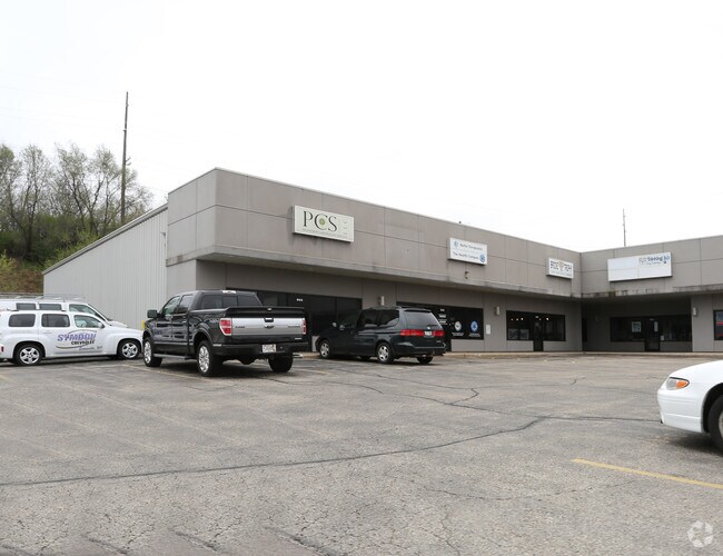
Property Record
1000 N Parker Dr, Janesville, WI 53545

NEARBY LISTINGS FOR SALE OR LEASE
Property Detail
1000 N Parker Dr
012-5100128
PT OF GOVERNMENT LOT 2 OFTHE FRACTIONAL NW1/4 OF SEC25-3-12 E OF THE 4TH P.M.,CITY OF JANESVLLE, ROCKCOUNTY, WI DAF: COMM SE CORLOT 3 CSM 882022 VOL. 7 PGS202; TH N78D49'30E 50' M/LTO WL OLD SOO LINE RR; THS5D36'E ALG SD RR ROW874.40' TO POB; TH S3D1
Sfr
Rock
X
Wisconsin
55105C0184E
2
2024
5.70 AC
2024
Rock County
000600
Milwaukee/Madison
20,643 SF
Janesville-Beloit, WI
DEMOGRAPHICS near 1000 N Parker Dr
1 Mile
3 Mile
5 Mile
2024 Total Population
9,940
47,428
70,732
2029 Population
10,089
47,880
71,450
Pop Growth 2024-2029
+ 1.50%
+ 0.95%
+ 1.02%
Average Age
40
40
41
2024 Total Households
4,353
20,166
29,201
HH Growth 2024-2029
+ 1.68%
+ 1.01%
+ 1.04%
Median Household Inc
$52,012
$61,241
$67,551
Avg Household Size
2.20
2.30
2.30
2024 Avg HH Vehicles
2.00
2.00
2.00
Median Home Value
$148,361
$169,863
$190,472
Median Year Built
1954
1965
1972
Nearby Places
Map Layers
Map Styles
 Street
 Aerial
- Restaurants
- Banks
- Shops
- Fitness
- Groceries
PUBLIC TRANSPORTATION
AIRPORT
Dane County Regional/Truax Field
DRIVE
WALK
Distance
Dane County Regional/Truax Field
57 min
41.8 mi
Chicago/Rockford International
DRIVE
WALK
Distance
Chicago/Rockford International
62 min
45.4 mi
SALE & LEASE HISTORY
LISTING DATE
SALE/LEASE

Sep 25, 2016
For Lease
Mar 05, 2018
For Lease
Nearby Properties
Address
Land Use
TOTAL SIZE
Lot Size
Zoning
Address
Land Use
TOTAL SIZE
Lot Size
Zoning
31,064 SF
11.57 AC
R3
Address
Land Use
TOTAL SIZE
Lot Size
Zoning
12,620 SF
8.05 AC
R3
Address
Land Use
TOTAL SIZE
Lot Size
Zoning
48,110 SF
13.04 AC
R3
Address
Land Use
TOTAL SIZE
Lot Size
Zoning
135,322 SF
18.41 AC
B2
Address
Land Use
TOTAL SIZE
Lot Size
Zoning
2,800 SF
69 AC
M1
Address
Land Use
TOTAL SIZE
Lot Size
Zoning
18,480 SF
14.50 AC
O1
Address
Land Use
TOTAL SIZE
Lot Size
Zoning
77,811 SF
8.74 AC
B4
Address
Land Use
TOTAL SIZE
Lot Size
Zoning
98,370 SF
8.64 AC
B4
Address
Land Use
TOTAL SIZE
Lot Size
Zoning
175,991 SF
26.17 AC
B4
Address
Land Use
TOTAL SIZE
Lot Size
Zoning
7.52 AC
R3
Address
Land Use
TOTAL SIZE
Lot Size
Zoning
161,640 SF
20.71 AC
B4
Address
Land Use
TOTAL SIZE
Lot Size
Zoning
Address
Land Use
TOTAL SIZE
Lot Size
Zoning
14,580 SF
28.75 AC
M1
Address
Land Use
TOTAL SIZE
Lot Size
Zoning
42.07 AC
Address
Land Use
TOTAL SIZE
Lot Size
Zoning
17,183 SF
6.65 AC
B3
Address
Land Use
TOTAL SIZE
Lot Size
Zoning
24,960 SF
8.85 AC
B4
Address
Land Use
TOTAL SIZE
Lot Size
Zoning
12.42 AC
M1
Address
Land Use
TOTAL SIZE
Lot Size
Zoning
110,820 SF
10.62 AC
B4
Address
Land Use
TOTAL SIZE
Lot Size
Zoning
17.14 AC
M1
Address
Land Use
TOTAL SIZE
Lot Size
Zoning
111,847 SF
11.72 AC
B4
Address
Land Use
TOTAL SIZE
Lot Size
Zoning
1,020 SF
9.77 AC
B4
Address
Land Use
TOTAL SIZE
Lot Size
Zoning
2.30 AC
Address
Land Use
TOTAL SIZE
Lot Size
Zoning
10,534 SF
9.14 AC
B4
Address
Land Use
TOTAL SIZE
Lot Size
Zoning
101,195 SF
1.40 AC
B6
Address
Land Use
TOTAL SIZE
Lot Size
Zoning
2,662 SF
4.48 AC
B4
Address
Land Use
TOTAL SIZE
Lot Size
Zoning
35,800 SF
17.55 AC
B4
Address
Land Use
TOTAL SIZE
Lot Size
Zoning
12,838 SF
21.41 AC
B4
Address
Land Use
TOTAL SIZE
Lot Size
Zoning
49,524 SF
1.57 AC
B6
Address
Land Use
TOTAL SIZE
Lot Size
Zoning
18.84 AC
M1
Address
Land Use
TOTAL SIZE
Lot Size
Zoning
94,053 SF
4.52 AC
R3
The World's #1 Commercial Real Estate Marketplace
Connect with us
© 2026 CoStar Group
The information above has been obtained from sources believed reliable. While we do not doubt its accuracy we have not verified it and make no guarantee, warranty or representation about it. It is your responsibility to independently confirm its accuracy and completeness. Any projections, opinions, assumptions, or estimates used are for example only and do not represent the current or future performance of the property. The value of this transaction to you depends on tax and other factors which should be evaluated by your tax, financial, and legal advisors. You and your advisors should conduct a careful, independent investigation of the property to determine to your satisfaction the suitability of the property for your needs.