Property Record
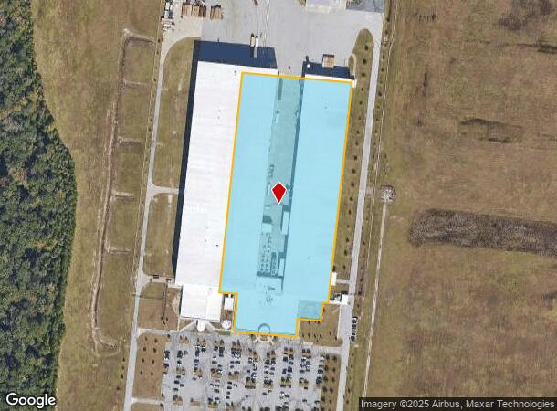
1000 Pine Meadow Dr, Pooler, GA 31322


NEARBY LISTINGS FOR SALE OR LEASE
Property Detail
1000 Pine Meadow Dr
1101003008L
Pooler
Heavymanufacturing
IMPROVEMENTS ONLY LOCATED ON A 1 19.34 AC TRACT BEING A PT OF LAN
X
Chatham
13051C0128G
Georgia
0
19.34 AC
2025
Bloomingdale/Pooler
010810
Savannah
17,400 SF
Savannah, GA
DEMOGRAPHICS near 1000 Pine Meadow Dr
1 Mile
3 Mile
5 Mile
2024 Total Population
981
22,828
59,104
2029 Population
995
23,777
61,773
Pop Growth 2024-2029
+ 1.43%
+ 4.16%
+ 4.52%
Average Age
51
40
39
2024 Total Households
417
8,599
23,191
HH Growth 2024-2029
+ 1.44%
+ 4.33%
+ 4.71%
Median Household Inc
$168,684
$85,018
$65,685
Avg Household Size
2.40
2.60
2.40
2024 Avg HH Vehicles
2.00
2.00
2.00
Median Home Value
$409,048
$227,363
$213,264
Median Year Built
1998
2003
2002
Nearby Places
Map Layers
Map Styles
 Street
 Aerial
- Restaurants
- Banks
- Shops
- Fitness
- Groceries
PUBLIC TRANSPORTATION
COMMUTER RAIL
Savannah (Palmetto - Amtrak, Silver Meteor - Amtrak, Silver Star - Amtrak)
DRIVE
WALK
Distance
Savannah (Palmetto - Amtrak, Silver Meteor - Amtrak, Silver Star - Amtrak)
17 min
6.6 mi
AIRPORT
Savannah/Hilton Head International
DRIVE
WALK
Distance
Savannah/Hilton Head International
18 min
6.3 mi
Freight Ports
Georgia Ports - Savannah
DRIVE
WALK
Distance
Georgia Ports - Savannah
20 min
8.4 mi
Nearby Properties
Address
Land Use
TOTAL SIZE
Lot Size
Zoning
Address
Land Use
TOTAL SIZE
Lot Size
Zoning
226,440 SF
270.14 AC
I-1
Address
Land Use
TOTAL SIZE
Lot Size
Zoning
3,515 SF
61.21 AC
I1
Address
Land Use
TOTAL SIZE
Lot Size
Zoning
944,260 SF
56.31 AC
I-1
Address
Land Use
TOTAL SIZE
Lot Size
Zoning
691,228 SF
48.27 AC
I-1
Address
Land Use
TOTAL SIZE
Lot Size
Zoning
547,528 SF
67.26 AC
I-1
Address
Land Use
TOTAL SIZE
Lot Size
Zoning
670,800 SF
43.38 AC
I-H
Address
Land Use
TOTAL SIZE
Lot Size
Zoning
985.60 AC
I-2
Address
Land Use
TOTAL SIZE
Lot Size
Zoning
35,130 SF
21.45 AC
PUD
Address
Land Use
TOTAL SIZE
Lot Size
Zoning
41,172 SF
29.69 AC
PUD
Address
Land Use
TOTAL SIZE
Lot Size
Zoning
495,600 SF
35.64 AC
I-H
Address
Land Use
TOTAL SIZE
Lot Size
Zoning
26,124 SF
12 AC
BC1
Address
Land Use
TOTAL SIZE
Lot Size
Zoning
355,570 SF
25.41 AC
PIL
Address
Land Use
TOTAL SIZE
Lot Size
Zoning
500 SF
24.13 AC
I-1
Address
Land Use
TOTAL SIZE
Lot Size
Zoning
314,100 SF
14.50 AC
I-1
Address
Land Use
TOTAL SIZE
Lot Size
Zoning
325,500 SF
22.29 AC
I-1
Address
Land Use
TOTAL SIZE
Lot Size
Zoning
249,600 SF
16.74 AC
I-1
Address
Land Use
TOTAL SIZE
Lot Size
Zoning
213,800 SF
14.12 AC
I-H
Address
Land Use
TOTAL SIZE
Lot Size
Zoning
200,200 SF
12.97 AC
I-1
Address
Land Use
TOTAL SIZE
Lot Size
Zoning
136,240 SF
59.83 AC
I-1
Address
Land Use
TOTAL SIZE
Lot Size
Zoning
180,000 SF
16.62 AC
PUDI
Address
Land Use
TOTAL SIZE
Lot Size
Zoning
79.49 AC
I-H
Address
Land Use
TOTAL SIZE
Lot Size
Zoning
35,415 SF
3.50 AC
C-2
Address
Land Use
TOTAL SIZE
Lot Size
Zoning
110,279 SF
55.81 AC
R1B
Address
Land Use
TOTAL SIZE
Lot Size
Zoning
3.69 AC
BC1
Address
Land Use
TOTAL SIZE
Lot Size
Zoning
5,100 SF
4.32 AC
PUDI
Address
Land Use
TOTAL SIZE
Lot Size
Zoning
58.54 AC
I-H
Address
Land Use
TOTAL SIZE
Lot Size
Zoning
60,363 SF
10 AC
PUD
Address
Land Use
TOTAL SIZE
Lot Size
Zoning
9,750 SF
10.67 AC
I-1
Address
Land Use
TOTAL SIZE
Lot Size
Zoning
139,488 SF
16.32 AC
C-2
The World's #1 Commercial Real Estate Marketplace
Connect with us
© 2026 CoStar Group
The information above has been obtained from sources believed reliable. While we do not doubt its accuracy we have not verified it and make no guarantee, warranty or representation about it. It is your responsibility to independently confirm its accuracy and completeness. Any projections, opinions, assumptions, or estimates used are for example only and do not represent the current or future performance of the property. The value of this transaction to you depends on tax and other factors which should be evaluated by your tax, financial, and legal advisors. You and your advisors should conduct a careful, independent investigation of the property to determine to your satisfaction the suitability of the property for your needs.