Property Record
1000 Railhead Dr, Haslet, TX 76052
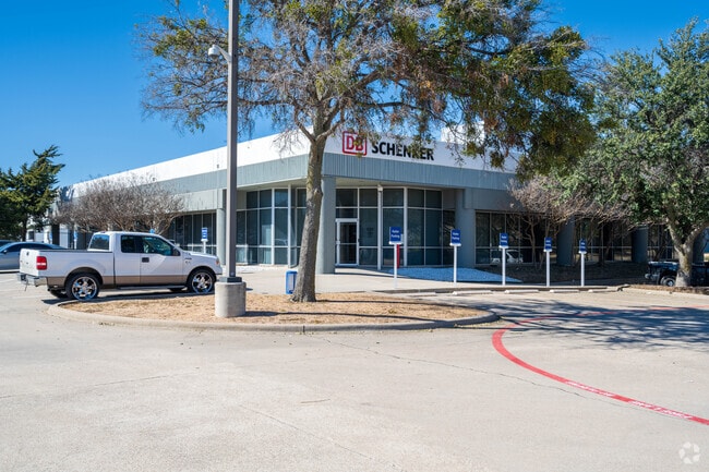

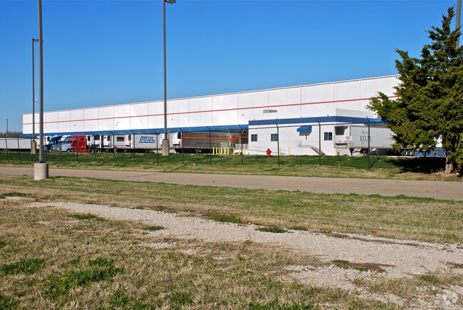

Property Detail
1000 Railhead Dr
Dallas-Fort Worth-Arlington, TX
WESTPORT PARK ADDITION BLOCK 2 LOT 1
06993850
TARRANT
Commercialnec
Texas
AE The base floodplain where base flood elevations are provided. AE Zones are now used on new format FIRMs instead of A1-A30 Zones.
1
2025
56.18 AC
2025
NE Tarrant/Alliance
114111
Dallas/Ft Worth
731,548 SF
NEARBY LISTINGS FOR SALE OR LEASE
DEMOGRAPHICS near 1000 Railhead Dr
1 mile
3 mile
5 mile
2025 Total Population
84
21,539
134,928
2030 Population
90
23,577
146,939
Pop Growth 2025-2030
+ 7.14%
+ 9.46%
+ 8.90%
Average Age
30
35
35
2025 Total Households
23
7,026
43,400
HH Growth 2025-2030
+ 8.70%
+ 9.75%
+ 9.07%
Median Household Inc
$121,874
$126,434
$122,898
Avg Household Size
3.60
3.00
3.10
2025 Avg HH Vehicles
2.00
2.00
2.00
Median Home Value
$356,249
$382,736
$405,920
Median Year Built
2008
2010
2010
Nearby Places
Map Layers
Map Styles
 Street
 Aerial
Transit
 Traffic
 Biking
Places
Listings with unknown addresses are not visible on the map
- Restaurants
- Banks
- Shops
- Fitness
- Groceries
PUBLIC TRANSPORTATION
AIRPORT
Dallas-Fort Worth International
Drive
Walk
Distance
Dallas-Fort Worth International
37 min
26.3 mi
Freight Ports
Port of Shreveport
Drive
Walk
Distance
Port of Shreveport
264 min
240.1 mi
Nearby Properties
Address
Land Use
TOTAL SIZE
Lot Size
Zoning
Address
Land Use
TOTAL SIZE
Lot Size
Zoning
348,270 SF
39.34 AC
Address
Land Use
TOTAL SIZE
Lot Size
Zoning
830,399 SF
11.02 AC
Address
Land Use
TOTAL SIZE
Lot Size
Zoning
553,605 SF
81.10 AC
Address
Land Use
TOTAL SIZE
Lot Size
Zoning
305,697 SF
42.24 AC
Address
Land Use
TOTAL SIZE
Lot Size
Zoning
1,141,133 SF
67.79 AC
Address
Land Use
TOTAL SIZE
Lot Size
Zoning
422,682 SF
22.66 AC
Address
Land Use
TOTAL SIZE
Lot Size
Zoning
504,000 SF
26.39 AC
Address
Land Use
TOTAL SIZE
Lot Size
Zoning
882,565 SF
56.65 AC
Address
Land Use
TOTAL SIZE
Lot Size
Zoning
175,000 SF
14.48 AC
Address
Land Use
TOTAL SIZE
Lot Size
Zoning
807,229 SF
46.10 AC
Address
Land Use
TOTAL SIZE
Lot Size
Zoning
562,500 SF
29.64 AC
Address
Land Use
TOTAL SIZE
Lot Size
Zoning
184,400 SF
19.75 AC
Address
Land Use
TOTAL SIZE
Lot Size
Zoning
436,589 SF
32.43 AC
Address
Land Use
TOTAL SIZE
Lot Size
Zoning
74,825 SF
13.41 AC
Address
Land Use
TOTAL SIZE
Lot Size
Zoning
436,589 SF
32.33 AC
Address
Land Use
TOTAL SIZE
Lot Size
Zoning
46,464 SF
15.24 AC
Address
Land Use
TOTAL SIZE
Lot Size
Zoning
247,070 SF
5.79 AC
Address
Land Use
TOTAL SIZE
Lot Size
Zoning
72,713 SF
10.88 AC
Address
Land Use
TOTAL SIZE
Lot Size
Zoning
181,074 SF
14 AC
Address
Land Use
TOTAL SIZE
Lot Size
Zoning
54,510 SF
5 AC
Address
Land Use
TOTAL SIZE
Lot Size
Zoning
53,619 SF
14.34 AC
Address
Land Use
TOTAL SIZE
Lot Size
Zoning
154,434 SF
17.47 AC
Address
Land Use
TOTAL SIZE
Lot Size
Zoning
147,806 SF
21.60 AC
Address
Land Use
TOTAL SIZE
Lot Size
Zoning
212,388 SF
28.94 AC
Address
Land Use
TOTAL SIZE
Lot Size
Zoning
55,000 SF
13.80 AC
Address
Land Use
TOTAL SIZE
Lot Size
Zoning
111,532 SF
6.75 AC
Address
Land Use
TOTAL SIZE
Lot Size
Zoning
8,707 SF
6.23 AC
Address
Land Use
TOTAL SIZE
Lot Size
Zoning
53,064 SF
27.41 AC
Address
Land Use
TOTAL SIZE
Lot Size
Zoning
30,788 SF
3.29 AC
The World's #1 Commercial Real Estate Marketplace
Connect with us
© 2026 CoStar Group
The information above has been obtained from sources believed reliable. While we do not doubt its accuracy we have not verified it and make no guarantee, warranty or representation about it. It is your responsibility to independently confirm its accuracy and completeness. Any projections, opinions, assumptions, or estimates used are for example only and do not represent the current or future performance of the property. The value of this transaction to you depends on tax and other factors which should be evaluated by your tax, financial, and legal advisors. You and your advisors should conduct a careful, independent investigation of the property to determine to your satisfaction the suitability of the property for your needs.