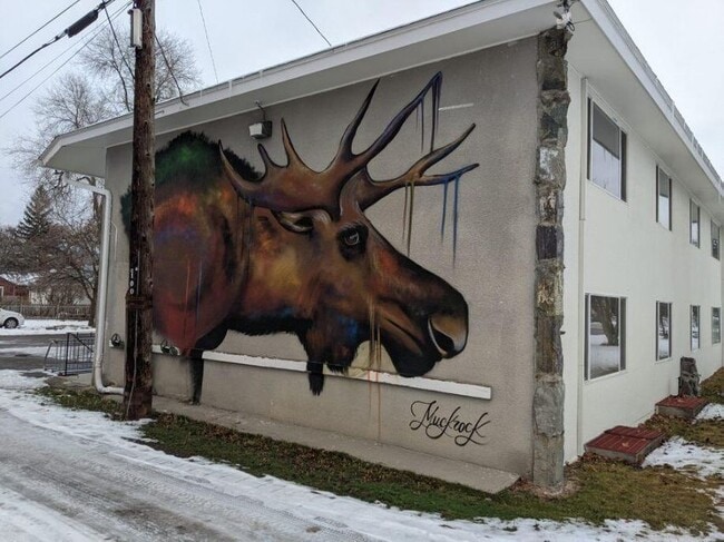
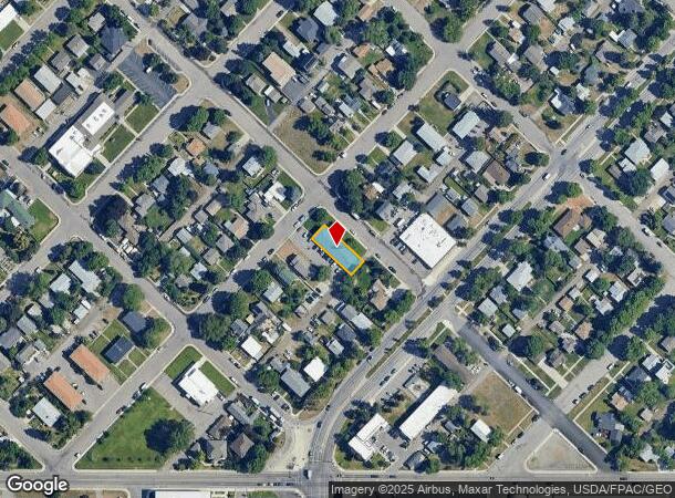
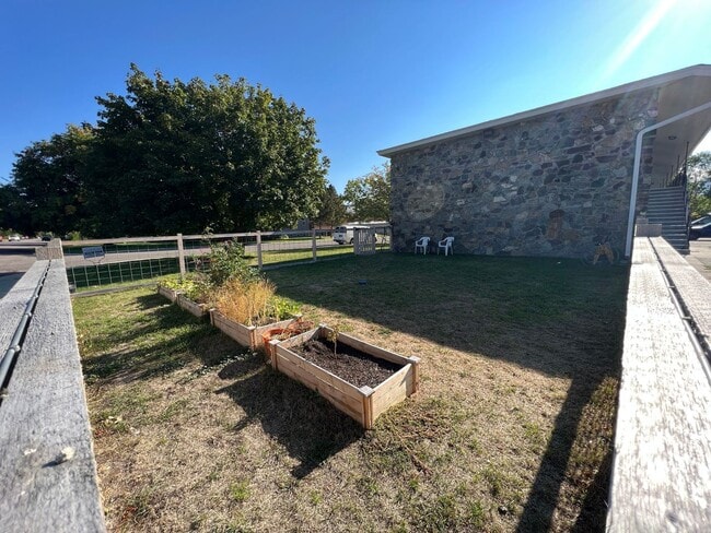
Property Record
1000 Rollins St, Missoula, MT 59801
NEARBY LISTINGS FOR SALE OR LEASE
Property Detail
1000 Rollins St
Missoula, MT
South Missoula
04-2200-28-2-10-08-0000
SOUTH MISSOULA, S28, T13 N, R19 W, BLOCK 89, LOT 1 - N2 OF 2
Multifamilydwelling
Missoula
X
Montana
30063C1460E
1-2
2024
0.13 AC
2025
Missoula
001100
Other Market Areas
7,424 SF
DEMOGRAPHICS near 1000 Rollins St
1 Mile
3 Mile
5 Mile
2024 Total Population
16,841
67,239
94,936
2029 Population
18,157
72,637
102,856
Pop Growth 2024-2029
+ 7.81%
+ 8.03%
+ 8.34%
Average Age
37
38
39
2024 Total Households
8,113
30,893
41,832
HH Growth 2024-2029
+ 7.96%
+ 8.25%
+ 8.50%
Median Household Inc
$50,890
$56,597
$64,674
Avg Household Size
2.00
2.00
2.10
2024 Avg HH Vehicles
2.00
2.00
2.00
Median Home Value
$349,054
$360,468
$382,482
Median Year Built
1969
1978
1985
Nearby Places
Map Layers
Map Styles
 Street
 Aerial
- Restaurants
- Banks
- Shops
- Fitness
- Groceries
PUBLIC TRANSPORTATION
AIRPORT
Missoula Montana
DRIVE
WALK
Distance
Missoula Montana
13 min
6.3 mi
Freight Ports
Port of Everett
DRIVE
WALK
Distance
Port of Everett
552 min
500.0 mi
SALE & LEASE HISTORY
LISTING DATE
SALE/LEASE

Jan 13, 2022
For Sale
Nearby Properties
Address
Land Use
TOTAL SIZE
Lot Size
Zoning
Address
Land Use
TOTAL SIZE
Lot Size
Zoning
227,454 SF
2.89 AC
2
Address
Land Use
TOTAL SIZE
Lot Size
Zoning
243,789 SF
11.95 AC
Address
Land Use
TOTAL SIZE
Lot Size
Zoning
321,769 SF
6.14 AC
1
Address
Land Use
TOTAL SIZE
Lot Size
Zoning
352,710 SF
Address
Land Use
TOTAL SIZE
Lot Size
Zoning
19.46 AC
3
Address
Land Use
TOTAL SIZE
Lot Size
Zoning
130,966 SF
1.06 AC
6
Address
Land Use
TOTAL SIZE
Lot Size
Zoning
252,171 SF
8.63 AC
Address
Land Use
TOTAL SIZE
Lot Size
Zoning
157,658 SF
2.04 AC
Address
Land Use
TOTAL SIZE
Lot Size
Zoning
187,680 SF
10.06 AC
Address
Land Use
TOTAL SIZE
Lot Size
Zoning
160,371 SF
23.84 AC
1
Address
Land Use
TOTAL SIZE
Lot Size
Zoning
175,964 SF
5.01 AC
Address
Land Use
TOTAL SIZE
Lot Size
Zoning
334,916 SF
24 AC
Address
Land Use
TOTAL SIZE
Lot Size
Zoning
50,795 SF
18.10 AC
Address
Land Use
TOTAL SIZE
Lot Size
Zoning
28,161 SF
0.31 AC
6
Address
Land Use
TOTAL SIZE
Lot Size
Zoning
138,544 SF
5.28 AC
Address
Land Use
TOTAL SIZE
Lot Size
Zoning
35,884 SF
7.40 AC
6
Address
Land Use
TOTAL SIZE
Lot Size
Zoning
125,976 SF
10.64 AC
1
Address
Land Use
TOTAL SIZE
Lot Size
Zoning
50,493 SF
2.20 AC
1
Address
Land Use
TOTAL SIZE
Lot Size
Zoning
128,120 SF
1.15 AC
5
Address
Land Use
TOTAL SIZE
Lot Size
Zoning
104,592 SF
3.36 AC
6
Address
Land Use
TOTAL SIZE
Lot Size
Zoning
205,960 SF
18.52 AC
Address
Land Use
TOTAL SIZE
Lot Size
Zoning
107,422 SF
6.90 AC
Address
Land Use
TOTAL SIZE
Lot Size
Zoning
105,004 SF
3.45 AC
Address
Land Use
TOTAL SIZE
Lot Size
Zoning
66.44 AC
1
Address
Land Use
TOTAL SIZE
Lot Size
Zoning
133,210 SF
11.25 AC
Address
Land Use
TOTAL SIZE
Lot Size
Zoning
73,411 SF
0.68 AC
6
Address
Land Use
TOTAL SIZE
Lot Size
Zoning
147,269 SF
25.16 AC
1
Address
Land Use
TOTAL SIZE
Lot Size
Zoning
31,523 SF
5 AC
Address
Land Use
TOTAL SIZE
Lot Size
Zoning
131,066 SF
9.14 AC
1
Address
Land Use
TOTAL SIZE
Lot Size
Zoning
66,900 SF
0.25 AC
6
The World's #1 Commercial Real Estate Marketplace
Connect with us
© 2025 CoStar Group
The information above has been obtained from sources believed reliable. While we do not doubt its accuracy we have not verified it and make no guarantee, warranty or representation about it. It is your responsibility to independently confirm its accuracy and completeness. Any projections, opinions, assumptions, or estimates used are for example only and do not represent the current or future performance of the property. The value of this transaction to you depends on tax and other factors which should be evaluated by your tax, financial, and legal advisors. You and your advisors should conduct a careful, independent investigation of the property to determine to your satisfaction the suitability of the property for your needs.