Property Record
1000 Sw Red Oaks Pl, Topeka, KS 66615
NEARBY LISTINGS FOR SALE OR LEASE
Property Detail
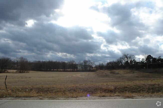
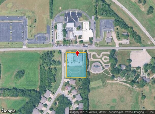
1000 Sw Red Oaks Pl
Topeka, KS
Red Oaks Place
099-32-0-30-01-003-000
RED OAKS PLACE , BLOCK B , LOT 1 , BLK B LOT 1 RED OAKS PLACE SECTION 32 TOWNSHIP 11 RANGE 15
Officebuilding
Shawnee
X
Kansas
20177C0192E
1
0
1.62 AC
2025
Topeka
002401
Kansas City
6,018 SF
DEMOGRAPHICS near 1000 Sw Red Oaks Pl
1 Mile
3 Mile
5 Mile
2024 Total Population
1,719
30,494
80,234
2029 Population
1,689
29,922
79,194
Pop Growth 2024-2029
(1.75%)
(1.88%)
(1.30%)
Average Age
44
43
41
2024 Total Households
810
13,816
35,445
HH Growth 2024-2029
(1.98%)
(1.96%)
(1.40%)
Median Household Inc
$66,785
$61,630
$56,916
Avg Household Size
2.10
2.10
2.20
2024 Avg HH Vehicles
2.00
2.00
2.00
Median Home Value
$192,928
$166,522
$151,492
Median Year Built
1993
1979
1971
Nearby Places
Map Layers
Map Styles
 Street
 Aerial
- Restaurants
- Banks
- Shops
- Fitness
- Groceries
PUBLIC TRANSPORTATION
COMMUTER RAIL
DRIVE
WALK
Distance
10 min
7.0 mi
Nearby Properties
Address
Land Use
TOTAL SIZE
Lot Size
Zoning
Address
Land Use
TOTAL SIZE
Lot Size
Zoning
43,282 SF
19.33 AC
PUD,M2
Address
Land Use
TOTAL SIZE
Lot Size
Zoning
32,544 SF
17.25 AC
PUD
Address
Land Use
TOTAL SIZE
Lot Size
Zoning
218,962 SF
49.63 AC
R1
Address
Land Use
TOTAL SIZE
Lot Size
Zoning
94,830 SF
17.09 AC
PUD,M4
Address
Land Use
TOTAL SIZE
Lot Size
Zoning
208,685 SF
38.23 AC
R1
Address
Land Use
TOTAL SIZE
Lot Size
Zoning
70,578 SF
10.16 AC
PUD,C2
Address
Land Use
TOTAL SIZE
Lot Size
Zoning
52,375 SF
12.94 AC
RR1
Address
Land Use
TOTAL SIZE
Lot Size
Zoning
175,246 SF
80.42 AC
R1
Address
Land Use
TOTAL SIZE
Lot Size
Zoning
22,484 SF
75.33 AC
R1
Address
Land Use
TOTAL SIZE
Lot Size
Zoning
6.95 AC
PUD,OI1
Address
Land Use
TOTAL SIZE
Lot Size
Zoning
81,364 SF
19.52 AC
R1
Address
Land Use
TOTAL SIZE
Lot Size
Zoning
53,136 SF
18.28 AC
PUD,M2
Address
Land Use
TOTAL SIZE
Lot Size
Zoning
11.05 AC
PUD,C2,C4,
Address
Land Use
TOTAL SIZE
Lot Size
Zoning
116,026 SF
47.17 AC
R1
Address
Land Use
TOTAL SIZE
Lot Size
Zoning
38,087 SF
10.27 AC
PUD,M4
Address
Land Use
TOTAL SIZE
Lot Size
Zoning
15,880 SF
85.20 AC
R1
Address
Land Use
TOTAL SIZE
Lot Size
Zoning
7,704 SF
13.43 AC
PUD
Address
Land Use
TOTAL SIZE
Lot Size
Zoning
22,194 SF
3.59 AC
M4
Address
Land Use
TOTAL SIZE
Lot Size
Zoning
19,892 SF
3.51 AC
M4
Address
Land Use
TOTAL SIZE
Lot Size
Zoning
31,132 SF
111.36 AC
R1
Address
Land Use
TOTAL SIZE
Lot Size
Zoning
52,406 SF
4.87 AC
M1
Address
Land Use
TOTAL SIZE
Lot Size
Zoning
231,116 SF
42.17 AC
PUD,OI3,RR
Address
Land Use
TOTAL SIZE
Lot Size
Zoning
59,337 SF
6.84 AC
R1
Address
Land Use
TOTAL SIZE
Lot Size
Zoning
51,636 SF
3.89 AC
C4
Address
Land Use
TOTAL SIZE
Lot Size
Zoning
72,105 SF
13.79 AC
C2,M1,M2,R
Address
Land Use
TOTAL SIZE
Lot Size
Zoning
57,380 SF
15.03 AC
RR1
Address
Land Use
TOTAL SIZE
Lot Size
Zoning
61,383 SF
8.09 AC
R1
Address
Land Use
TOTAL SIZE
Lot Size
Zoning
58,568 SF
8.73 AC
R1
Address
Land Use
TOTAL SIZE
Lot Size
Zoning
135,625 SF
23.52 AC
PUD,M2
Address
Land Use
TOTAL SIZE
Lot Size
Zoning
45,231 SF
11.95 AC
OI2
The World's #1 Commercial Real Estate Marketplace
Connect with us
© 2026 CoStar Group
The information above has been obtained from sources believed reliable. While we do not doubt its accuracy we have not verified it and make no guarantee, warranty or representation about it. It is your responsibility to independently confirm its accuracy and completeness. Any projections, opinions, assumptions, or estimates used are for example only and do not represent the current or future performance of the property. The value of this transaction to you depends on tax and other factors which should be evaluated by your tax, financial, and legal advisors. You and your advisors should conduct a careful, independent investigation of the property to determine to your satisfaction the suitability of the property for your needs.