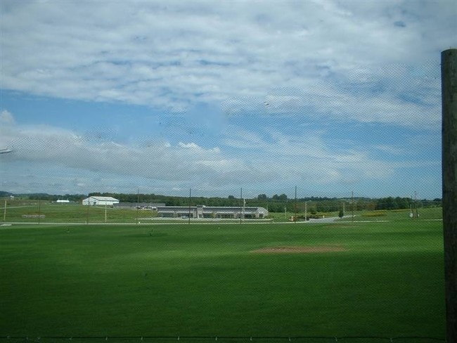
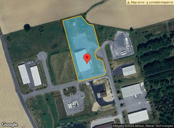
Property Record
1000 Tomahawk Ct, Kutztown, PA 19530
NEARBY LISTINGS FOR SALE OR LEASE
Property Detail
1000 Tomahawk Ct
63-5454-00-96-6481
Arrowhead Business And Industrial Park A
Warehouse
Berks
X
Pennsylvania
42011C0215G
1116
2025
4.21 AC
2025
Berks County
014102
Philadelphia
22,000 SF
Reading, PA
DEMOGRAPHICS near 1000 Tomahawk Ct
1 mile
3 mile
5 mile
2024 Total Population
403
7,647
23,399
2029 Population
398
7,696
23,519
Pop Growth 2024-2029
(1.24%)
+ 0.64%
+ 0.51%
Average Age
44
42
41
2024 Total Households
160
3,155
8,783
HH Growth 2024-2029
(1.25%)
+ 0.76%
+ 0.59%
Median Household Inc
$78,846
$67,185
$76,116
Avg Household Size
2.50
2.30
2.40
2024 Avg HH Vehicles
2.00
2.00
2.00
Median Home Value
$270,512
$234,453
$262,041
Median Year Built
1957
1963
1972
Nearby Places
Map Layers
Map Styles
 Street
 Aerial
Transit
 Traffic
 Biking
Places
Listings with unknown addresses are not visible on the map
- Restaurants
- Banks
- Shops
- Fitness
- Groceries
PUBLIC TRANSPORTATION
AIRPORT
Lehigh Valley International
Drive
Walk
Distance
Lehigh Valley International
33 min
20.2 mi
Freight Ports
Port of Philadelphia
Drive
Walk
Distance
Port of Philadelphia
91 min
68.5 mi
Nearby Properties
Address
Land Use
TOTAL SIZE
Lot Size
Zoning
Address
Land Use
TOTAL SIZE
Lot Size
Zoning
31,697 SF
22.56 AC
Address
Land Use
TOTAL SIZE
Lot Size
Zoning
53,353 SF
3.81 AC
Address
Land Use
TOTAL SIZE
Lot Size
Zoning
120,641 SF
12.95 AC
Address
Land Use
TOTAL SIZE
Lot Size
Zoning
4,324 SF
88.64 AC
Address
Land Use
TOTAL SIZE
Lot Size
Zoning
38,956 SF
4.90 AC
Address
Land Use
TOTAL SIZE
Lot Size
Zoning
10,770 SF
13.06 AC
Address
Land Use
TOTAL SIZE
Lot Size
Zoning
39,104 SF
4.06 AC
Address
Land Use
TOTAL SIZE
Lot Size
Zoning
245,468 SF
9.93 AC
Address
Land Use
TOTAL SIZE
Lot Size
Zoning
13,440 SF
8.23 AC
Address
Land Use
TOTAL SIZE
Lot Size
Zoning
266,451 SF
59.37 AC
Address
Land Use
TOTAL SIZE
Lot Size
Zoning
120,973 SF
7.31 AC
Address
Land Use
TOTAL SIZE
Lot Size
Zoning
3,364 SF
141.42 AC
RC
Address
Land Use
TOTAL SIZE
Lot Size
Zoning
27,880 SF
16.60 AC
Address
Land Use
TOTAL SIZE
Lot Size
Zoning
12,692 SF
3.68 AC
Address
Land Use
TOTAL SIZE
Lot Size
Zoning
14,797 SF
1.45 AC
Address
Land Use
TOTAL SIZE
Lot Size
Zoning
33,100 SF
5.58 AC
Address
Land Use
TOTAL SIZE
Lot Size
Zoning
221,411 SF
23.93 AC
Address
Land Use
TOTAL SIZE
Lot Size
Zoning
2,700 SF
109.50 AC
RU15
Address
Land Use
TOTAL SIZE
Lot Size
Zoning
68,606 SF
10.15 AC
Address
Land Use
TOTAL SIZE
Lot Size
Zoning
3,603 SF
125.35 AC
RU15
Address
Land Use
TOTAL SIZE
Lot Size
Zoning
15,458 SF
1.45 AC
Address
Land Use
TOTAL SIZE
Lot Size
Zoning
17,072 SF
1.41 AC
Address
Land Use
TOTAL SIZE
Lot Size
Zoning
38,357 SF
4.95 AC
Address
Land Use
TOTAL SIZE
Lot Size
Zoning
2,957 SF
0.76 AC
L1
Address
Land Use
TOTAL SIZE
Lot Size
Zoning
6,520 SF
15.20 AC
R
Address
Land Use
TOTAL SIZE
Lot Size
Zoning
37,264 SF
9.80 AC
Address
Land Use
TOTAL SIZE
Lot Size
Zoning
1,462 SF
31.72 AC
Address
Land Use
TOTAL SIZE
Lot Size
Zoning
31,114 SF
2.05 AC
Address
Land Use
TOTAL SIZE
Lot Size
Zoning
17.82 AC
LI
The World's #1 Commercial Real Estate Marketplace
Connect with us
© 2026 CoStar Group
The information above has been obtained from sources believed reliable. While we do not doubt its accuracy we have not verified it and make no guarantee, warranty or representation about it. It is your responsibility to independently confirm its accuracy and completeness. Any projections, opinions, assumptions, or estimates used are for example only and do not represent the current or future performance of the property. The value of this transaction to you depends on tax and other factors which should be evaluated by your tax, financial, and legal advisors. You and your advisors should conduct a careful, independent investigation of the property to determine to your satisfaction the suitability of the property for your needs.