Property Record
1000 W Sr 9, Virgin, UT 84779
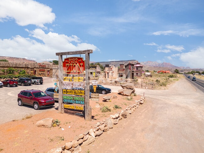


This Property Is For Sale
Property Detail
1000 W Sr 9
0529167
S: 21 T: 41S R: 12W BEG N89*3816 W ALG 1/4 SEC/L 1226.79 FT FM E1/4 COR SEC 21 T41S R12W TH N89*3816 W ALG 1/4 SEC/L 271.30 FT; TH S07*4703 W 821.53 FT M/L TO N R/W/L HWY-9; TH S82*1257 E ALG SD R/W/L 374.03 FT; TH N07*4703 E 250 FT; TH N82*1257 W 10
Commercialnec
WASHINGTON
B and X Area of moderate flood hazard, usually the area between the limits of the 100-year and 500-year floods.
Utah
2024
5.78 AC
2025
Zion National Park
270102
Other Market Areas
8,500 SF
St. George, UT
NEARBY LISTINGS FOR SALE OR LEASE
-
-
View all Virgin listings for sale on LoopNet.com
DEMOGRAPHICS near 1000 W Sr 9
1 mile
3 mile
5 mile
2025 Total Population
383
608
9,707
2030 Population
404
638
10,495
Pop Growth 2025-2030
+ 5.48%
+ 4.93%
+ 8.12%
Average Age
42
42
39
2025 Total Households
126
200
3,091
HH Growth 2025-2030
+ 4.76%
+ 4.00%
+ 8.35%
Median Household Inc
$77,232
$79,545
$67,105
Avg Household Size
2.70
2.70
3.10
2025 Avg HH Vehicles
2.00
2.00
2.00
Median Home Value
$484,090
$487,878
$436,842
Median Year Built
1988
1988
1995
Nearby Places
Map Layers
Map Styles
 Street
 Aerial
Layers
 Traffic
 Biking
Places
Listings with unknown addresses are not visible on the map
- Restaurants
- Banks
- Shops
- Fitness
- Groceries
PUBLIC TRANSPORTATION
AIRPORT
St George Regional
Drive
Walk
Distance
St George Regional
43 min
33.5 mi
Freight Ports
Port of Long Beach
Drive
Walk
Distance
Port of Long Beach
475 min
432.6 mi
Nearby Properties
Address
Land Use
TOTAL SIZE
Lot Size
Zoning
Address
Land Use
TOTAL SIZE
Lot Size
Zoning
109,651 SF
11.97 AC
Address
Land Use
TOTAL SIZE
Lot Size
Zoning
10,450 SF
31.24 AC
Address
Land Use
TOTAL SIZE
Lot Size
Zoning
20,414 SF
20.02 AC
Address
Land Use
TOTAL SIZE
Lot Size
Zoning
8,737 SF
16.60 AC
Address
Land Use
TOTAL SIZE
Lot Size
Zoning
4,500 SF
3,041.62 AC
Address
Land Use
TOTAL SIZE
Lot Size
Zoning
1,342 SF
71.44 AC
Address
Land Use
TOTAL SIZE
Lot Size
Zoning
6,969 SF
35 AC
A20
Address
Land Use
TOTAL SIZE
Lot Size
Zoning
4,673 SF
2.19 AC
Address
Land Use
TOTAL SIZE
Lot Size
Zoning
7,260 SF
4.72 AC
Address
Land Use
TOTAL SIZE
Lot Size
Zoning
8,789 SF
2.50 AC
Address
Land Use
TOTAL SIZE
Lot Size
Zoning
14,386 SF
11.58 AC
Address
Land Use
TOTAL SIZE
Lot Size
Zoning
6,468 SF
3.26 AC
Address
Land Use
TOTAL SIZE
Lot Size
Zoning
10,585 SF
2.72 AC
Address
Land Use
TOTAL SIZE
Lot Size
Zoning
2,291 SF
30.94 AC
Address
Land Use
TOTAL SIZE
Lot Size
Zoning
2,482 SF
18.11 AC
Address
Land Use
TOTAL SIZE
Lot Size
Zoning
4,827 SF
1 AC
Address
Land Use
TOTAL SIZE
Lot Size
Zoning
5,920 SF
3.23 AC
Address
Land Use
TOTAL SIZE
Lot Size
Zoning
2,400 SF
9.28 AC
Address
Land Use
TOTAL SIZE
Lot Size
Zoning
1,536 SF
18.52 AC
Address
Land Use
TOTAL SIZE
Lot Size
Zoning
4,480 SF
6.20 AC
Address
Land Use
TOTAL SIZE
Lot Size
Zoning
4,044 SF
2.21 AC
Address
Land Use
TOTAL SIZE
Lot Size
Zoning
1,734 SF
20 AC
A20
The World's #1 Commercial Real Estate Marketplace
Connect with us
© 2026 CoStar Group
The information above has been obtained from sources believed reliable. While we do not doubt its accuracy we have not verified it and make no guarantee, warranty or representation about it. It is your responsibility to independently confirm its accuracy and completeness. Any projections, opinions, assumptions, or estimates used are for example only and do not represent the current or future performance of the property. The value of this transaction to you depends on tax and other factors which should be evaluated by your tax, financial, and legal advisors. You and your advisors should conduct a careful, independent investigation of the property to determine to your satisfaction the suitability of the property for your needs.