Property Record
1000 Williamston Rd, Anderson, SC 29621
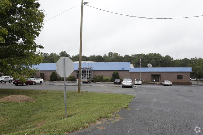

Property Detail
1000 Williamston Rd
149-20-01-001
CP 037/105 F595 D560 WILLIAMSTON RD
Industrialgeneral
Anderson
B and X Area of moderate flood hazard, usually the area between the limits of the 100-year and 500-year floods.
South Carolina
2025
11.60 AC
2024
Outlying Anderson Co
012300
Greenville/Spartanburg
47,562 SF
Greenville-Anderson-Greer, SC
NEARBY LISTINGS FOR SALE OR LEASE
DEMOGRAPHICS near 1000 Williamston Rd
1 mile
3 mile
5 mile
2025 Total Population
3,425
34,014
68,005
2030 Population
3,614
36,081
71,876
Pop Growth 2025-2030
+ 5.52%
+ 6.08%
+ 5.69%
Average Age
35
39
40
2025 Total Households
1,318
13,140
26,892
HH Growth 2025-2030
+ 5.77%
+ 6.17%
+ 5.81%
Median Household Inc
$36,125
$51,475
$52,228
Avg Household Size
2.50
2.30
2.40
2025 Avg HH Vehicles
2.00
2.00
2.00
Median Home Value
$192,879
$197,614
$203,756
Median Year Built
1975
1977
1979
Nearby Places
Map Layers
Map Styles
 Street
 Aerial
Transit
 Traffic
 Biking
Places
Listings with unknown addresses are not visible on the map
- Restaurants
- Banks
- Shops
- Fitness
- Groceries
PUBLIC TRANSPORTATION
AIRPORT
Greenville Spartanburg International
Drive
Walk
Distance
Greenville Spartanburg International
55 min
39.5 mi
SALE & LEASE HISTORY
LISTING DATE
SALE/LEASE

May 08, 2019
For Sale
Dec 18, 2020
For Sale
Nearby Properties
Address
Land Use
TOTAL SIZE
Lot Size
Zoning
Address
Land Use
TOTAL SIZE
Lot Size
Zoning
17,286 SF
19.71 AC
Address
Land Use
TOTAL SIZE
Lot Size
Zoning
13,220 SF
13.49 AC
Address
Land Use
TOTAL SIZE
Lot Size
Zoning
15,168 SF
11.99 AC
Address
Land Use
TOTAL SIZE
Lot Size
Zoning
7,568 SF
10.99 AC
Address
Land Use
TOTAL SIZE
Lot Size
Zoning
45,014 SF
0.29 AC
Address
Land Use
TOTAL SIZE
Lot Size
Zoning
40,071 SF
18.83 AC
Address
Land Use
TOTAL SIZE
Lot Size
Zoning
25,908 SF
12.50 AC
Address
Land Use
TOTAL SIZE
Lot Size
Zoning
61,281 SF
0.74 AC
Address
Land Use
TOTAL SIZE
Lot Size
Zoning
91,698 SF
10.04 AC
Address
Land Use
TOTAL SIZE
Lot Size
Zoning
0.74 AC
Address
Land Use
TOTAL SIZE
Lot Size
Zoning
110,140 SF
6 AC
Address
Land Use
TOTAL SIZE
Lot Size
Zoning
80,205 SF
9.58 AC
Address
Land Use
TOTAL SIZE
Lot Size
Zoning
149,148 SF
16.87 AC
Address
Land Use
TOTAL SIZE
Lot Size
Zoning
70,821 SF
3.57 AC
Address
Land Use
TOTAL SIZE
Lot Size
Zoning
46,410 SF
4.88 AC
Address
Land Use
TOTAL SIZE
Lot Size
Zoning
24.90 AC
Address
Land Use
TOTAL SIZE
Lot Size
Zoning
9,406 SF
7.92 AC
Address
Land Use
TOTAL SIZE
Lot Size
Zoning
44,568 SF
2.47 AC
Address
Land Use
TOTAL SIZE
Lot Size
Zoning
1,408 SF
20.24 AC
Address
Land Use
TOTAL SIZE
Lot Size
Zoning
31,970 SF
2.87 AC
Address
Land Use
TOTAL SIZE
Lot Size
Zoning
2,315 SF
Address
Land Use
TOTAL SIZE
Lot Size
Zoning
14,656 SF
1.93 AC
Address
Land Use
TOTAL SIZE
Lot Size
Zoning
44,358 SF
6.25 AC
Address
Land Use
TOTAL SIZE
Lot Size
Zoning
14,749 SF
1.58 AC
Address
Land Use
TOTAL SIZE
Lot Size
Zoning
30,796 SF
3.56 AC
Address
Land Use
TOTAL SIZE
Lot Size
Zoning
3,080 SF
1.04 AC
Address
Land Use
TOTAL SIZE
Lot Size
Zoning
28.04 AC
Address
Land Use
TOTAL SIZE
Lot Size
Zoning
24,661 SF
41.82 AC
The World's #1 Commercial Real Estate Marketplace
Connect with us
© 2026 CoStar Group
The information above has been obtained from sources believed reliable. While we do not doubt its accuracy we have not verified it and make no guarantee, warranty or representation about it. It is your responsibility to independently confirm its accuracy and completeness. Any projections, opinions, assumptions, or estimates used are for example only and do not represent the current or future performance of the property. The value of this transaction to you depends on tax and other factors which should be evaluated by your tax, financial, and legal advisors. You and your advisors should conduct a careful, independent investigation of the property to determine to your satisfaction the suitability of the property for your needs.