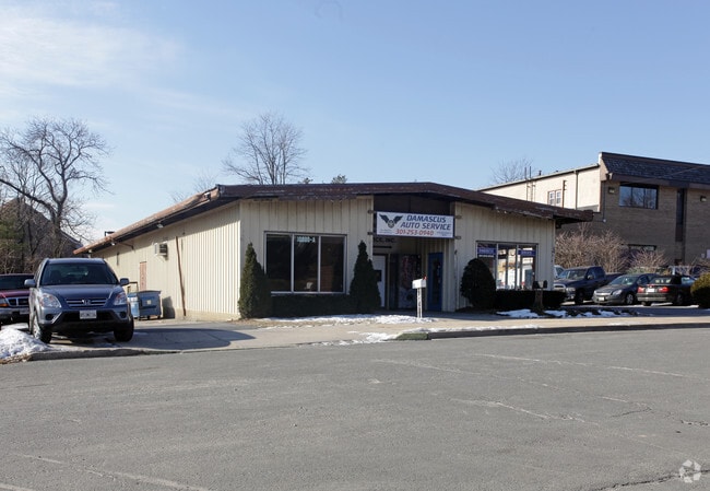
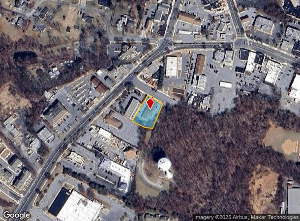
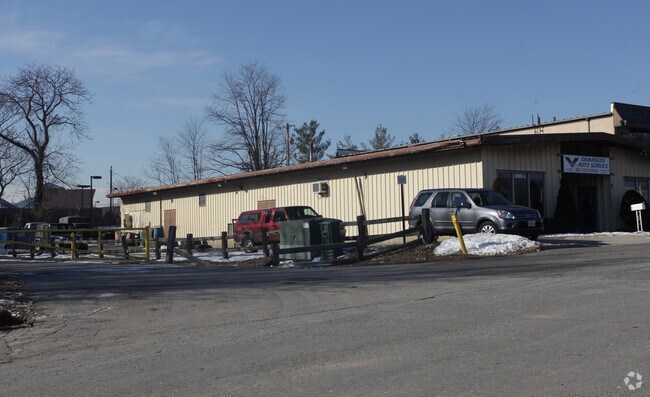
Property Record
10000 Damascus Blvd, Damascus, MD 20872

NEARBY LISTINGS FOR SALE OR LEASE
-
-
View all Damascus listings for sale on LoopNet.com
Property Detail
10000 Damascus Blvd
Washington-Arlington-Alexandria, DC-VA-MD-WV
Locust Level
12-00925831
PAR 1 GLADHILL CAIN ADD DAMASCUS
Storebuilding
Montgomery
X
Maryland
24013C0375D
1
2024
0.47 AC
2025
E Montgomery Outlying
700207
Washington, DC
4,800 SF
DEMOGRAPHICS near 10000 Damascus Blvd
1 mile
3 mile
5 mile
2024 Total Population
4,364
17,904
50,613
2029 Population
4,320
17,633
51,271
Pop Growth 2024-2029
(1.01%)
(1.51%)
+ 1.30%
Average Age
38
40
39
2024 Total Households
1,473
5,904
16,185
HH Growth 2024-2029
(1.29%)
(1.74%)
+ 1.37%
Median Household Inc
$107,342
$132,709
$143,323
Avg Household Size
2.90
3.00
3.10
2024 Avg HH Vehicles
2.00
2.00
2.00
Median Home Value
$373,577
$459,157
$561,682
Median Year Built
1980
1981
1991
Nearby Places
Map Layers
Map Styles
 Street
 Aerial
Transit
 Traffic
 Biking
Places
Listings with unknown addresses are not visible on the map
- Restaurants
- Banks
- Shops
- Fitness
- Groceries
PUBLIC TRANSPORTATION
AIRPORT
Ronald Reagan Washington Ntl
Drive
Walk
Distance
Ronald Reagan Washington Ntl
59 min
37.9 mi
Baltimore/Washington International Thurgood Marshall
Drive
Walk
Distance
Baltimore/Washington International Thurgood Marshall
52 min
40.1 mi
Washington Dulles International
Drive
Walk
Distance
Washington Dulles International
64 min
44.3 mi
Freight Ports
Port of Baltimore
Drive
Walk
Distance
Port of Baltimore
51 min
40.4 mi
Nearby Properties
Address
Land Use
TOTAL SIZE
Lot Size
Zoning
Address
Land Use
TOTAL SIZE
Lot Size
Zoning
235,986 SF
26.49 AC
R200
Address
Land Use
TOTAL SIZE
Lot Size
Zoning
145,148 SF
15 AC
CRT17
Address
Land Use
TOTAL SIZE
Lot Size
Zoning
120,532 SF
19.68 AC
RC
Address
Land Use
TOTAL SIZE
Lot Size
Zoning
79,453 SF
10 AC
R200
Address
Land Use
TOTAL SIZE
Lot Size
Zoning
73,280 SF
3.43 AC
R200
Address
Land Use
TOTAL SIZE
Lot Size
Zoning
75,520 SF
10.56 AC
R200
Address
Land Use
TOTAL SIZE
Lot Size
Zoning
135.12 AC
AR
Address
Land Use
TOTAL SIZE
Lot Size
Zoning
48.66 AC
RC
Address
Land Use
TOTAL SIZE
Lot Size
Zoning
57,307 SF
9.60 AC
R200
Address
Land Use
TOTAL SIZE
Lot Size
Zoning
91,381 SF
9.37 AC
CRT1.
Address
Land Use
TOTAL SIZE
Lot Size
Zoning
53,121 SF
10 AC
R200
Address
Land Use
TOTAL SIZE
Lot Size
Zoning
53,239 SF
9.42 AC
CRT1.
Address
Land Use
TOTAL SIZE
Lot Size
Zoning
111,801 SF
5.98 AC
CRT1.
Address
Land Use
TOTAL SIZE
Lot Size
Zoning
121,437 SF
3.88 AC
CRT1.
Address
Land Use
TOTAL SIZE
Lot Size
Zoning
67,148 SF
3.16 AC
CRT1.
Address
Land Use
TOTAL SIZE
Lot Size
Zoning
37,329 SF
8.88 AC
CRT1.
Address
Land Use
TOTAL SIZE
Lot Size
Zoning
45,000 SF
12.96 AC
AR
Address
Land Use
TOTAL SIZE
Lot Size
Zoning
16,938 SF
15.69 AC
AR
Address
Land Use
TOTAL SIZE
Lot Size
Zoning
7.59 AC
RE2
Address
Land Use
TOTAL SIZE
Lot Size
Zoning
31,064 SF
37.97 AC
RE2C
Address
Land Use
TOTAL SIZE
Lot Size
Zoning
18,016 SF
1.66 AC
CRT1.
Address
Land Use
TOTAL SIZE
Lot Size
Zoning
28,125 SF
1.22 AC
CRT1.
Address
Land Use
TOTAL SIZE
Lot Size
Zoning
34,755 SF
8.47 AC
CRT1.
Address
Land Use
TOTAL SIZE
Lot Size
Zoning
15,562 SF
7.04 AC
R200
Address
Land Use
TOTAL SIZE
Lot Size
Zoning
10,125 SF
1.36 AC
CRT1.
Address
Land Use
TOTAL SIZE
Lot Size
Zoning
20,327 SF
0.82 AC
CRT17
Address
Land Use
TOTAL SIZE
Lot Size
Zoning
14,200 SF
2.50 AC
CRT1.
Address
Land Use
TOTAL SIZE
Lot Size
Zoning
15,264 SF
6.96 AC
AR
Address
Land Use
TOTAL SIZE
Lot Size
Zoning
16,219 SF
5.36 AC
AR
Address
Land Use
TOTAL SIZE
Lot Size
Zoning
26,320 SF
0.70 AC
CRT17
The World's #1 Commercial Real Estate Marketplace
Connect with us
© 2026 CoStar Group
The information above has been obtained from sources believed reliable. While we do not doubt its accuracy we have not verified it and make no guarantee, warranty or representation about it. It is your responsibility to independently confirm its accuracy and completeness. Any projections, opinions, assumptions, or estimates used are for example only and do not represent the current or future performance of the property. The value of this transaction to you depends on tax and other factors which should be evaluated by your tax, financial, and legal advisors. You and your advisors should conduct a careful, independent investigation of the property to determine to your satisfaction the suitability of the property for your needs.