Property Record
10021 Balls Ford Rd, Manassas, VA 20109


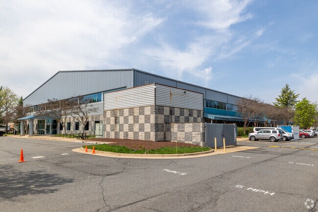
Property Detail
10021 Balls Ford Rd
7697-98-4714
NONE
Publicschool
Prince William
B1
Virginia
AE The base floodplain where base flood elevations are provided. AE Zones are now used on new format FIRMs instead of A1-A30 Zones.
4714
2024
15.70 AC
2025
Route 29/I-66 Corridor
901602
Washington, DC
99,320 SF
Washington-Arlington-Alexandria, DC-VA-MD-WV
NEARBY LISTINGS FOR SALE OR LEASE
DEMOGRAPHICS near 10021 Balls Ford Rd
1 mile
3 mile
5 mile
2025 Total Population
3,218
80,311
197,151
2030 Population
3,295
81,863
200,427
Pop Growth 2025-2030
+ 2.39%
+ 1.93%
+ 1.66%
Average Age
37
36
37
2025 Total Households
1,011
24,660
64,041
HH Growth 2025-2030
+ 2.47%
+ 2.02%
+ 1.68%
Median Household Inc
$95,819
$103,514
$117,780
Avg Household Size
3.10
3.20
3.00
2025 Avg HH Vehicles
3.00
2.00
2.00
Median Home Value
$441,397
$447,488
$489,187
Median Year Built
1978
1984
1988
Nearby Places
Map Layers
Map Styles
 Street
 Aerial
Transit
 Traffic
 Biking
Places
Listings with unknown addresses are not visible on the map
- Restaurants
- Banks
- Shops
- Fitness
- Groceries
PUBLIC TRANSPORTATION
COMMUTER RAIL
Drive
Walk
Distance
13 min
5.9 mi
Drive
Walk
Distance
16 min
7.6 mi
AIRPORT
Washington Dulles International
Drive
Walk
Distance
Washington Dulles International
32 min
18.7 mi
Ronald Reagan Washington Ntl
Drive
Walk
Distance
Ronald Reagan Washington Ntl
46 min
33.2 mi
SALE & LEASE HISTORY
LISTING DATE
SALE/LEASE

Sep 24, 2016
For Lease
Mar 22, 2021
For Lease
Mar 14, 2017
For Lease
Nearby Properties
Address
Land Use
TOTAL SIZE
Lot Size
Zoning
Address
Land Use
TOTAL SIZE
Lot Size
Zoning
328,915 SF
117.39 AC
030
Address
Land Use
TOTAL SIZE
Lot Size
Zoning
40.47 AC
PBD
Address
Land Use
TOTAL SIZE
Lot Size
Zoning
51.84 AC
MIXED
Address
Land Use
TOTAL SIZE
Lot Size
Zoning
75,816 SF
29.15 AC
R16
Address
Land Use
TOTAL SIZE
Lot Size
Zoning
29,500 SF
21.97 AC
M1
Address
Land Use
TOTAL SIZE
Lot Size
Zoning
203,544 SF
20.90 AC
GENERAL CO
Address
Land Use
TOTAL SIZE
Lot Size
Zoning
327,574 SF
34.13 AC
R16
Address
Land Use
TOTAL SIZE
Lot Size
Zoning
529,436 SF
24.63 AC
MIXED
Address
Land Use
TOTAL SIZE
Lot Size
Zoning
240,103 SF
19.93 AC
R16
Address
Land Use
TOTAL SIZE
Lot Size
Zoning
69,276 SF
18.15 AC
R16
Address
Land Use
TOTAL SIZE
Lot Size
Zoning
406,297 SF
67.08 AC
A1
Address
Land Use
TOTAL SIZE
Lot Size
Zoning
3,621 SF
48.25 AC
A1
Address
Land Use
TOTAL SIZE
Lot Size
Zoning
371,926 SF
38.17 AC
B1
Address
Land Use
TOTAL SIZE
Lot Size
Zoning
111,222 SF
15.75 AC
R16
Address
Land Use
TOTAL SIZE
Lot Size
Zoning
267,292 SF
13.66 AC
R16
Address
Land Use
TOTAL SIZE
Lot Size
Zoning
227,465 SF
20.33 AC
PBD
Address
Land Use
TOTAL SIZE
Lot Size
Zoning
28.35 AC
PMD
Address
Land Use
TOTAL SIZE
Lot Size
Zoning
49,528 SF
15.34 AC
R16
Address
Land Use
TOTAL SIZE
Lot Size
Zoning
150,000 SF
9.51 AC
M1
Address
Land Use
TOTAL SIZE
Lot Size
Zoning
82,216 SF
76.98 AC
M1
Address
Land Use
TOTAL SIZE
Lot Size
Zoning
499,912 SF
49.96 AC
B1
Address
Land Use
TOTAL SIZE
Lot Size
Zoning
128,850 SF
5.04 AC
030
Address
Land Use
TOTAL SIZE
Lot Size
Zoning
109,800 SF
7.31 AC
PBD
Address
Land Use
TOTAL SIZE
Lot Size
Zoning
75,202 SF
14.06 AC
R16
Address
Land Use
TOTAL SIZE
Lot Size
Zoning
78,124 SF
13.92 AC
R16
Address
Land Use
TOTAL SIZE
Lot Size
Zoning
18,750 SF
12.25 AC
M1
Address
Land Use
TOTAL SIZE
Lot Size
Zoning
31,032 SF
15.29 AC
MULTI-FAMI
Address
Land Use
TOTAL SIZE
Lot Size
Zoning
146,112 SF
100.14 AC
MIXED
Address
Land Use
TOTAL SIZE
Lot Size
Zoning
81,719 SF
11.91 AC
R16
Address
Land Use
TOTAL SIZE
Lot Size
Zoning
109,543 SF
7.66 AC
M1
The World's #1 Commercial Real Estate Marketplace
Connect with us
© 2026 CoStar Group
The information above has been obtained from sources believed reliable. While we do not doubt its accuracy we have not verified it and make no guarantee, warranty or representation about it. It is your responsibility to independently confirm its accuracy and completeness. Any projections, opinions, assumptions, or estimates used are for example only and do not represent the current or future performance of the property. The value of this transaction to you depends on tax and other factors which should be evaluated by your tax, financial, and legal advisors. You and your advisors should conduct a careful, independent investigation of the property to determine to your satisfaction the suitability of the property for your needs.