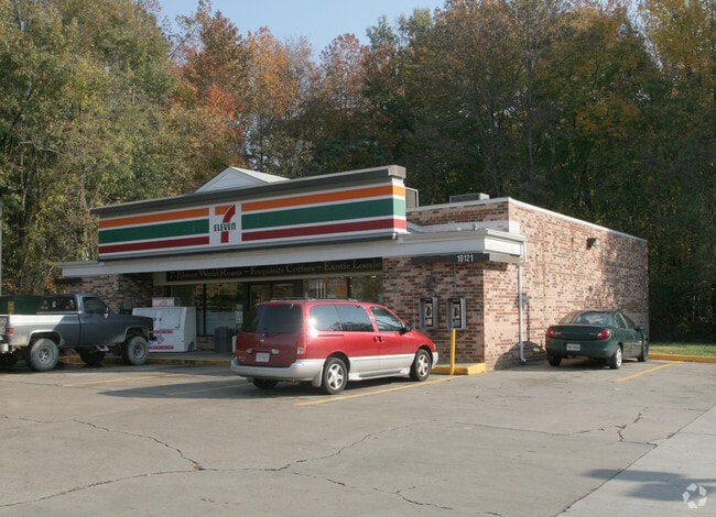
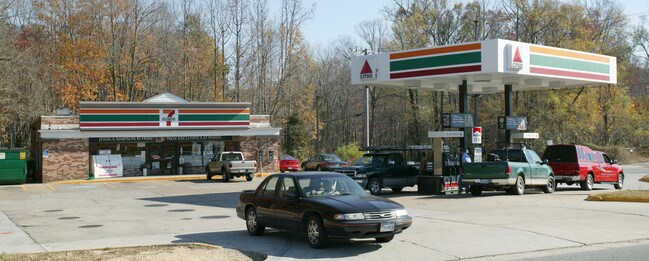
Property Record
10001 Chester Rd, Chester, VA 23831
NEARBY LISTINGS FOR SALE OR LEASE
Property Detail
10001 Chester Rd
Richmond, VA
East Line Of Chester Road
787-66-42-23-400-000
E/L CHESTER RD PAR A
Commercialnec
Chesterfield
AE
Virginia
5101290100E
5.66 AC
2025
South Chesterfield
2025
Richmond VA
100409
DEMOGRAPHICS near 10001 Chester Rd
1 Mile
3 Mile
5 Mile
2024 Total Population
5,177
47,657
99,314
2029 Population
5,684
52,363
108,812
Pop Growth 2024-2029
+ 9.79%
+ 9.87%
+ 9.56%
Average Age
41
40
39
2024 Total Households
1,911
18,620
36,850
HH Growth 2024-2029
+ 9.94%
+ 10.06%
+ 9.73%
Median Household Inc
$80,060
$68,989
$69,479
Avg Household Size
2.60
2.50
2.60
2024 Avg HH Vehicles
2.00
2.00
2.00
Median Home Value
$254,410
$262,042
$263,334
Median Year Built
1985
1987
1987
Nearby Places
Map Layers
Map Styles
 Street
 Aerial
- Restaurants
- Banks
- Shops
- Fitness
- Groceries
PUBLIC TRANSPORTATION
AIRPORT
Richmond International
DRIVE
WALK
Distance
Richmond International
26 min
16.3 mi
Freight Ports
Virginia Port Authority - Richmond
DRIVE
WALK
Distance
Virginia Port Authority - Richmond
16 min
8.9 mi
Nearby Properties
Address
Land Use
TOTAL SIZE
Lot Size
Zoning
Address
Land Use
TOTAL SIZE
Lot Size
Zoning
100 SF
652.52 AC
A - AGRICU
Address
Land Use
TOTAL SIZE
Lot Size
Zoning
21.01 AC
RMF - RES,
Address
Land Use
TOTAL SIZE
Lot Size
Zoning
437,024 SF
39.40 AC
I3 - HVY I
Address
Land Use
TOTAL SIZE
Lot Size
Zoning
406,110 SF
57.69 AC
I3 - HVY I
Address
Land Use
TOTAL SIZE
Lot Size
Zoning
289,964 SF
39.62 AC
R7 - SINGL
Address
Land Use
TOTAL SIZE
Lot Size
Zoning
121,974 SF
33.25 AC
RMF - RES,
Address
Land Use
TOTAL SIZE
Lot Size
Zoning
5.61 AC
A - AGRICU
Address
Land Use
TOTAL SIZE
Lot Size
Zoning
1.60 AC
RMF - RES,
Address
Land Use
TOTAL SIZE
Lot Size
Zoning
246,090 SF
7.33 AC
C3 - COMMU
Address
Land Use
TOTAL SIZE
Lot Size
Zoning
278,193 SF
74.49 AC
A - AGRICU
Address
Land Use
TOTAL SIZE
Lot Size
Zoning
100 SF
36.88 AC
RMF - RES,
Address
Land Use
TOTAL SIZE
Lot Size
Zoning
95,419 SF
21.13 AC
RMF - RES,
Address
Land Use
TOTAL SIZE
Lot Size
Zoning
177,908 SF
13.59 AC
RMF - RES,
Address
Land Use
TOTAL SIZE
Lot Size
Zoning
100 SF
21.30 AC
R7 - SINGL
Address
Land Use
TOTAL SIZE
Lot Size
Zoning
116,527 SF
25.57 AC
RMF - RES,
Address
Land Use
TOTAL SIZE
Lot Size
Zoning
320,853 SF
33.68 AC
I3 - HVY I
Address
Land Use
TOTAL SIZE
Lot Size
Zoning
220,825 SF
55.17 AC
I3 - HVY I
Address
Land Use
TOTAL SIZE
Lot Size
Zoning
100 SF
25.80 AC
R7 - SINGL
Address
Land Use
TOTAL SIZE
Lot Size
Zoning
99,934 SF
27.15 AC
A - AGRICU
Address
Land Use
TOTAL SIZE
Lot Size
Zoning
8,432 SF
65.59 AC
A - AGRICU
Address
Land Use
TOTAL SIZE
Lot Size
Zoning
55,952 SF
11.82 AC
C3 - COMMU
Address
Land Use
TOTAL SIZE
Lot Size
Zoning
406,490 SF
19.58 AC
I3 - HVY I
Address
Land Use
TOTAL SIZE
Lot Size
Zoning
100 SF
10.98 AC
R7 - SINGL
Address
Land Use
TOTAL SIZE
Lot Size
Zoning
67,060 SF
4.93 AC
C5 - GEN B
Address
Land Use
TOTAL SIZE
Lot Size
Zoning
65,261 SF
64.31 AC
A - AGRICU
Address
Land Use
TOTAL SIZE
Lot Size
Zoning
70,882 SF
20.08 AC
C3 - COMMU
Address
Land Use
TOTAL SIZE
Lot Size
Zoning
29,808 SF
5.63 AC
C3 - COMMU
Address
Land Use
TOTAL SIZE
Lot Size
Zoning
86,109 SF
29.94 AC
C3 - COMMU
Address
Land Use
TOTAL SIZE
Lot Size
Zoning
119,527 SF
14.89 AC
C5 - GEN B
Address
Land Use
TOTAL SIZE
Lot Size
Zoning
318,611 SF
24.17 AC
I3 - HVY I
The World's #1 Commercial Real Estate Marketplace
Connect with us
© 2025 CoStar Group
The information above has been obtained from sources believed reliable. While we do not doubt its accuracy we have not verified it and make no guarantee, warranty or representation about it. It is your responsibility to independently confirm its accuracy and completeness. Any projections, opinions, assumptions, or estimates used are for example only and do not represent the current or future performance of the property. The value of this transaction to you depends on tax and other factors which should be evaluated by your tax, financial, and legal advisors. You and your advisors should conduct a careful, independent investigation of the property to determine to your satisfaction the suitability of the property for your needs.