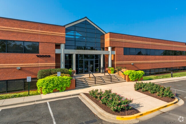
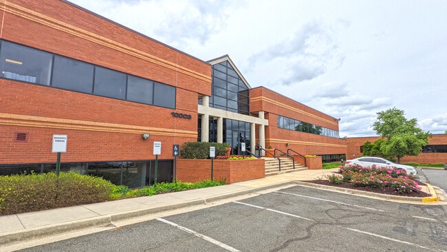
Property Record
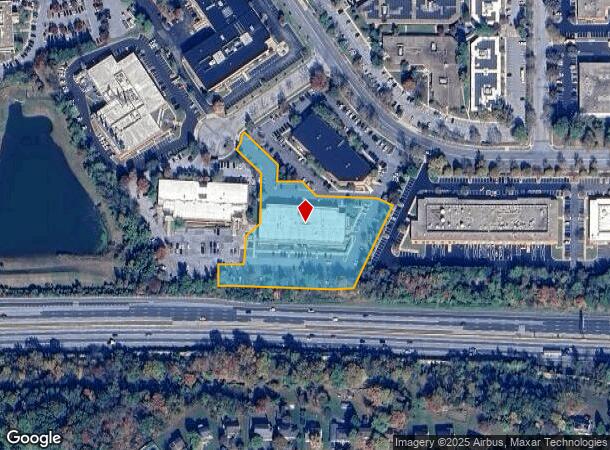
10003 Derekwood Ln, Lanham, MD 20706
Current Lease Availabilities
NEARBY LISTINGS FOR SALE OR LEASE
Property Detail
10003 Derekwood Ln
13-1442169
Patuxent Greens
Officebuilding
PT PAR P EQ 124138 SF
X
Prince George's
24033C0155E
Maryland
2024
2.85 AC
2025
Lanham
803516
Washington, DC
56,184 SF
Washington-Arlington-Alexandria, DC-VA-MD-WV
DEMOGRAPHICS near 10003 Derekwood Ln
1 Mile
3 Mile
5 Mile
2024 Total Population
6,812
91,745
259,888
2029 Population
6,606
89,873
253,775
Pop Growth 2024-2029
(3.02%)
(2.04%)
(2.35%)
Average Age
42
40
40
2024 Total Households
2,100
28,973
88,334
HH Growth 2024-2029
(3.24%)
(2.12%)
(2.43%)
Median Household Inc
$135,409
$102,847
$94,728
Avg Household Size
3.10
3.10
2.90
2024 Avg HH Vehicles
3.00
2.00
2.00
Median Home Value
$383,125
$407,155
$379,957
Median Year Built
1988
1981
1978
Nearby Places
Map Layers
Map Styles
 Street
 Aerial
- Restaurants
- Banks
- Shops
- Fitness
- Groceries
PUBLIC TRANSPORTATION
COMMUTER RAIL
Seabrook (Penn Line - Maryland Area Regional Commuter Trains (The MARC))
DRIVE
WALK
Distance
Seabrook (Penn Line - Maryland Area Regional Commuter Trains (The MARC))
7 min
2.7 mi
New Carrollton (Penn Line - Maryland Area Regional Commuter Trains (The MARC))
DRIVE
WALK
Distance
New Carrollton (Penn Line - Maryland Area Regional Commuter Trains (The MARC))
8 min
3.9 mi
AIRPORT
Ronald Reagan Washington Ntl
DRIVE
WALK
Distance
Ronald Reagan Washington Ntl
28 min
17.3 mi
Baltimore/Washington International Thurgood Marshall
DRIVE
WALK
Distance
Baltimore/Washington International Thurgood Marshall
39 min
25.3 mi
Washington Dulles International
DRIVE
WALK
Distance
Washington Dulles International
62 min
40.0 mi
Freight Ports
Port of Baltimore
DRIVE
WALK
Distance
Port of Baltimore
48 min
31.6 mi
Nearby Properties
Address
Land Use
TOTAL SIZE
Lot Size
Zoning
Address
Land Use
TOTAL SIZE
Lot Size
Zoning
1,631,415 SF
24.33 AC
RTOHC
Address
Land Use
TOTAL SIZE
Lot Size
Zoning
413,915 SF
39.86 AC
IE
Address
Land Use
TOTAL SIZE
Lot Size
Zoning
337,216 SF
1.18 AC
RTOHC
Address
Land Use
TOTAL SIZE
Lot Size
Zoning
290,728 SF
29.27 AC
RSF95
Address
Land Use
TOTAL SIZE
Lot Size
Zoning
1,082,460 SF
9.28 AC
RTOHC
Address
Land Use
TOTAL SIZE
Lot Size
Zoning
27.07 AC
RMF20
Address
Land Use
TOTAL SIZE
Lot Size
Zoning
2.35 AC
RTOHC
Address
Land Use
TOTAL SIZE
Lot Size
Zoning
327,240 SF
1.72 AC
RTOHC
Address
Land Use
TOTAL SIZE
Lot Size
Zoning
182,907 SF
39.78 AC
RR
Address
Land Use
TOTAL SIZE
Lot Size
Zoning
491,397 SF
6.20 AC
RTOHE
Address
Land Use
TOTAL SIZE
Lot Size
Zoning
20.50 AC
RMF20
Address
Land Use
TOTAL SIZE
Lot Size
Zoning
104,397 SF
27.71 AC
AG
Address
Land Use
TOTAL SIZE
Lot Size
Zoning
368,038 SF
12.87 AC
IE
Address
Land Use
TOTAL SIZE
Lot Size
Zoning
4,704 SF
7.20 AC
RMF48
Address
Land Use
TOTAL SIZE
Lot Size
Zoning
217,500 SF
12.95 AC
RTOHE
Address
Land Use
TOTAL SIZE
Lot Size
Zoning
2.09 AC
RTOHC
Address
Land Use
TOTAL SIZE
Lot Size
Zoning
218,628 SF
1.45 AC
RTOHC
Address
Land Use
TOTAL SIZE
Lot Size
Zoning
300,000 SF
2.82 AC
RTOHC
Address
Land Use
TOTAL SIZE
Lot Size
Zoning
187,192 SF
7.15 AC
RE
Address
Land Use
TOTAL SIZE
Lot Size
Zoning
108,864 SF
0.91 AC
RTOHC
Address
Land Use
TOTAL SIZE
Lot Size
Zoning
209,871 SF
85.27 AC
RR
Address
Land Use
TOTAL SIZE
Lot Size
Zoning
2.35 AC
RTOHC
Address
Land Use
TOTAL SIZE
Lot Size
Zoning
57,288 SF
6.94 AC
TACE
Address
Land Use
TOTAL SIZE
Lot Size
Zoning
182,000 SF
3.69 AC
RTOHE
Address
Land Use
TOTAL SIZE
Lot Size
Zoning
329,080 SF
15.31 AC
IE
Address
Land Use
TOTAL SIZE
Lot Size
Zoning
317 SF
14.09 AC
RMF20
Address
Land Use
TOTAL SIZE
Lot Size
Zoning
1,296 SF
10.78 AC
RMF20
Address
Land Use
TOTAL SIZE
Lot Size
Zoning
192,270 SF
16.35 AC
CGO
Address
Land Use
TOTAL SIZE
Lot Size
Zoning
212,073 SF
32.80 AC
RSF95
Address
Land Use
TOTAL SIZE
Lot Size
Zoning
346 SF
17.37 AC
TACE
The World's #1 Commercial Real Estate Marketplace
Connect with us
© 2025 CoStar Group
The information above has been obtained from sources believed reliable. While we do not doubt its accuracy we have not verified it and make no guarantee, warranty or representation about it. It is your responsibility to independently confirm its accuracy and completeness. Any projections, opinions, assumptions, or estimates used are for example only and do not represent the current or future performance of the property. The value of this transaction to you depends on tax and other factors which should be evaluated by your tax, financial, and legal advisors. You and your advisors should conduct a careful, independent investigation of the property to determine to your satisfaction the suitability of the property for your needs.